- Home
- :
- All Communities
- :
- Products
- :
- Imagery and Remote Sensing
- :
- Imagery Questions
- :
- Merging multiple raster files produces incorrect v...
- Subscribe to RSS Feed
- Mark Topic as New
- Mark Topic as Read
- Float this Topic for Current User
- Bookmark
- Subscribe
- Mute
- Printer Friendly Page
Merging multiple raster files produces incorrect values
- Mark as New
- Bookmark
- Subscribe
- Mute
- Subscribe to RSS Feed
- Permalink
- Report Inappropriate Content
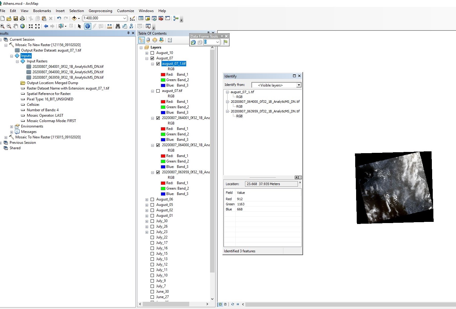
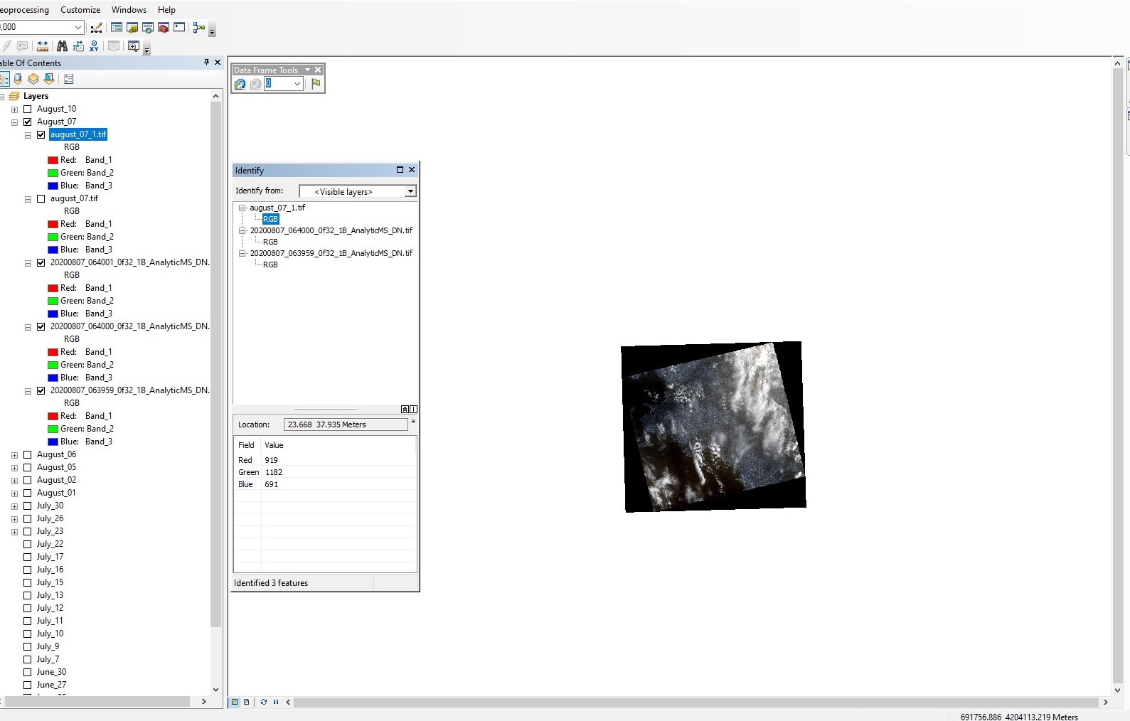
When i merge them using the Mosaic to New raster tool with proper folder locations, the merged file name (something.tif), pixel type (16 bit unsigned int), number of bands (4 - R, G, B and NIR), Mosaic operator (last) and mosaic colourmap (first) selected i get a new raster whose values are sometimes different than the underlying rasters in a few pixels.
For example, these are the values for a colocated pixel: Merged raster: 919,1182,619 Raster 1: 883,1124,631 Raster 2:912,1163,668
The merged raster values are very close to the underlying raster in some pixels and same values in some pixels but shouldn´t it be the same as the last raster encountered throughout the image? Why is it different?
I´ve attached images of these pixel values along with some info on the merge function i ran.