- Home
- :
- All Communities
- :
- Products
- :
- Imagery and Remote Sensing
- :
- Imagery Questions
- :
- Re: Import of geotiff to create moasic not preserv...
- Subscribe to RSS Feed
- Mark Topic as New
- Mark Topic as Read
- Float this Topic for Current User
- Bookmark
- Subscribe
- Mute
- Printer Friendly Page
Import of geotiff to create moasic not preserving colourmap
- Mark as New
- Bookmark
- Subscribe
- Mute
- Subscribe to RSS Feed
- Permalink
- Report Inappropriate Content
Hi, I have twelve UK Ordnance Survey Mastermap tiles which I am trying to mosaic into one layer. If I load the images one at a time they look correct. If I use the Mosaic to New Raster tool some of the tiles do not preserve their colourmap.
I am using ArcGIS 10.41. Tiles are standard OS Mastermap Raster Local.
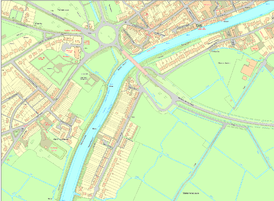
If I use the Mosaic to New Raster tool to import the twelve tiles I get the following:
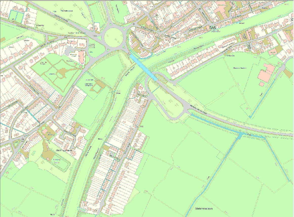
River is now green, Bridge is wrong colour, Road changes from blue to grey, some field drains are no longer blue, some of the houses out of screen grab are blue.
I have tried importing colourmap, saving as .tif and saving as ESRI grid. To date no joy.
Any and all suggestions welcome as I am sure it is some simple mistake but I can not seem to find it.
Thanks
Jeff Chartrand
- Mark as New
- Bookmark
- Subscribe
- Mute
- Subscribe to RSS Feed
- Permalink
- Report Inappropriate Content
The suggestion from the help... http://pro.arcgis.com/en/pro-app/tool-reference/data-management/mosaic-to-new-raster.htm
suggests using Mosaic
When mosaicking with raster datasets containing color maps, it is important to note differences across the color maps for each raster dataset you choose to mosaic. In this situation, use the Mosaic tool for raster with different color maps; however, you must choose the proper Mosaic Colormap Mode operator. If an improper colormap mode is chosen, your output might not turn out as you expected.
- Mark as New
- Bookmark
- Subscribe
- Mute
- Subscribe to RSS Feed
- Permalink
- Report Inappropriate Content
Hi Jeff,
is there a way to get access to two of the images with the different colours coming up? They are 8bit tif with internal color maps? Is there a website with the official "legend" for the data?
I ask all that because again a MosaicDataset would be the way to go - but it might be worth to think about a nice way of even integrationg the legend with the data. I'd like to show you how to do it ... if I get access to a sample of at least two tiles.
If that is not possible - try with a MosaicDataset and keep the images seperate.
Regards
Guenter
- Mark as New
- Bookmark
- Subscribe
- Mute
- Subscribe to RSS Feed
- Permalink
- Report Inappropriate Content
Similar to Guenter my recommendation would be to create a mosaic dataset. There can though still be issues as each of the images may have different color maps. One solution is to then select all the raster and use the 'Batch Edit Raster functions' to insert a 'Colormap to RGB' function at the top level of each item. Essentially you will be converting all the image from using a color map to using RGB. Note that with a mosaic dataset you need not export the data, but can if you want to.