- Home
- :
- All Communities
- :
- Products
- :
- Imagery and Remote Sensing
- :
- Imagery Questions
- :
- How to insert georeferenced Suomi NPP VIIRS imager...
- Subscribe to RSS Feed
- Mark Topic as New
- Mark Topic as Read
- Float this Topic for Current User
- Bookmark
- Subscribe
- Mute
- Printer Friendly Page
How to insert georeferenced Suomi NPP VIIRS imagery into arcmap?
- Mark as New
- Bookmark
- Subscribe
- Mute
- Subscribe to RSS Feed
- Permalink
- Report Inappropriate Content
I need to create mosaic dataset for Suomi NPP VIIRS imagery. I added rasters to mosaic dataset as HDF raster type, but the result is incorrect. Please see below screenshot.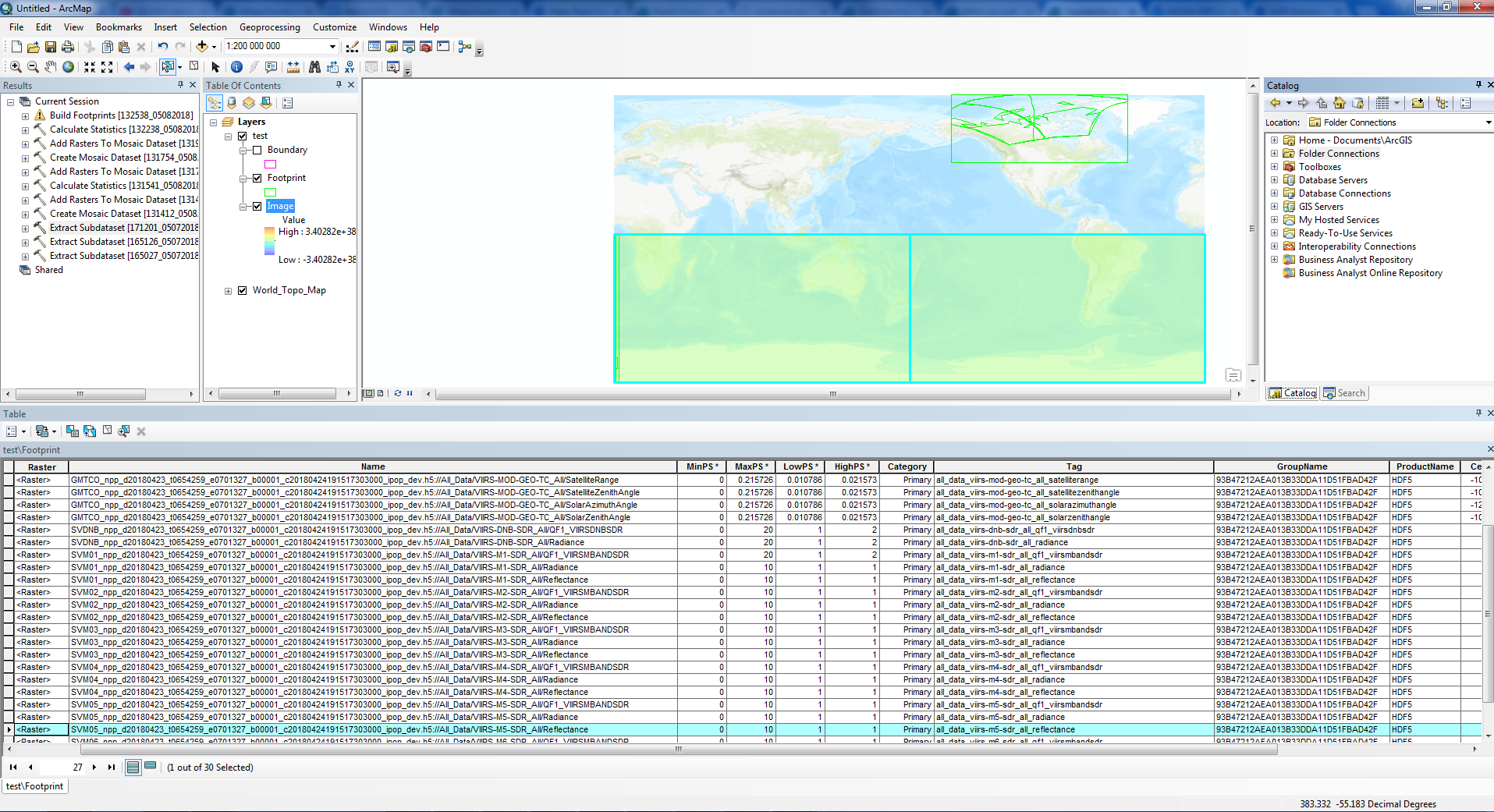
Also I have tried to apply Extract Subdataset geoprocessing tool. The imagery is ok, but there is no spatial reference.
Does anybody have an idea how to open it correctly?
- Mark as New
- Bookmark
- Subscribe
- Mute
- Subscribe to RSS Feed
- Permalink
- Report Inappropriate Content
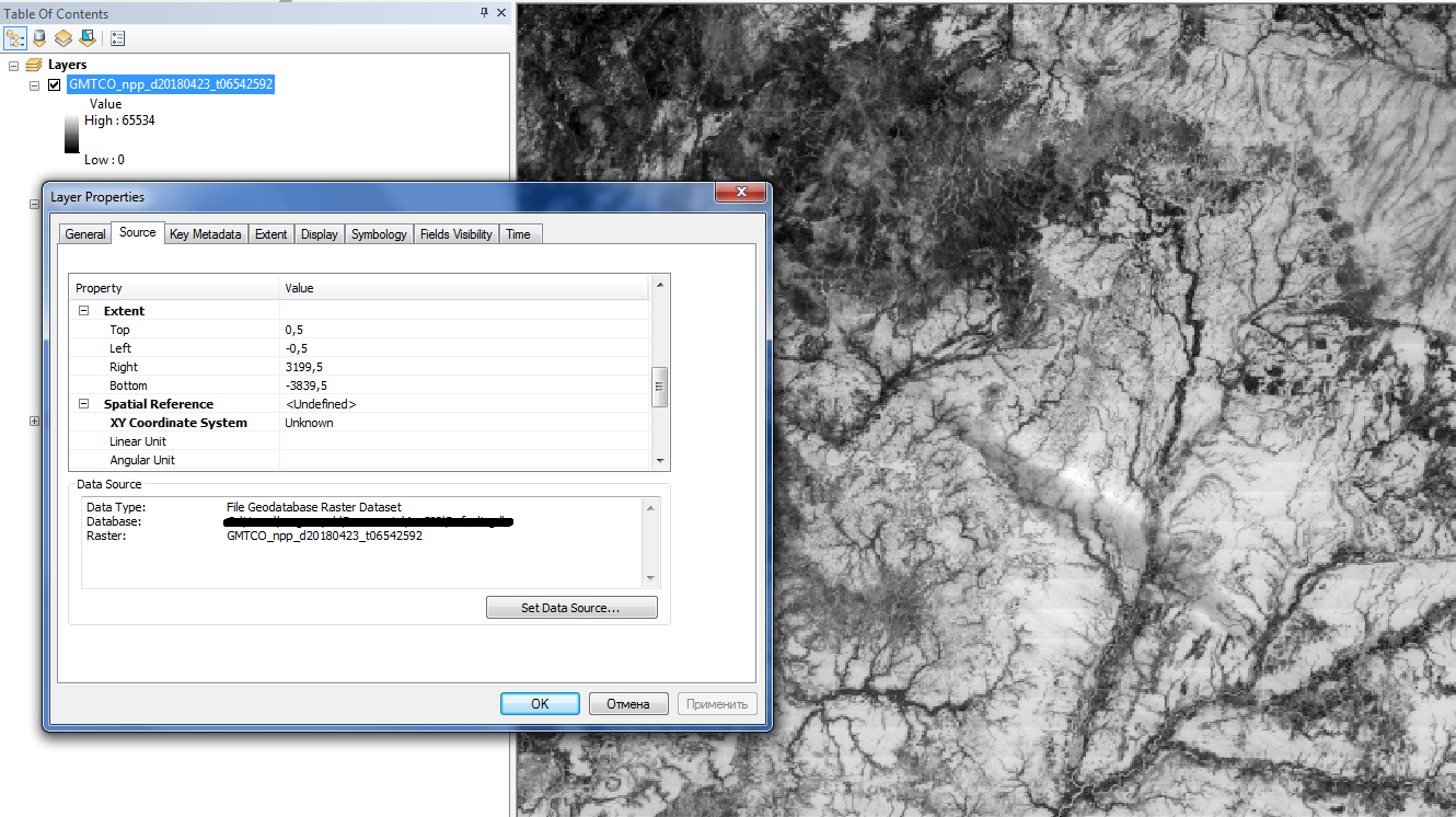
It looks as if the spatial reference of the image is not being picked up. It may not be defined appropriately in the HDF Try determine the spatial reference of the data, then create a mosaic dataset with this projection before adding the data. Alternatively in Add Raster use the Force Spatial Reference option. Else, an you point to some sample data and we can take a look.
- Mark as New
- Bookmark
- Subscribe
- Mute
- Subscribe to RSS Feed
- Permalink
- Report Inappropriate Content
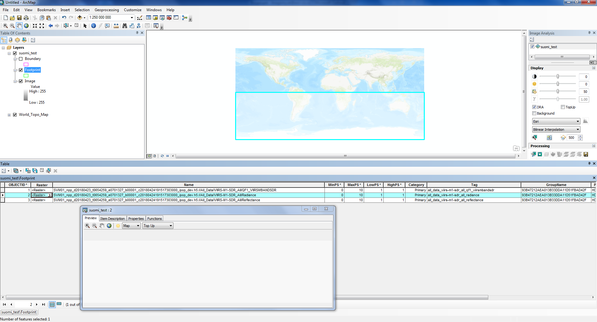
Hello Piter! I've uploaded sample data: link. Also I created mosaic dataset with GCS_WGS_1984 coordinate system and added raster (SVM01_npp_d20180423_t0654259_e0701327_b00001_c20180424191517303000_ipop_dev.h5) with the Force Spatial Reference option but only footprint is dispayed.
- Mark as New
- Bookmark
- Subscribe
- Mute
- Subscribe to RSS Feed
- Permalink
- Report Inappropriate Content
Hello Piter! Have you had a chance to look at it?
- Mark as New
- Bookmark
- Subscribe
- Mute
- Subscribe to RSS Feed
- Permalink
- Report Inappropriate Content
Hi Konstantin,
I looked the data you provided. Out of the 8 files, only one h5 file has variables of Geo2D type, all other variables in these files are either 1D or 2D (which does not have any coordinate defined). Mosaic dataset or raster layer does not support 1D array. ArcGIS can read a 2D array as raster, but as these 2D array does not have any Geo info, it will not make any sense to display in map. These are as designed.
ArcGIS supports reading HDF5 that has well defined coordinates, such as HDFEOS and a few products that follows CF convention, looks like this product is not among those. The file (GMT_npp....h5) has a height variable of Geo2D type, but ArcGIS reads it off 180 degree. one workaround to display this Height variable is that you convert the Height variable to a TIFF (Add Multidimensional raster tool and Export to a tif raster, or use the Extract Raster To Subdataset GP tool), then use the Shift GP tool to shift the raster -180 degree in X direction. Hope this helps.