- Home
- :
- All Communities
- :
- Products
- :
- Oriented Imagery
- :
- Oriented Imagery Classic
- :
- Re: Errors and failure while trying Add Images to ...
- Subscribe to RSS Feed
- Mark Topic as New
- Mark Topic as Read
- Float this Topic for Current User
- Bookmark
- Subscribe
- Mute
- Printer Friendly Page
Errors and failure while trying Add Images to Oriented Imagery Catalog
- Mark as New
- Bookmark
- Subscribe
- Mute
- Subscribe to RSS Feed
- Permalink
- Report Inappropriate Content
While learning to use the oriented imagery tools I get an error "Incomplete EXIF data: Could not add image"
I have tried DJI P4P imagery as well as others from an iphone, with the same result.
The drone imagery has already been used to create an ortho with D2M, and I checked the EXIF data and made sure everything was there.
What would be my troubleshooting steps to move forward since the errors don't tell me what is missing, and the data looks good?
- Mark as New
- Bookmark
- Subscribe
- Mute
- Subscribe to RSS Feed
- Permalink
- Report Inappropriate Content
Hi Greg,
Sorry you are facing issues. This usually happens when the exif metadata cannot be read from the image.
Can you please provide me a sample of the imagery you are trying to add to the OIC?
You also mentioned iPhone imagery as well, can you send me a sample of that well.
One image of each would be just find.
Thanks,
Randall
- Mark as New
- Bookmark
- Subscribe
- Mute
- Subscribe to RSS Feed
- Permalink
- Report Inappropriate Content
I thought I had replied to this but it sure doesn't look like it.
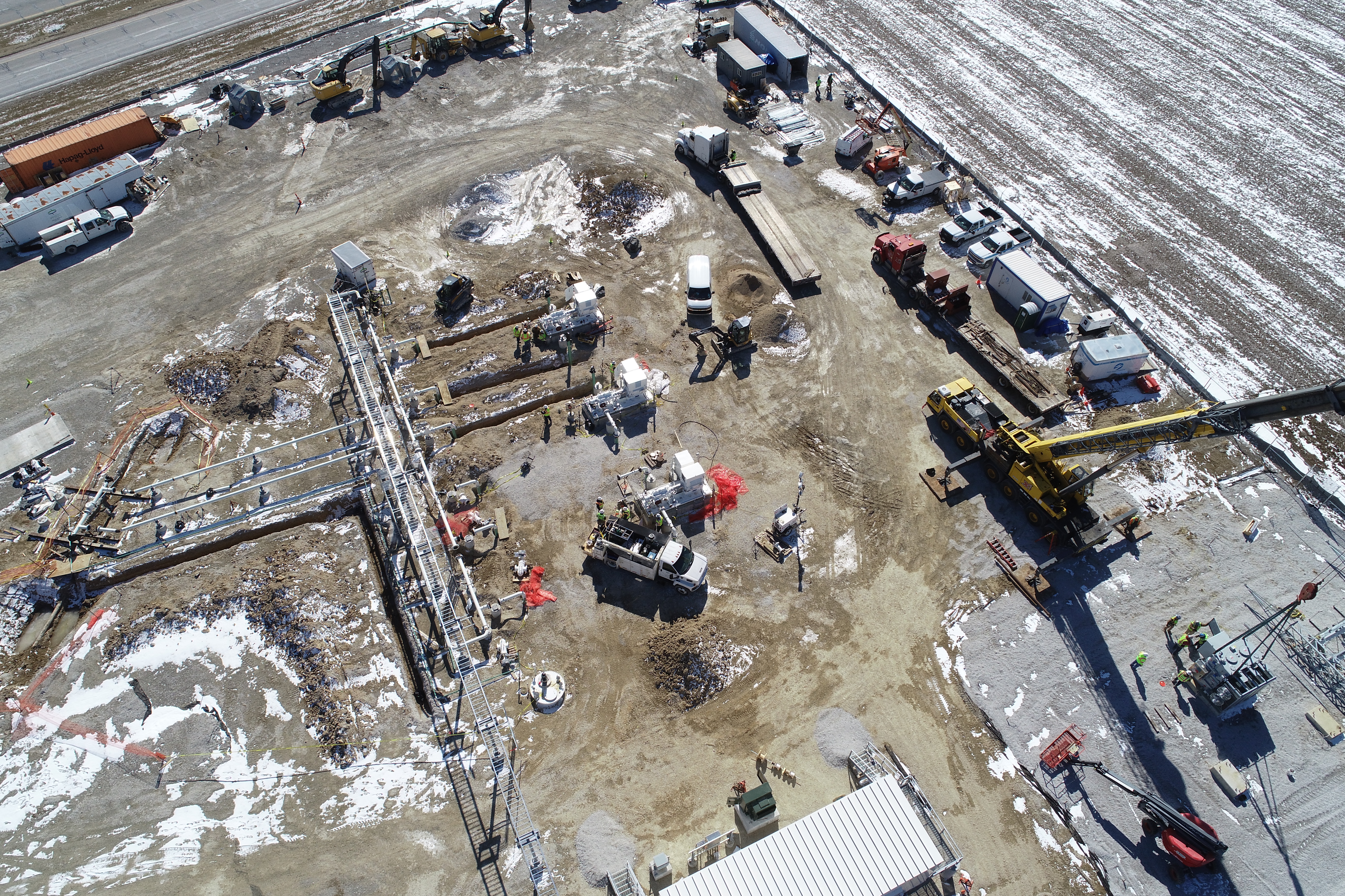
Here is a Phantom 4 Pro image
- Mark as New
- Bookmark
- Subscribe
- Mute
- Subscribe to RSS Feed
- Permalink
- Report Inappropriate Content
Greg
Please try with the version recently released last week.
The Oriented Imagery Management tools are now directly accessible in https://www.arcgis.com/home/item.html?id=36ee0bbedca64a5a8b68d7c69ab51728
- Mark as New
- Bookmark
- Subscribe
- Mute
- Subscribe to RSS Feed
- Permalink
- Report Inappropriate Content
Thanks for your reply Peter,
Looks like this was a 2.3.0 issue.
I installed the patch to 2.3.2 today and the tool works.
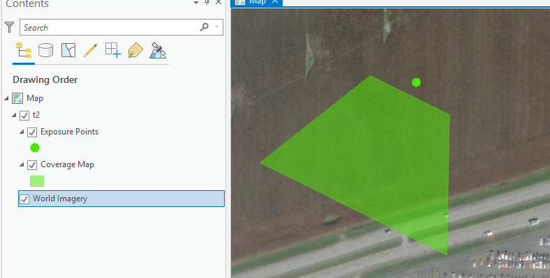
Still working on getting the images to display though, as the imagery viewer does not appear when I click on the exposure points or coverage area.
- Mark as New
- Bookmark
- Subscribe
- Mute
- Subscribe to RSS Feed
- Permalink
- Report Inappropriate Content
HI Greg,
I can help you out with this. Just need a little but of info.
Are your images on accessible a cloud storage? The viewer will only read images from an http location. If you added data from a local hard drive to your OIC then it will not work. The data needs to be uploaded to a cloud storage drive.
If you already have the data in the cloud but added the data using a local copy, then you can use the repair path tool to repair the path to the images.
Another way of addding data to the OIC is to provide a list of images (as a text file) that are in your cloud storage to the add data process.
Hope this helps.
Randall
- Mark as New
- Bookmark
- Subscribe
- Mute
- Subscribe to RSS Feed
- Permalink
- Report Inappropriate Content
Thanks Randall,
That helps me to move forward, but I am still having an issue even with the hosted imagery listed in the .txt file from the tutorial.
I am getting an 'Incomple EXIF data" error on the Redlands campus dataset.
- Mark as New
- Bookmark
- Subscribe
- Mute
- Subscribe to RSS Feed
- Permalink
- Report Inappropriate Content
Greg,
can you a small test on your machine.
open command prompt and type the below command
c:\Image_Mgmt_Workflows\OrientedImagery\Dependents\OptimizeRasters\GDAL\bin\gdalinfo.exe /vsicurl/http://orientedimagerysamples.s3.amazonaws.com/EsriCampus180701/109/IMG_7706_4983491.JPG
it should return you EXIF data. let me know if this works
- Mark as New
- Bookmark
- Subscribe
- Mute
- Subscribe to RSS Feed
- Permalink
- Report Inappropriate Content
I received the following error.
ERROR 11: CURL error: Failed to connect to orientedimagerysamples.s3.amazonaws.com port 80: Timed out
gdalinfo failed - unable to open '/vsicurl/http://orientedimagerysamples.s3.amazonaws.com/EsriCampus180701/109/IMG_7706_4983491.JPG'.
- Mark as New
- Bookmark
- Subscribe
- Mute
- Subscribe to RSS Feed
- Permalink
- Report Inappropriate Content
Greg,
open the command prompt and type the below command now it should get you the exif info
set GDAL_HTTP_UNSAFESSL=YES
set AWS_HTTPS=YES
c:\Image_Mgmt_Workflows\OrientedImagery\Dependents\OptimizeRasters\GDAL\bin\gdalinfo.exe /vsicurl/http://orientedimagerysamples.s3.amazonaws.com/EsriCampus180701/109/IMG_7706_4983491.JPG