- Home
- :
- All Communities
- :
- Products
- :
- Oriented Imagery
- :
- Oriented Imagery Classic
- :
- Re: Custom DTM to use with OIC
- Subscribe to RSS Feed
- Mark Topic as New
- Mark Topic as Read
- Float this Topic for Current User
- Bookmark
- Subscribe
- Mute
- Printer Friendly Page
Custom DTM to use with OIC
- Mark as New
- Bookmark
- Subscribe
- Mute
- Subscribe to RSS Feed
- Permalink
- Report Inappropriate Content
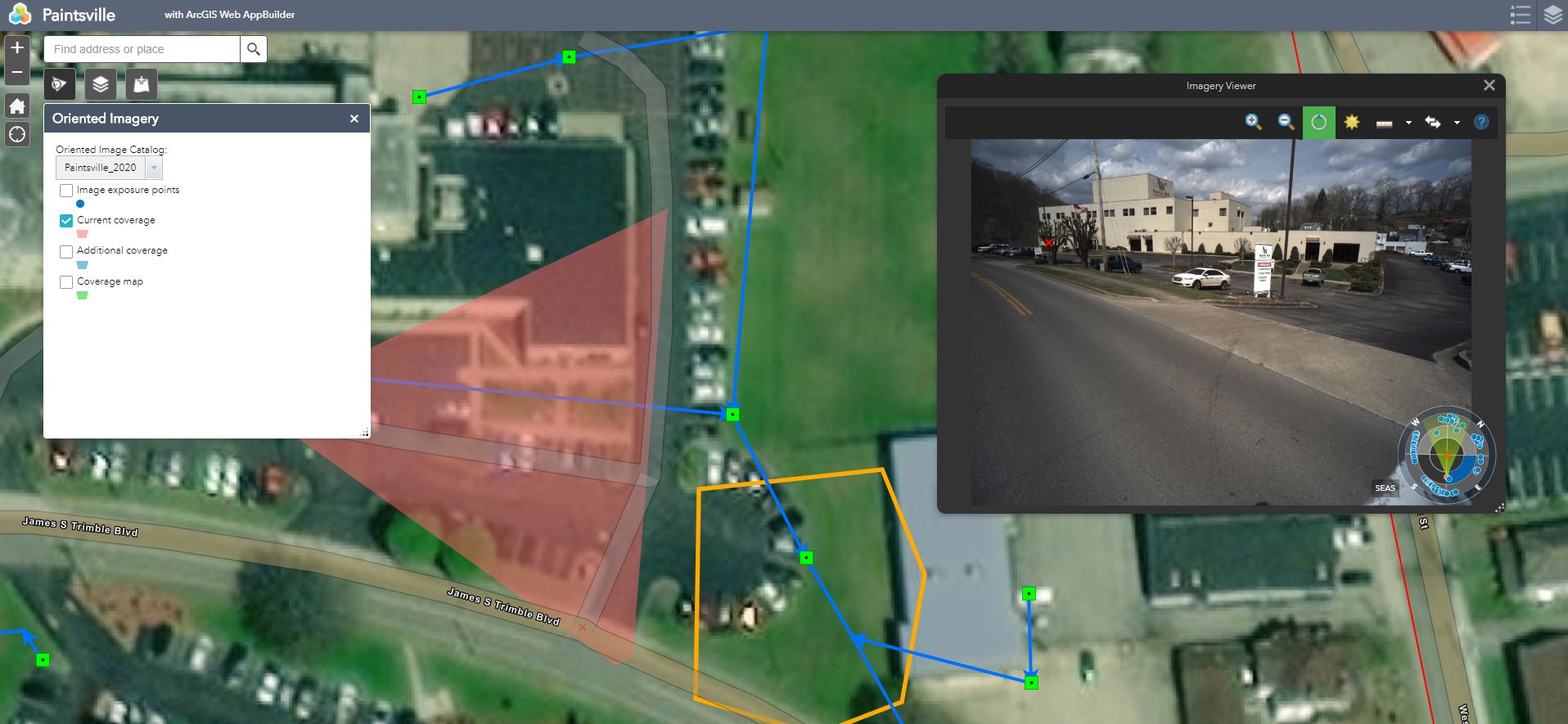
I have accurate Camera Heading,Roll,Pitch,X,Y,Z. It appears OIC does not use elevation data but rather Height above Ground. I am guessing it projects the little red x that you click onto the screen on the DEM and then translates that to the image. In my cause its really far off. See screenshot. Is this the case or do you suppose I am missing something else? I am also wondering how to get it to show the other image locations projected onto the image. Can they navigate from one image to the next by clicking on it IN the image instead of on the map?
Thanks in advance!
- Mark as New
- Bookmark
- Subscribe
- Mute
- Subscribe to RSS Feed
- Permalink
- Report Inappropriate Content
Will it be in October?
Le jeu. 8 oct. 2020 à 18:09, Kushagra Patel <geonet@esri.com> a écrit :
GeoNet, The Esri Community | GIS and Geospatial Professional Community
<https://community.esri.com/?et=watches.email.thread>
Re: Custom DTM to use with OIC
reply from Kushagra Patel
<https://community.esri.com/people/Kushagra_Patel-esristaff?et=watches.email.thread>
in Imagery and Remote Sensing - View the full discussion
<https://community.esri.com/message/958136-re-custom-dtm-to-use-with-oic?commentID=958136&et=watches.email.thread#comment-958136>
- Mark as New
- Bookmark
- Subscribe
- Mute
- Subscribe to RSS Feed
- Permalink
- Report Inappropriate Content
No. We just had a release in September.
Thank you.
- Mark as New
- Bookmark
- Subscribe
- Mute
- Subscribe to RSS Feed
- Permalink
- Report Inappropriate Content
What sort of release schedule do you anticipate? We are pretty impressed with this tool but we need those couple of bugs to be addressed before we can continue any further. Trying to weigh out options as an approach to provide a solution to our clients.
Thank you again for all your help!
- Mark as New
- Bookmark
- Subscribe
- Mute
- Subscribe to RSS Feed
- Permalink
- Report Inappropriate Content
Hi,
We usually follow 3 months release schedule. Bugs will be fixed in next release.
Thank you.
- Mark as New
- Bookmark
- Subscribe
- Mute
- Subscribe to RSS Feed
- Permalink
- Report Inappropriate Content
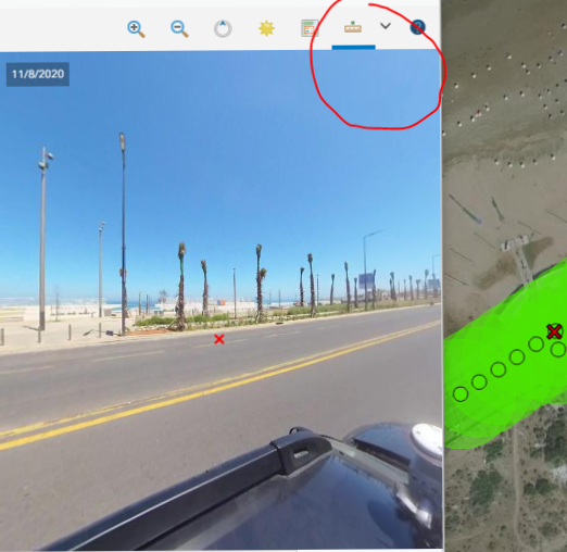
Interesting obseveration, if I click on one of the storm structures it picks the closest image. If I click just on the map, it doesnt.. Still think its a DTM issue.. Maybe...
- Mark as New
- Bookmark
- Subscribe
- Mute
- Subscribe to RSS Feed
- Permalink
- Report Inappropriate Content
Hi,
This is not a DTM issue.
There is an issue with the method we used to compute the best image for street-side images. It is a known issue. This will be updated in the next release and will resolve your issue.
Thank you.
- Mark as New
- Bookmark
- Subscribe
- Mute
- Subscribe to RSS Feed
- Permalink
- Report Inappropriate Content
- Mark as New
- Bookmark
- Subscribe
- Mute
- Subscribe to RSS Feed
- Permalink
- Report Inappropriate Content
oops, wrong thread. I think you had one posted for this already...
- Mark as New
- Bookmark
- Subscribe
- Mute
- Subscribe to RSS Feed
- Permalink
- Report Inappropriate Content
Do you know anything about this?
- Mark as New
- Bookmark
- Subscribe
- Mute
- Subscribe to RSS Feed
- Permalink
- Report Inappropriate Content
Unfortunately I do not, Hopefully someone can answer your thread soon.
- « Previous
-
- 1
- 2
- Next »
- « Previous
-
- 1
- 2
- Next »