- Home
- :
- All Communities
- :
- Products
- :
- Oriented Imagery
- :
- Oriented Imagery Classic
- :
- Re: Custom DTM to use with OIC
- Subscribe to RSS Feed
- Mark Topic as New
- Mark Topic as Read
- Float this Topic for Current User
- Bookmark
- Subscribe
- Mute
- Printer Friendly Page
Custom DTM to use with OIC
- Mark as New
- Bookmark
- Subscribe
- Mute
- Subscribe to RSS Feed
- Permalink
- Report Inappropriate Content
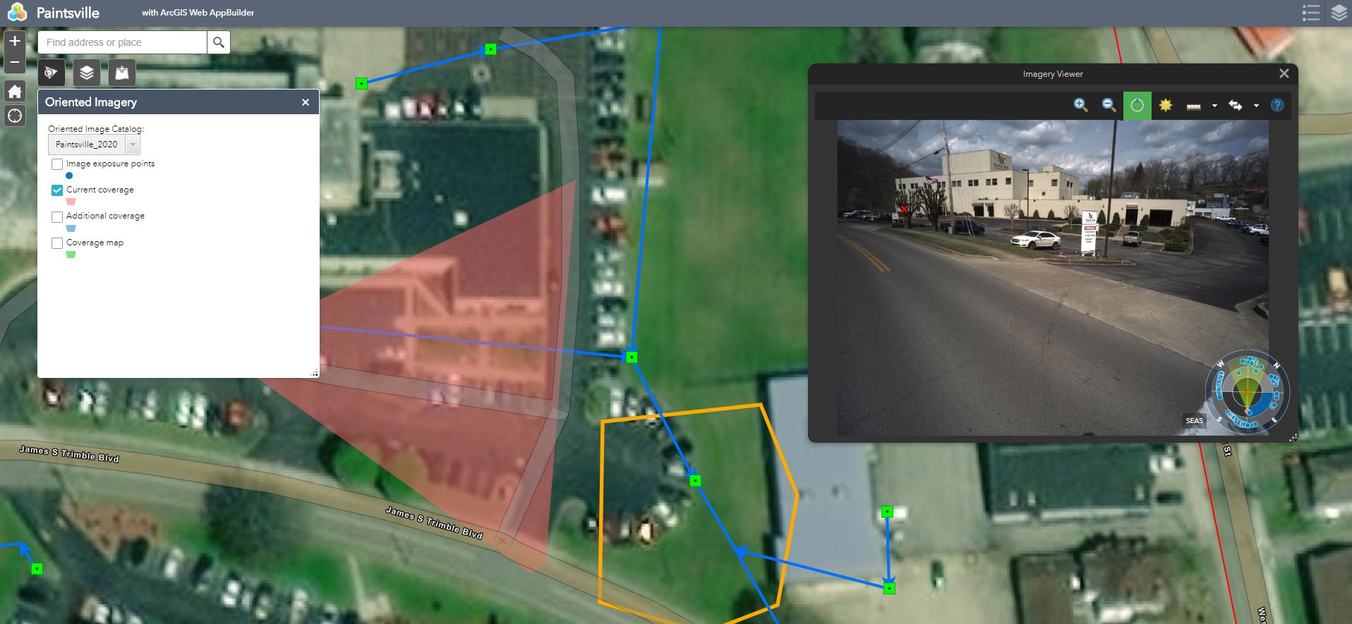
I have accurate Camera Heading,Roll,Pitch,X,Y,Z. It appears OIC does not use elevation data but rather Height above Ground. I am guessing it projects the little red x that you click onto the screen on the DEM and then translates that to the image. In my cause its really far off. See screenshot. Is this the case or do you suppose I am missing something else? I am also wondering how to get it to show the other image locations projected onto the image. Can they navigate from one image to the next by clicking on it IN the image instead of on the map?
Thanks in advance!
- Mark as New
- Bookmark
- Subscribe
- Mute
- Subscribe to RSS Feed
- Permalink
- Report Inappropriate Content
Hi,
Yes, you can navigate from one image to another by clicking on image locations in the image.
If the image locations fall within the extent of the current coverage, then you will see those location overlayed on top of image.
To turn on the image locations in the image, go to the overlay tab and turn on the Camera locations. You will see orange and green dots. Orange means that the image is pointing in the different direction as compared to current image. Green means that the image heading is similar to the current image.
Note - the overlay button will only show up in the viewer if there are image locations for the current image.
See the screenshots below-
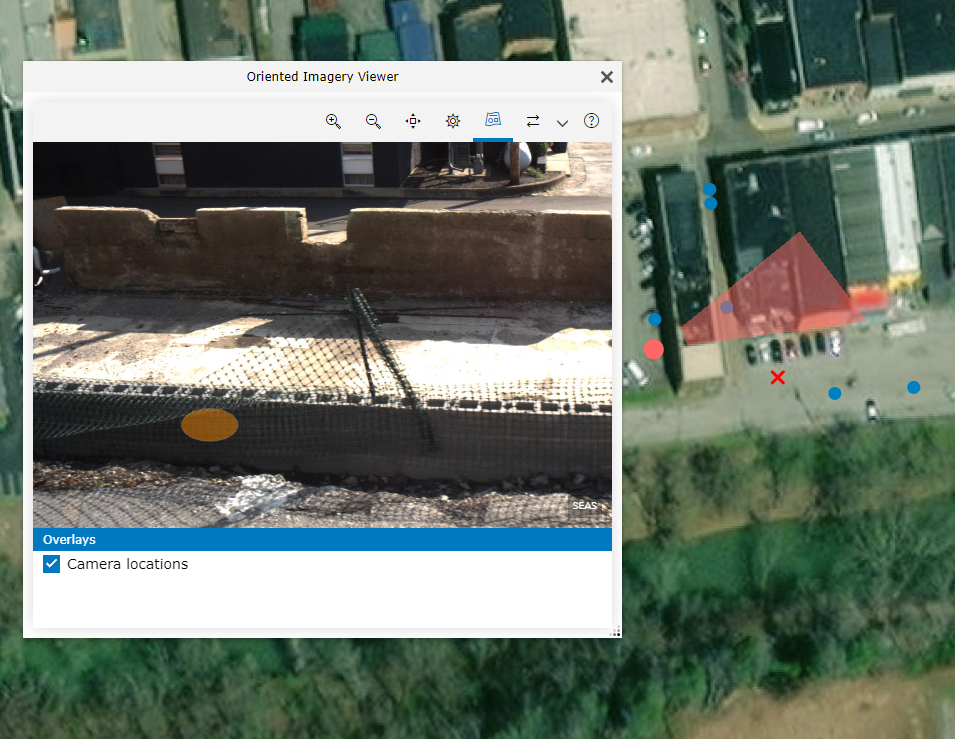
Data - Paintsville (OIC provided by you)
- Mark as New
- Bookmark
- Subscribe
- Mute
- Subscribe to RSS Feed
- Permalink
- Report Inappropriate Content
Hmm, I wonder if I might have calculated pitch incorrectly. In the example I gave to you, I had everything set to 90 because I was just testing. I have a new one that I have posted that has the heading and roll information in it as well. I had to calculate the pitch because our pitch is measured from 0 being horizontal. Question: If my cameras are pointed downward should might pitch be less than 90 or greater than 90?
- Mark as New
- Bookmark
- Subscribe
- Mute
- Subscribe to RSS Feed
- Permalink
- Report Inappropriate Content
Pitch = 90 -> camera pointing towards the horizon
Pitch = 0 -> camera looking down (nadir)
Pitch = 180 -> camera looking up (sky)
So if cameras are pointed downward, then pitch is less than 90
- Mark as New
- Bookmark
- Subscribe
- Mute
- Subscribe to RSS Feed
- Permalink
- Report Inappropriate Content
Thank you for the quick response. Looks like I have them calc'd correctly. Any other idea's which would make the data so far off of my images?
Here is my new map. I built this with the Web Application Builder.
- Mark as New
- Bookmark
- Subscribe
- Mute
- Subscribe to RSS Feed
- Permalink
- Report Inappropriate Content
Hi,
I can confirm that the OIC is not using the elevation data. The reason for this is because the DTM is not defined properly in the OIC.
Can you update the "DEMPrefix" Parameter in the OIC to this
"DEMPrefix":"E|https://elevation3d.arcgis.com/arcgis/rest/services/WorldElevation3D/Terrain3D/ImageServer|13"
You can update by using the Properties tool.
- Mark as New
- Bookmark
- Subscribe
- Mute
- Subscribe to RSS Feed
- Permalink
- Report Inappropriate Content
Thank you so much for sticking this out with me. I have tried both
"E|https://elevation3d.arcgis.com/arcgis/rest/services/WorldElevation3D/Terrain3D/ImageServer|13"
and
"https://elevation3d.arcgis.com/arcgis/rest/services/WorldElevation3D/Terrain3D/ImageServer"
If I keep the little E part and the 13 at the end, the site seems to work but the little red x doesnt show up and all and neither do the nearby image overlays.
If I disregard the begining E| and ending |13 in the path the images will not even load. I think you are on to something tho. I am getting excited this will work soon!!
- Mark as New
- Bookmark
- Subscribe
- Mute
- Subscribe to RSS Feed
- Permalink
- Report Inappropriate Content
Hi,
Please use this - E|https://elevation3d.arcgis.com/arcgis/rest/services/WorldElevation3D/Terrain3D/ImageServer|13
It is correct value to define DEM.
I think it's working fine. See below

- Mark as New
- Bookmark
- Subscribe
- Mute
- Subscribe to RSS Feed
- Permalink
- Report Inappropriate Content
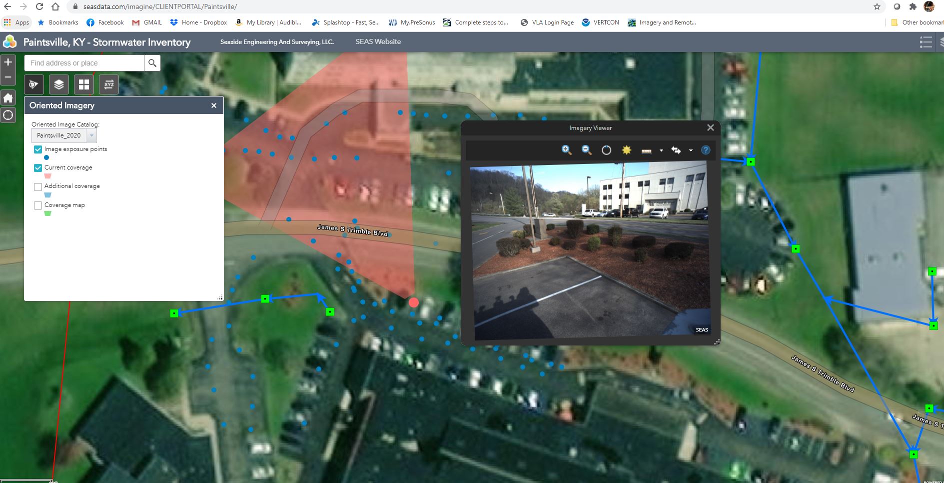
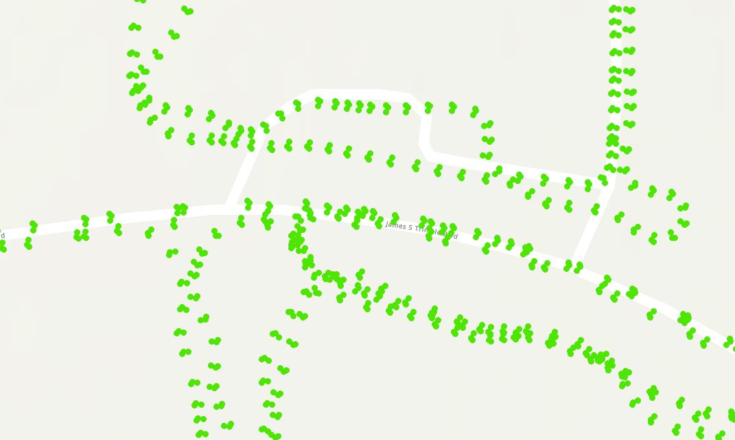
ok, its loading images now but the overlay is still not working and i just realized that its picking strange images to view where i pick. We drove up and down all the roads and several parking lots. It seems to be picking the parking lot pictures which are further away than the images collected along the roadway. I am attaching two screenshots. The first one is from the web site and you can see it sporatically plotting image locations and them NOT showing up in the image viewer. Then the second shot is in ArcGIS Pro showing the actual image locations. I now have the DEM specified with the E at the beginning and the 13 at the end and its showing images now. See screenshots below.
- Mark as New
- Bookmark
- Subscribe
- Mute
- Subscribe to RSS Feed
- Permalink
- Report Inappropriate Content
Hi,
Image locations are not coming up in the image because the CamPitch value of the current image is less than 80.
Currently, camera locations will only show up if the CamPitch value for an image is between 80 to 95.
This issue will be fixed in the next release.
Thank You.