- Home
- :
- All Communities
- :
- Products
- :
- Imagery and Remote Sensing
- :
- Imagery Questions
- :
- Issue importing GeoTIFF to ArcMap (ArcGIS 10.2)
- Subscribe to RSS Feed
- Mark Topic as New
- Mark Topic as Read
- Float this Topic for Current User
- Bookmark
- Subscribe
- Mute
- Printer Friendly Page
Issue importing GeoTIFF to ArcMap (ArcGIS 10.2)
- Mark as New
- Bookmark
- Subscribe
- Mute
- Subscribe to RSS Feed
- Permalink
- Report Inappropriate Content
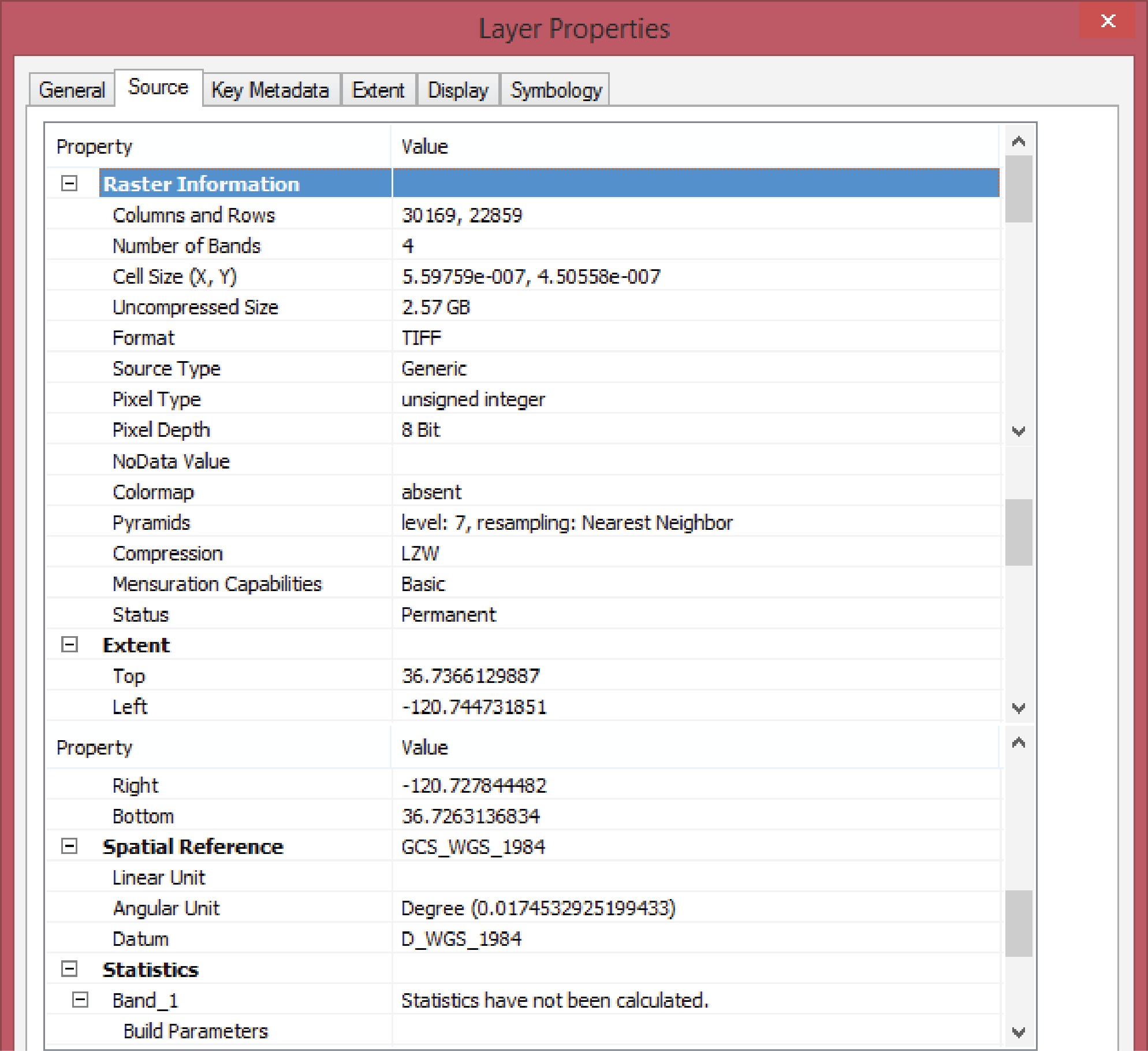
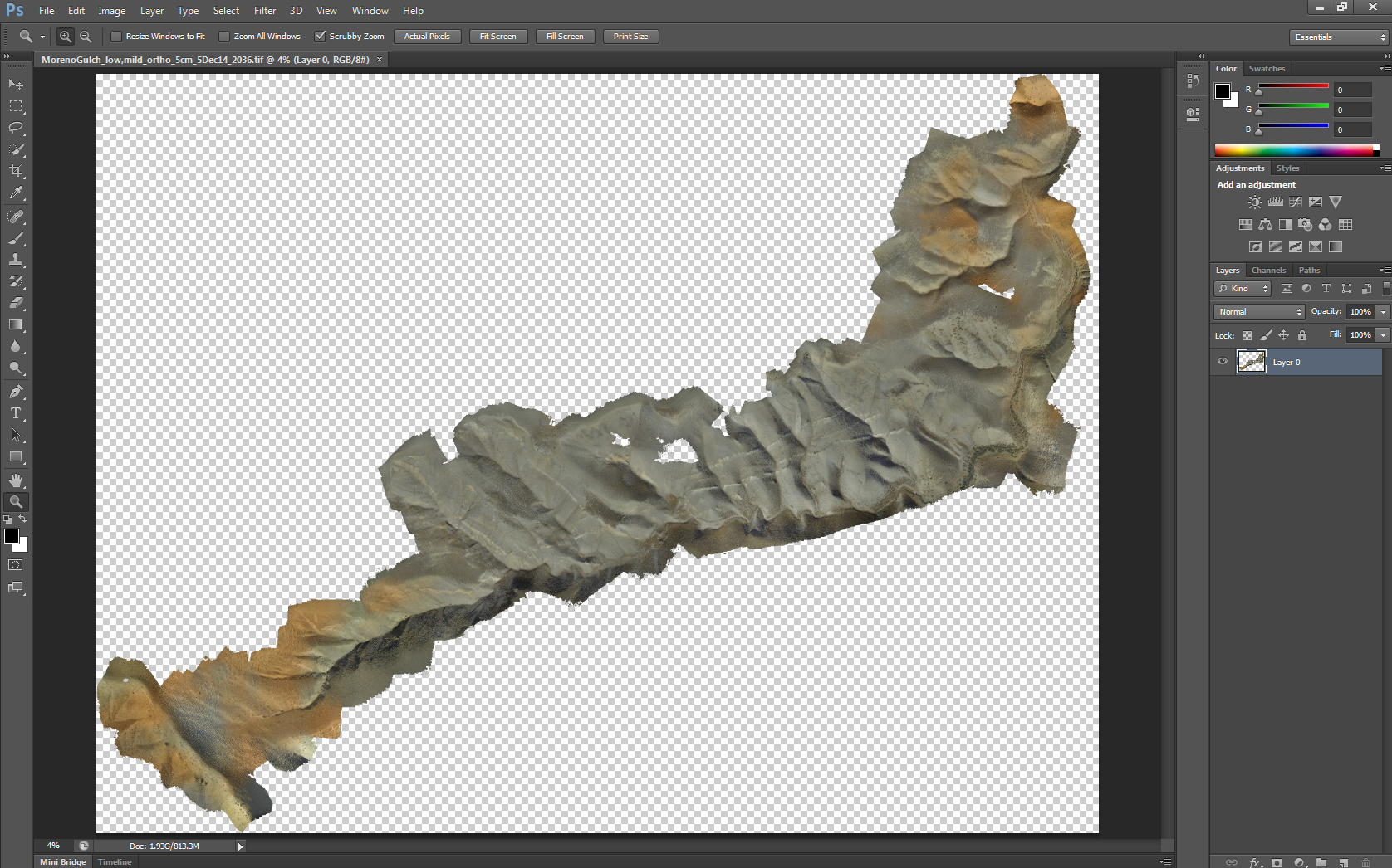
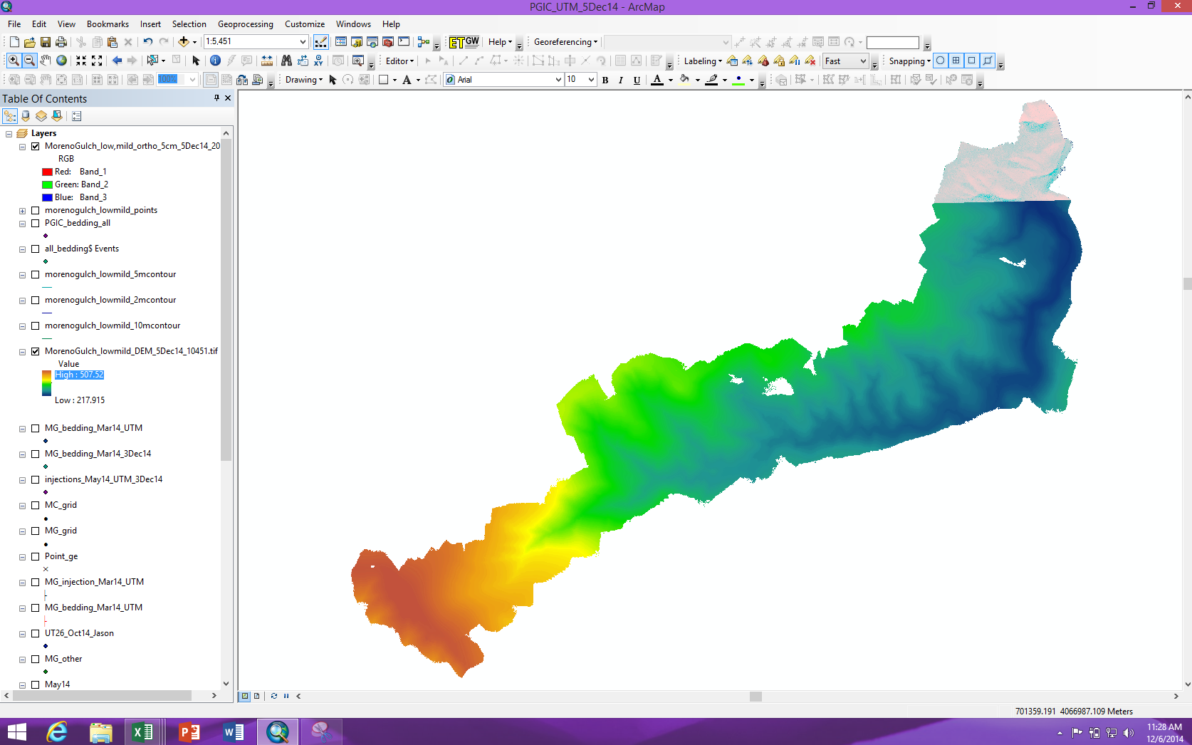
I created an orthophoto from Agisoft PhotoScan Pro, a photogrammetry processing software. I exported the orthophoto as a GeoTIFF (.TIF, .KML, and .OVR files were output). The TIFF displays properly in PhotoShop (see attached), but but only a small fraction of the TIFF displays in ArcMap (see attached; laid over at DEM [also exported from PhotoScan] to illustrate true extent), and the colors are not accurate. I've also attached the layer properties for the TIFF. Thanks in advance for any input!
- Mark as New
- Bookmark
- Subscribe
- Mute
- Subscribe to RSS Feed
- Permalink
- Report Inappropriate Content
jason,
what is the version that you are using? 1.0.0 or higher?
Can you check how big the TIFF is?
Generally, within ArcGIS, the size of all regular TIFF files should be less than 2 GB. (Otherwise, BigTIFF is required, which is not supported in Agisoft PhotoScan Pro 1.0.0.)