- Home
- :
- All Communities
- :
- Products
- :
- Imagery and Remote Sensing
- :
- Imagery Questions
- :
- Re: Error in RGB image
- Subscribe to RSS Feed
- Mark Topic as New
- Mark Topic as Read
- Float this Topic for Current User
- Bookmark
- Subscribe
- Mute
- Printer Friendly Page
Error in RGB image
- Mark as New
- Bookmark
- Subscribe
- Mute
- Subscribe to RSS Feed
- Permalink
- Report Inappropriate Content
Hello,
I have a multiband raster (TIFF) and want to open it the RGB. The first time I opened it was only in black (NoData area) and grey color (study area). Then I opened the different bands separately and executed the composite bands tool and this was the result:
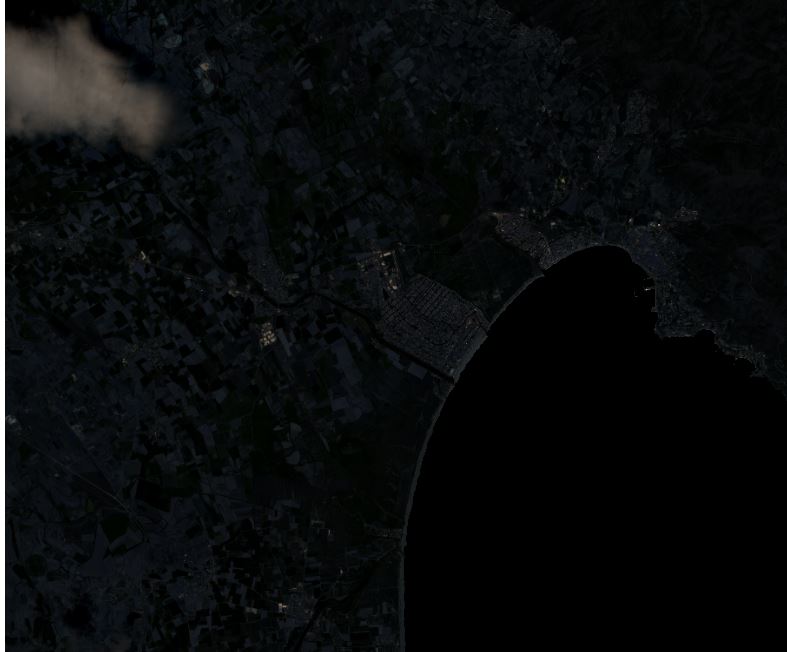
Why is this?? How can I get a correct RGB image??
I'm using ArcMap 10.0
Any help will be much appreciated!
- Mark as New
- Bookmark
- Subscribe
- Mute
- Subscribe to RSS Feed
- Permalink
- Report Inappropriate Content
If you used the proper bands when applying the composite bands, this would mean that the bands do not contain R, G and B values but maybe are the same. Can you calculate using Minus (Spatial Analyst) the difference in values between the R and G band? Or inspect the values of the separate bands for different pixels in the image? If they all result the same, it will explain the grey colors as result.
- Mark as New
- Bookmark
- Subscribe
- Mute
- Subscribe to RSS Feed
- Permalink
- Report Inappropriate Content
Thanks for your quick answer Xander.
I used the minus tool but cannot change the range, so the resulting raster is a black image.
This is the same image when open it in SNAP (Sentinel Application Platform). Shouldn't I see it the same way?
- Mark as New
- Bookmark
- Subscribe
- Mute
- Subscribe to RSS Feed
- Permalink
- Report Inappropriate Content
Note that 10.0 is no longer supported, so you may have trouble getting help on other issues.
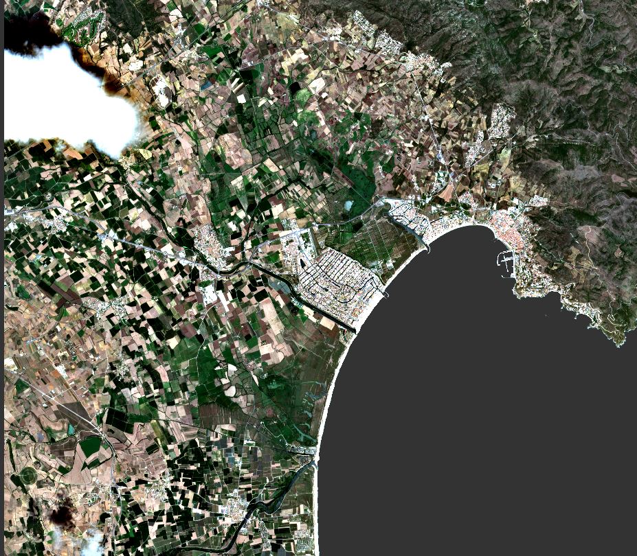
I don't recall for sure if the Image Analysis Window (IAW) existed at 10.0, but I think it did. It looks to me like you have 16 bit satellite data and it's just not being stretched. Go to Windows, Image Analysis, and with the RGB composite loaded, select that layer in the IAW window and turn on "DRA" (Dynamic Range Adjustment).
Note this is just a shortcut for selecting your RGB composite in the table of contents, right click, Properties, and apply a stretch (this screenshot is 10.5.1 so yours will be different, but stretch will be there). The Dynamic Range Adjustment is set to use Statistics "From Current Display Extent" - see gray pulldown at the bottom - so the stretch will change as you pan and zoom. that white cloud will dramatically alter the display, so you can zoom into the coastline and get the cloud offscreen, then you should see imagery as expected

- Mark as New
- Bookmark
- Subscribe
- Mute
- Subscribe to RSS Feed
- Permalink
- Report Inappropriate Content
I solved the problem. I had to choose Stretch Type: Percent Clip
Thanks for all your answers!