- Home
- :
- All Communities
- :
- Products
- :
- ArcGIS Drone2Map
- :
- ArcGIS Drone2Map Ideas
- :
- Add option for selecting fixed elevation to adjust...
- Subscribe to RSS Feed
- Mark as New
- Mark as Read
- Bookmark
- Follow this Idea
- Printer Friendly Page
- Report Inappropriate Content
Add option for selecting fixed elevation to adjust image altitudes
- Mark as New
- Bookmark
- Subscribe
- Mute
- Subscribe to RSS Feed
- Permalink
- Report Inappropriate Content
Under the Image Properties dialogue, there is a drop down option where one can Adjust Image Altitudes. One can currently then Adjust using: (1) Elevation service or (2) Digital Elevation Model. But as many drone users make use of DJI drones, and the image altitudes are based off the altitude of take off site and flight altitude, hence it would be great if you could add a third option, the ability to adjust using a fixed altitude so that one does not need to create fixed altitude elevation rasters and import them as a digital elevation models. Do see David Schwab's post for more information (Drone2Map: How to adjust image altitude in EXIF metadata from DJI Drones ). This workflow works wonderfully but can be easily simplified with some code.
In addition, it would also be really great if Drone2Map could lookup the Relative Altitude from image's EXIF properties to display under the Image Information dialogue box.
Thank you.
- Mark as Read
- Mark as New
- Bookmark
- Permalink
- Report Inappropriate Content
Thanks Mervyn,
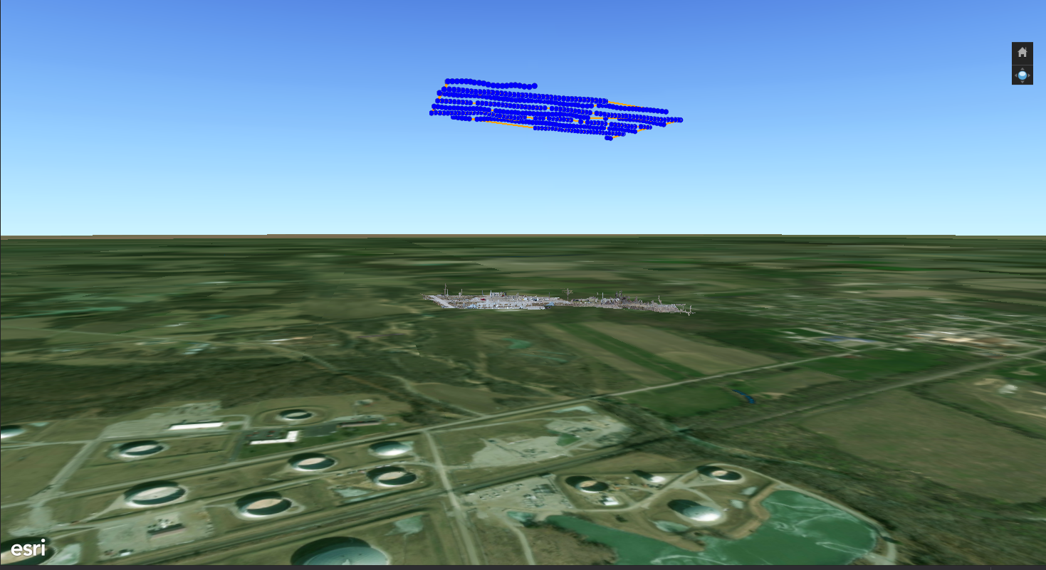
I've been struggling with my maps floating what looks to be several hundreds meters above the basemap.
When I use GCPs the situation becomes worse, and I can no longer zoom in close to see what I need to see, and the map just isn't quite right.
I did get some help from Danny R at ESRI support, Thanks Danny!!
Right now I'm being a smidge impatient with the time zone thing.... they are in California, I am in Illinois.
I just processed a map using my relative altitude (50 meters) to adjust image altitude, and saw no improvement in the final product. The image altitudes changed by about 20 meters after I clicked ok.
Is there a step that I am missing?
Thanks,
Greg
- Mark as Read
- Mark as New
- Bookmark
- Permalink
- Report Inappropriate Content
Hi Greg
I experienced what your results are showing.
The important step is obtaining the correct elevation for the point where
your drone flew from, and creating the raster with a fixed altitude.
I used the Manage GCP functionality get the correct altitude using the *add
ground control points from map functionality*, to get the correct
altitude. I then created a large polygon covering the area I surveyed and
added the flight to the attribute field. Then I create the raster from that
(polygon to raster tool).
If your results are failing, try adding your raster to a Local Scene and
set the layer properties to an absolute height. I haven't tried this, but
it should show you if there is an error with your raster elevation.
Good luck.
Cheers
Mervyn
- Mark as Read
- Mark as New
- Bookmark
- Permalink
- Report Inappropriate Content
Turns out - the elevations coming from my Trimble R1 are 100ft too low.
I'm a bit new to this learning as I go.
- Mark as Read
- Mark as New
- Bookmark
- Permalink
- Report Inappropriate Content
At Drone2Map 2.x you can now adjust Image altitudes using a constant elevation.

Have a look at the Adjust Images Altitude documentation for more information.
You must be a registered user to add a comment. If you've already registered, sign in. Otherwise, register and sign in.