3D geological modeling with ArcGIS
- Subscribe to RSS Feed
- Mark as New
- Mark as Read
- Bookmark
- Subscribe
- Printer Friendly Page
- Report Inappropriate Content
Interested in 3D geological modeling with ArcGIS?
Take a look at two new tools developed to make borehole and faults modeling easier.
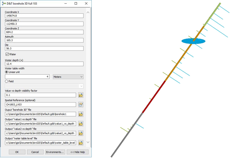
The first tool allows one to model boreholes in 3D in ArcScene, based on their geometrical characteristics (coordinates, azimuth, dip). The tool can be used to represent stratigraphic layers, the level of the water table, in situ and laboratory tests values. It allows rapid and accurate modeling and synthesis of a large quantity of data and helps improve the safety and performance of the works.
Further details can be found at http://www.geol-gis.ch/en/borehole-3d.
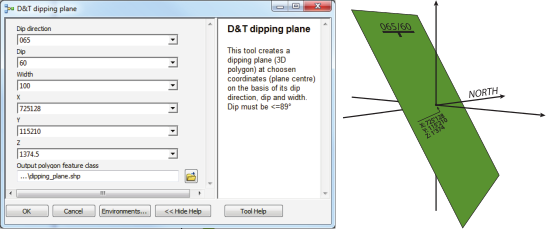
The second tool allows one to create a 3D square plane of determined orientation, dip and width, at pre-determined coordinates. The output is a 3D polygon. This tool is especially useful for the 3D modeling of geological features such as faults, joints, lithologic contacts, bedding or schistosity planes. It is also practical for creating geological cross-sections.
Further details can be found at http://www.geol-gis.ch/en/dt-dipping-plane.
- Tags:
- 3d & geomodeling
- 3d geospatial and geological modeling
- borehole
- drilling
- exploration geology
- fault
- fault plane
- faults
- geological cross section
- geological data modeling
- geological mapping and modeling
- geologie
- geology
- gis in geology
- géologie
- logging geology
- mine geology
- monitoring wells
- structural geology
- well bore construction
- well water
You must be a registered user to add a comment. If you've already registered, sign in. Otherwise, register and sign in.