Presentations - What's Old is New Again
- Subscribe to RSS Feed
- Mark as New
- Mark as Read
- Bookmark
- Subscribe
- Printer Friendly Page
- Report Inappropriate Content
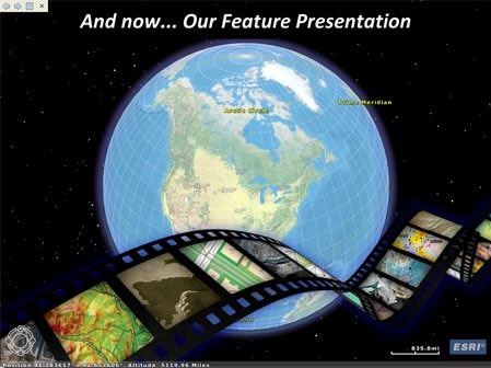
First introduced in November, 2006, ArcGIS Explorer Desktop was a pioneering product in many ways, breaking GIS ground with configurations, popups (as they were spelled back then), swipe tools, map notes, tasking, the ability to "skin" the application, and also introducing one of its most popular features—presentations.
ArcGIS Explorer Desktop was first introduced as Build 340 (build numbers were used instead of versions) in November of 2006. The ability to author presentations—a collection of interactive map slides that could capture the map state and include a title and eventually overlays and other capabilities—came along a bit later with Build 900 in 2009.
ArcGIS Explorer Online arrived in May of 2010, the result of a development effort that was focused on building an innovative, lightweight, browser-based app for exploration and query. It also iterated on many of the ArcGIS Explorer Desktop innovations, including it's own version of online presentations, and added some unique innovations of its own, most notably dashboards, gadgets, and queries. It was officially deprecated in December, 2013, though had not been actively developed for months before its official retirement.
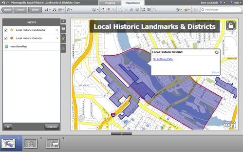
As the sun began to set on ArcGIS Explorer Online, the need to move support for presentations to the javascript-based ArcGIS Online map viewer became increasingly important. The map viewer began supporting viewing Explorer Online presentations in 2011. But other opportunities and alternatives also appeared and became popular for creating presentations—or more accurately—communicating using maps. These included the evolving landscape of app templates and Story Maps, the first of which was published as a custom app in April, 2011.
Earlier this year Explorer for ArcGIS was released on iOS with support for viewing presentations. Another recently introduced native MacOS version of Explorer for ArcGIS also offers the same capabilities.
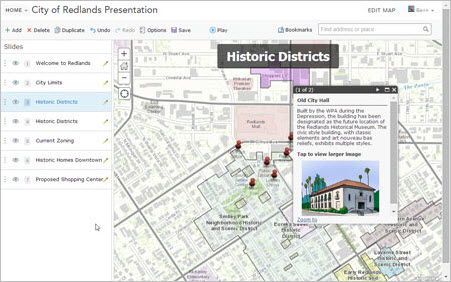
With the July, 2014, release of ArcGIS Online presentations have now come full circle. You can now author as well as view presentations using the ArcGIS Online map viewer. See Create a presentation with your map and Embed a presentation in your website.
So what's old is new once again. Presentations, as time and product development initiatives have shown, remain a popular and effective way to communicate with maps.
You must be a registered user to add a comment. If you've already registered, sign in. Otherwise, register and sign in.