Mostly Mapping Map of the Day - July 31, 2014
- Subscribe to RSS Feed
- Mark as New
- Mark as Read
- Bookmark
- Subscribe
- Printer Friendly Page
- Report Inappropriate Content
Unless you've been on vacation and off the grid the last few days, you've likely seen the coverage of the massive 30-inch water main break on Sunset Boulevard near the UCLA campus in the Westwood neighborhood of Los Angeles. The break has spewed over 20 million gallons of water, flooding UCLA buildings, creating a massive sinkhole in the street, and heightening awareness of the fact that California is suffering through a drought of epic proportions.
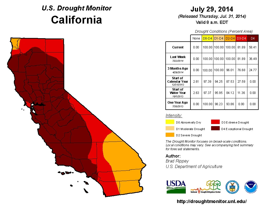
As this map from the U.S. Drought Monitor shows, most of the state is currently under extreme or exceptional drought conditions.
The Map of the Day today is not the Drought Monitor map above, but rather a Story Map Tour that for me, at least, really drives home in just a few clicks how low water levels really are - click once to advance the tour and see for yourself.
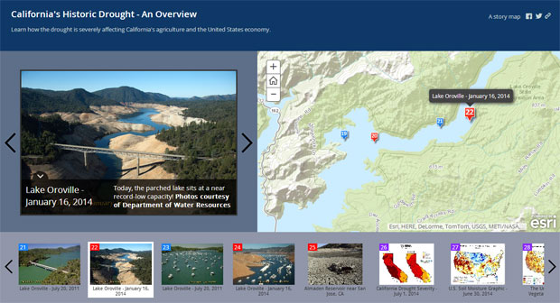
You can view the entire Story Map Tour, authored by the Metropolitan Water District of Southern California (MWD), to learn and see more. This simple, yet effective story map makes this the Map of the Day today.
Further info:
You must be a registered user to add a comment. If you've already registered, sign in. Otherwise, register and sign in.