- Home
- :
- All Communities
- :
- Products
- :
- Geoprocessing
- :
- Geoprocessing Questions
- :
- Why don't I have 'Extent' under the Environments t...
- Subscribe to RSS Feed
- Mark Topic as New
- Mark Topic as Read
- Float this Topic for Current User
- Bookmark
- Subscribe
- Mute
- Printer Friendly Page
Why don't I have 'Extent' under the Environments tab on geoprocessing tools?
- Mark as New
- Bookmark
- Subscribe
- Mute
- Subscribe to RSS Feed
- Permalink
- Report Inappropriate Content
I only have 'Processing Extent' which does not do what I need, which is to limit the extent of the output file from the "LAS Dataset to Raster" tool. The Tool help from http://resources.arcgis.com/en/help/main/10.2/0012/001200000052000000.htm says that 'Extent' should be between Workspace and Output Coordinates but as you can see it is not. What can I do? 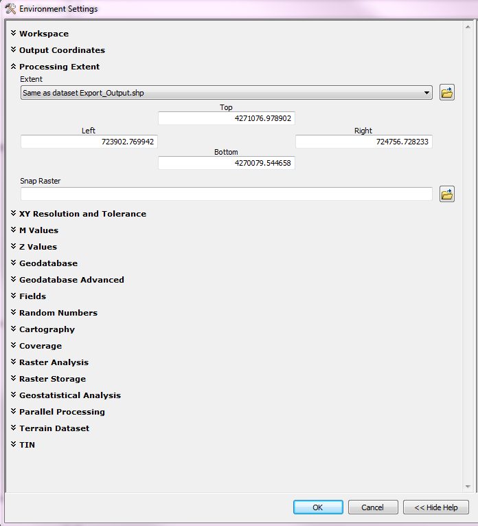
- Mark as New
- Bookmark
- Subscribe
- Mute
- Subscribe to RSS Feed
- Permalink
- Report Inappropriate Content
The extent ( ArcGIS Help (10.2, 10.2.1, and 10.2.2) ) is what you see at Processing Extent (and limits the output extent). You can set is equal to an existing layer or manually define the coordinates of the output extent of your raster.
- Mark as New
- Bookmark
- Subscribe
- Mute
- Subscribe to RSS Feed
- Permalink
- Report Inappropriate Content
I see. Thank you. But when I put in my shapefile I want my raster to be clipped to I get a blank output. I guess this only works for rectangle polygons and if I want my output raster to have the same shape as a non-rectangle polygon (based on a shapefile as a bounding input) the only way to do that is to clip it once it's made? Someone else said that I could 'Extent' to define the shape of my output raster, but I didn't think that was the case, just the highest north south east west points.
- Mark as New
- Bookmark
- Subscribe
- Mute
- Subscribe to RSS Feed
- Permalink
- Report Inappropriate Content
You can use any shape for the extent, but it will use the extent of all the features in the shapefile. The extent is a rectangle (minimum bounding box containing all the features). To "clip" the output using your irregular shapes, you should specify it in the Mask (see the part "Raster Analysis" where you can select a layer as mask).
The reason for a blank raster (result) could be the coordinate systems that don't match or the extent of the shapefile is outside the extent with data in your LAS file (or problems with your LAS dataset).