Turn on suggestions
Auto-suggest helps you quickly narrow down your search results by suggesting possible matches as you type.
Cancel
- Home
- :
- All Communities
- :
- Products
- :
- Geoprocessing
- :
- Geoprocessing Questions
- :
- Re: Point To Raster Tool
Options
- Subscribe to RSS Feed
- Mark Topic as New
- Mark Topic as Read
- Float this Topic for Current User
- Bookmark
- Subscribe
- Mute
- Printer Friendly Page
06-05-2014
07:35 AM
- Mark as New
- Bookmark
- Subscribe
- Mute
- Subscribe to RSS Feed
- Permalink
Hello,
I am using the point to raster tool, summing by "theCalcField", and using a cell size of .85 degrees. So I expect a full blocky-style raster.
Why then does the tool create a raster as though each cell is considering values from outside it's own cell (as per many other spatial analyst tools)?
This is my command.
arcpy.PointToRaster_conversion(LOCATIONS, theCalcField, RASTER_LAYER, "SUM", "NONE", "0.85")
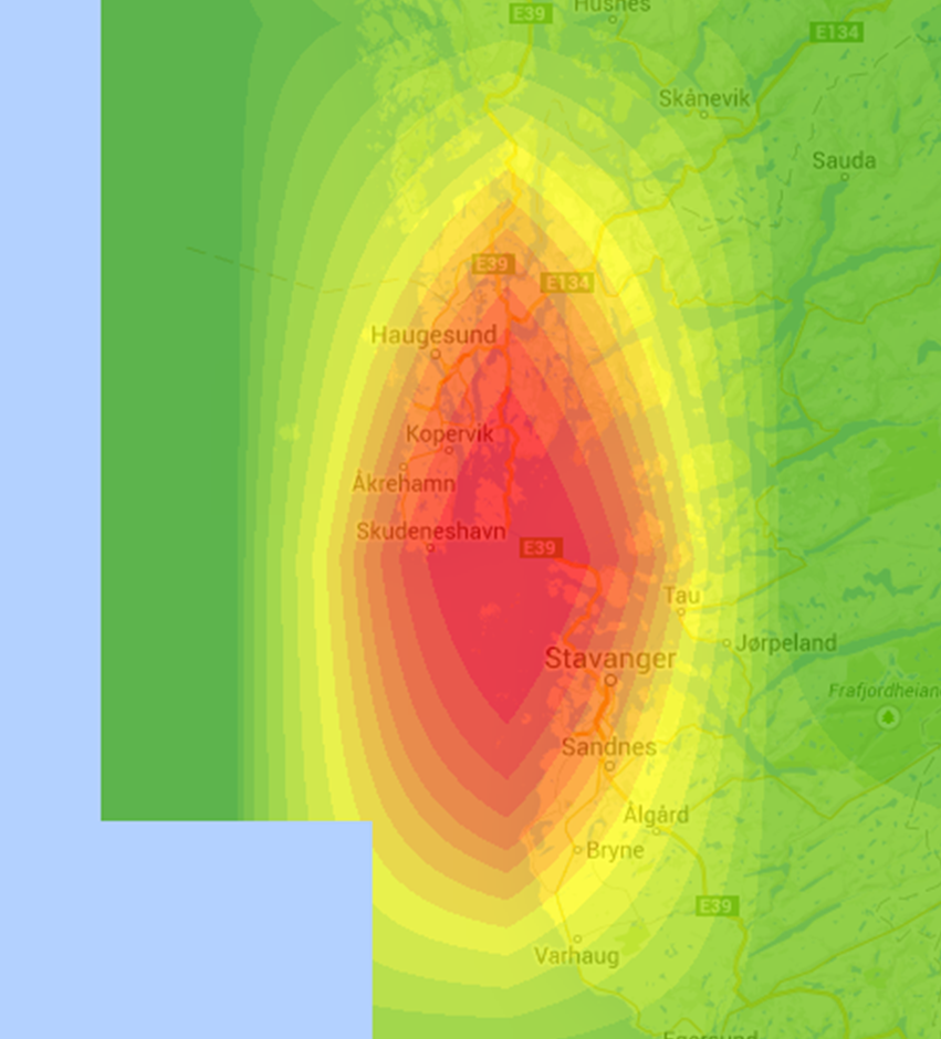
And an image of the raster:
[ATTACH=CONFIG]34391[/ATTACH]
I am using the point to raster tool, summing by "theCalcField", and using a cell size of .85 degrees. So I expect a full blocky-style raster.
Why then does the tool create a raster as though each cell is considering values from outside it's own cell (as per many other spatial analyst tools)?
This is my command.
arcpy.PointToRaster_conversion(LOCATIONS, theCalcField, RASTER_LAYER, "SUM", "NONE", "0.85")
And an image of the raster:
[ATTACH=CONFIG]34391[/ATTACH]
Solved! Go to Solution.
1 Solution
Accepted Solutions
06-06-2014
07:11 AM
- Mark as New
- Bookmark
- Subscribe
- Mute
- Subscribe to RSS Feed
- Permalink
Perhaps your layer display is using bilinear interpolation?
4 Replies
06-05-2014
08:03 AM
- Mark as New
- Bookmark
- Subscribe
- Mute
- Subscribe to RSS Feed
- Permalink
At .85 degrees, this should be 2 or 3 cells tall, correct? So the cellsize is not being set correctly. Is the input point data in geographic coordinate system?
Regards,
Jim
Regards,
Jim
06-05-2014
08:19 AM
- Mark as New
- Bookmark
- Subscribe
- Mute
- Subscribe to RSS Feed
- Permalink
Hmmm,
I think a degree at the equator should be approximately 69 miles (111 kilometers)
so, .85 of a degree maybe around 100km... and where in my image it is blocky (in the bottom left), this block size is about 100km, so that is the expected cell size.
the whole raster should be cells of this size, I would think, according to how point to raster works.
06-06-2014
07:11 AM
- Mark as New
- Bookmark
- Subscribe
- Mute
- Subscribe to RSS Feed
- Permalink
Perhaps your layer display is using bilinear interpolation?
06-06-2014
08:14 AM
- Mark as New
- Bookmark
- Subscribe
- Mute
- Subscribe to RSS Feed
- Permalink
Hi Jim,
Nice one! yes, it was due to the symbology that had been applied to the raster.
Thanks very much!
Nice one! yes, it was due to the symbology that had been applied to the raster.
Thanks very much!