- Home
- :
- All Communities
- :
- Products
- :
- Geoprocessing
- :
- Geoprocessing Questions
- :
- Clip not working
- Subscribe to RSS Feed
- Mark Topic as New
- Mark Topic as Read
- Float this Topic for Current User
- Bookmark
- Subscribe
- Mute
- Printer Friendly Page
Clip not working
- Mark as New
- Bookmark
- Subscribe
- Mute
- Subscribe to RSS Feed
- Permalink
I have a peculiar problem. The clip tool is simply not running. My results say that the tool ran, but the output isn't created, and there are no messages. 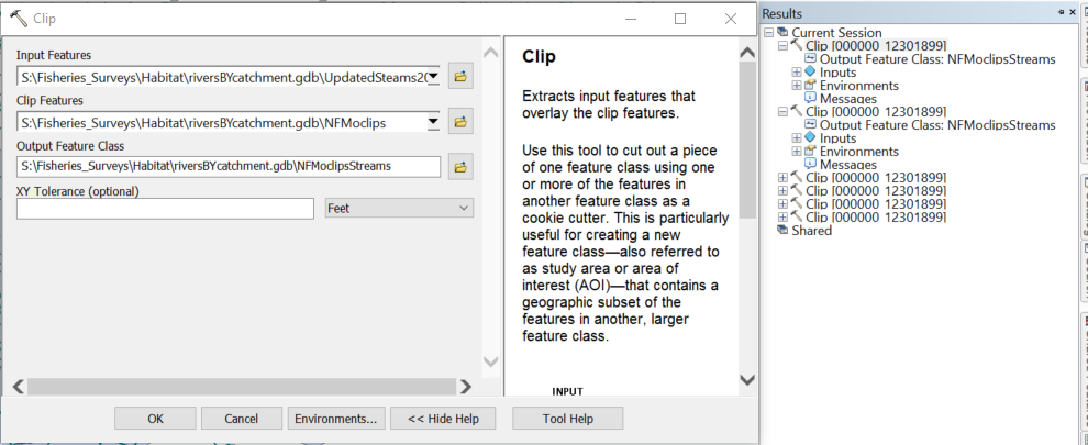
I have moved all the data into the same geodatabase, and it's all in the same projection. I welcome any suggestions to what could be going on because I am at a loss.
Thank you GeoNet Community!
- Mark as New
- Bookmark
- Subscribe
- Mute
- Subscribe to RSS Feed
- Permalink
If your polygons have invalid ring geometry, Clip may produce bizarre results.
Try verifying both your Input and Clip layers with CheckGeometry_management
- V
- Mark as New
- Bookmark
- Subscribe
- Mute
- Subscribe to RSS Feed
- Permalink
I will try that, but my clipping layer only has a single polygon, so no gaps or slivers or overlaps are possible...
- Mark as New
- Bookmark
- Subscribe
- Mute
- Subscribe to RSS Feed
- Permalink
The polygon can still be invalid in other ways (e.g., self-intersection).
- V
- Mark as New
- Bookmark
- Subscribe
- Mute
- Subscribe to RSS Feed
- Permalink
Checking the projection is one thing, but it is best to look at the numbers for both layer's 'extent'... In order to clip or intersect or any of the 'overlay' tools, the extents must intersect. if the bounding box of the layer being used to 'clip' the geometry doesn't overlap what is to be clipped, then nothing will occur.
- Mark as New
- Bookmark
- Subscribe
- Mute
- Subscribe to RSS Feed
- Permalink
I am having the same problem with multiple tools in the toolbox. It happens on completely different datasets. It happens regardless of coordinate system matching. It happens on 3 different PCs in our office. It is usually fixable by rebooting PC but only temporarily - so it gets very frustrating. Closing and restarting ArcGIS doesn't help. Right now it's happening with Extract by Mask (for raster) but there have been about 10 tools doing this. It's happening on 10.5.1 right now and also happened on previous version of ArcMap and on previous PC to the one I got recently. The exact opposite problem also occurs (sometimes it generates and error and says it couldn't complete process, but it actually generated a completely valid output in the folder).
- Mark as New
- Bookmark
- Subscribe
- Mute
- Subscribe to RSS Feed
- Permalink
Its a problem that i'm still having. running a repair works for a few days though... it seems to happen more if it's been a day or since i've restated my pc.
- Mark as New
- Bookmark
- Subscribe
- Mute
- Subscribe to RSS Feed
- Permalink
Faith, what do you mean by running a repair? I'm curious to try same thing here. We just upgraded to 10.6.1 and I was disappointed to find that the problem is still happening on a daily basis for me. And I still have to reboot my machine every time to fix it. It has become a big time consumer. It's interesting that you have also been experiencing the issue for many months and how recent you restarted also affects you. You wouldn't happen to be using a cloud backup appliance system like Panzura would you?
- Mark as New
- Bookmark
- Subscribe
- Mute
- Subscribe to RSS Feed
- Permalink
Repair.... Got to Windows Control panel, Add/Remove Programs, select arcmap and a 'Repair' will be one of the options
- Mark as New
- Bookmark
- Subscribe
- Mute
- Subscribe to RSS Feed
- Permalink
GDBs suffer from all kinds of geoprocessing failures. Move the data to shapefiles.
- Mark as New
- Bookmark
- Subscribe
- Mute
- Subscribe to RSS Feed
- Permalink
I have to point out that shapefiles are not an acceptable substitute for users with numeric NULLs, fieldnames longer than 10 characters, UTF-16 strings, strings exceeding 254 charcters, BLOB data, datetime fields with higher than day resolution, topologies, feature datasets, domains,.... Establishing correct spatial reference metadata can sometimes be a challenge, but getting the values right is much easier than trying to get by with a data format, created in the early 1990s, which lacks so many modern features.
- V