- Home
- :
- All Communities
- :
- Industries
- :
- Natural Resources
- :
- Forestry
- :
- Forestry Questions
- :
- Esri Celebrates the 50th Anniversary of the Wilder...
- Subscribe to RSS Feed
- Mark Topic as New
- Mark Topic as Read
- Float this Topic for Current User
- Bookmark
- Subscribe
- Mute
- Printer Friendly Page
Esri Celebrates the 50th Anniversary of the Wilderness Act
- Mark as New
- Bookmark
- Subscribe
- Mute
- Subscribe to RSS Feed
- Permalink
- Report Inappropriate Content
Yesterday was the 50th Anniversary of the Wilderness Act. In correspondence with this, President Obama has proclaimed September National Wilderness Month. Esri, a longtime advocate of environmental conservation, is pleased to showcase 10 influential online federal and nongovernmental maps that anyone can use to become part of the nation's wilderness conservation effort. In concert with Wilderness50, a coalition of agencies, organizations, and universities, Esri celebrates the success of America's Wilderness Act and encourages citizens to participate in learning about and preserving wilderness in their areas.
Additionally, yesterday an exhibit opened at Smithsonian’s National Museum of Natural History featuring photographs of the U.S. Wilderness System. The exhibit is in observance of this month's 50th anniversary of the Wilderness Act, and features touch-screen kiosks with two Esri story maps. Preview these online:
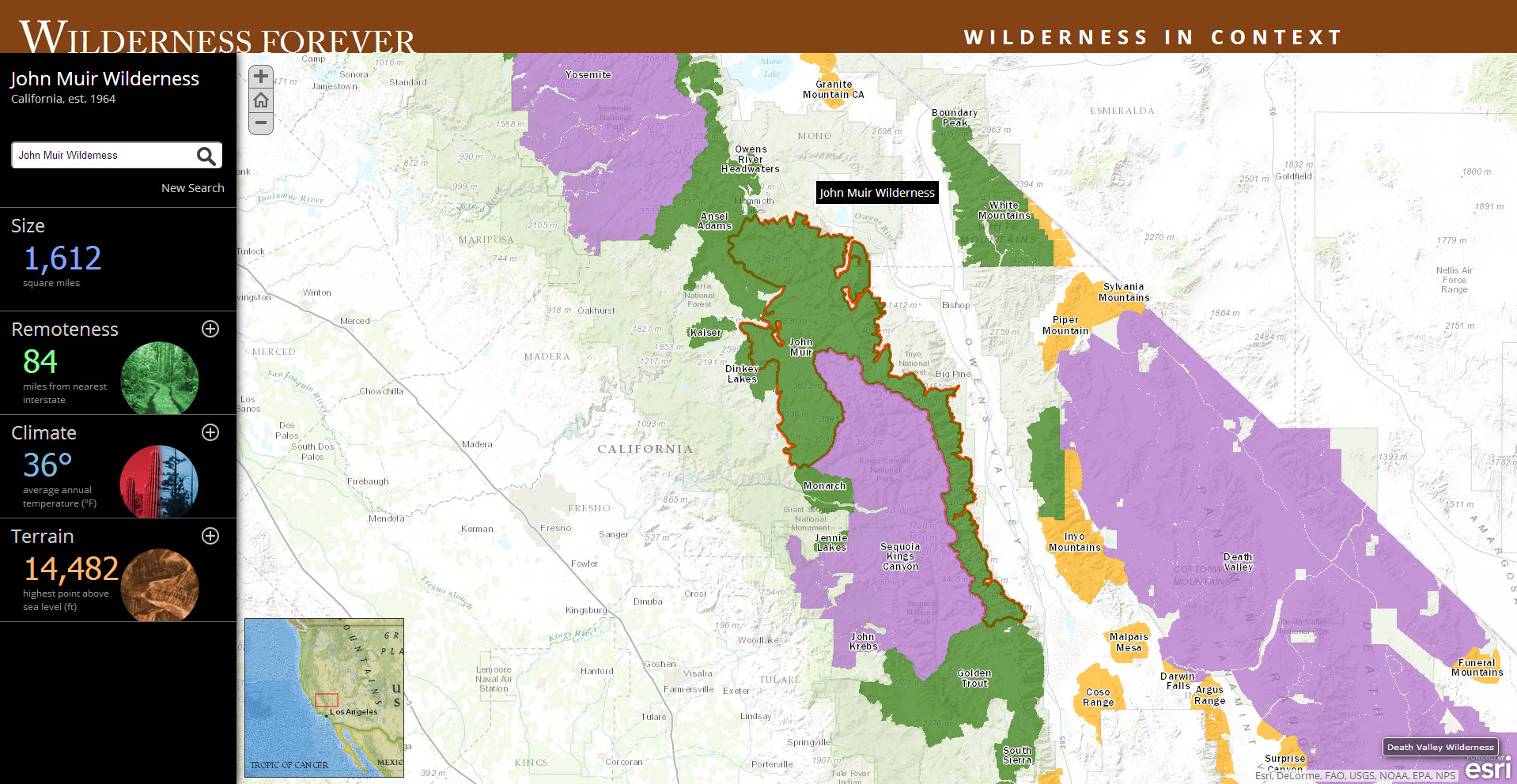
- Wilderness Forever: Wilderness in Context: This geographically provides vital wilderness information about size, remoteness, climate, and terrain.
- Wilderness Forever: Explore Photographs: A delightful way to enjoy exquisite wilderness photography across the American landscape
- Mark as New
- Bookmark
- Subscribe
- Mute
- Subscribe to RSS Feed
- Permalink
- Report Inappropriate Content
NPR had a story yesterday that talked about some of the benefits and challenges the WA has on communities & municipalities which are near wilderness lands:
Wilderness Area Accused Of Inhibiting Idaho Town's Economy : NPR