- Home
- :
- All Communities
- :
- Events
- :
- FedGIS Conference
- :
- FedGIS Conference Blog
- :
- 2018 Federal GIS Conference Highlights: Day 1 & 2
2018 Federal GIS Conference Highlights: Day 1 & 2
- Subscribe to RSS Feed
- Mark as New
- Mark as Read
- Bookmark
- Subscribe
- Printer Friendly Page
- Report Inappropriate Content
 After an inspirational Plenary on Day One and Keynote Plenary on Day Two of the 2018 Federal GIS Conference in Washington D.C., attendees dispersed to begin their adventures on the Expo floor and in the many workshops provided by Esri staff and user and partners. The GeoNet team had the pleasure of participating in this year's event, giving the https://community.esri.com/community/events/fedgis/blog/2018/03/20/live-from-the-fedgis-plenary?sr=s..., and meeting so many of the wonderful guests that braved the cold, snowy weather to learn what advancements Esri has in store for the future of GIS.
Enjoy the Highlights of what we captured.
YPN Luncheon
by Chris Catania

During the Young Professionals Network (Esri Young Professionals Network) luncheon on Tuesday, National Geographic’s Vice President of Media Innovation, Kaitlin Yarnell, shared a compelling commentary on the importance of crafting a visual story and the impact it can have on your career and ability to influence within your organization. Yarnell also took us through the story of how her role as a cartographer at Nat Geo evolved into her becoming a well-known and highly respected thought leader in geography worldwide. Here’s the highlights from her talk and Q&A session with YPN organizer Corianne Jones. We invite you to ask your questions and share your comments below.
When you have a complex story to tell it’s important to break it down in to smaller parts and figure out how to use visuals to make the story more compelling and memorable,” said Yarnell. “Thinking visually helps to see what parts of the story are most important and how to best tell them.”
As an example, Yarnell shared the Mindsuckers story explaining how National Geographic needed to evolve to reach a new audience with a complex story. To rise to the challenge, Yarnell explained that they couldn’t rely on just one channel but they need to take risks and pursue an approach that included a collection of integrated formats; a creative dub-stub inspired video, compelling photography, a graphic novel element and interactive web content. In the end, the approach worked. Yarnell’s team successfully pushed beyond previously traditional boundaries connecting Nat Geo with their new and younger target audience while also telling an important, complex and compelling scientific story.
To wrap up the session, Jones sat down with Yarnell to chat about what she has learned from building her team and developing her career.
What are the top three things you suggest doing when growing your career?
- Know your strengths. Experiment with many things early on in your career, but once you find what you’re good at, focus on it and use those unique talents to stand out from others.
- Have a personal 30 second elevator speech. Always be ready to quickly share your personal mission, your work, or what your most passionate about and why. This is an important tool to have ready, especially when talking with leaders and executives.
- Sketch out what you’re doing before starting projects. Instead of diving right into digital tools, use simple tools to start brainstorming, like paper and sharpie, and map out your ideas. This “analog” first step helps to refine what you’re trying to accomplish with projects.
What do you look for when hiring candidates?
I look for passion. If someone is passionate about a hobby or other areas besides design, like running marathons or publishing their own blog, I usually ask them more about those type of things. I love learning more about those “side interests” in candidates because it helps me gauge their passion and it demonstrates their level of dedication and determination. And together those elements show me that they truly care about they what they’re doing in life and work, and that type of passion usually means that they have the capacity to deliver great contributions on my team.
Wednesday Keynote Plenary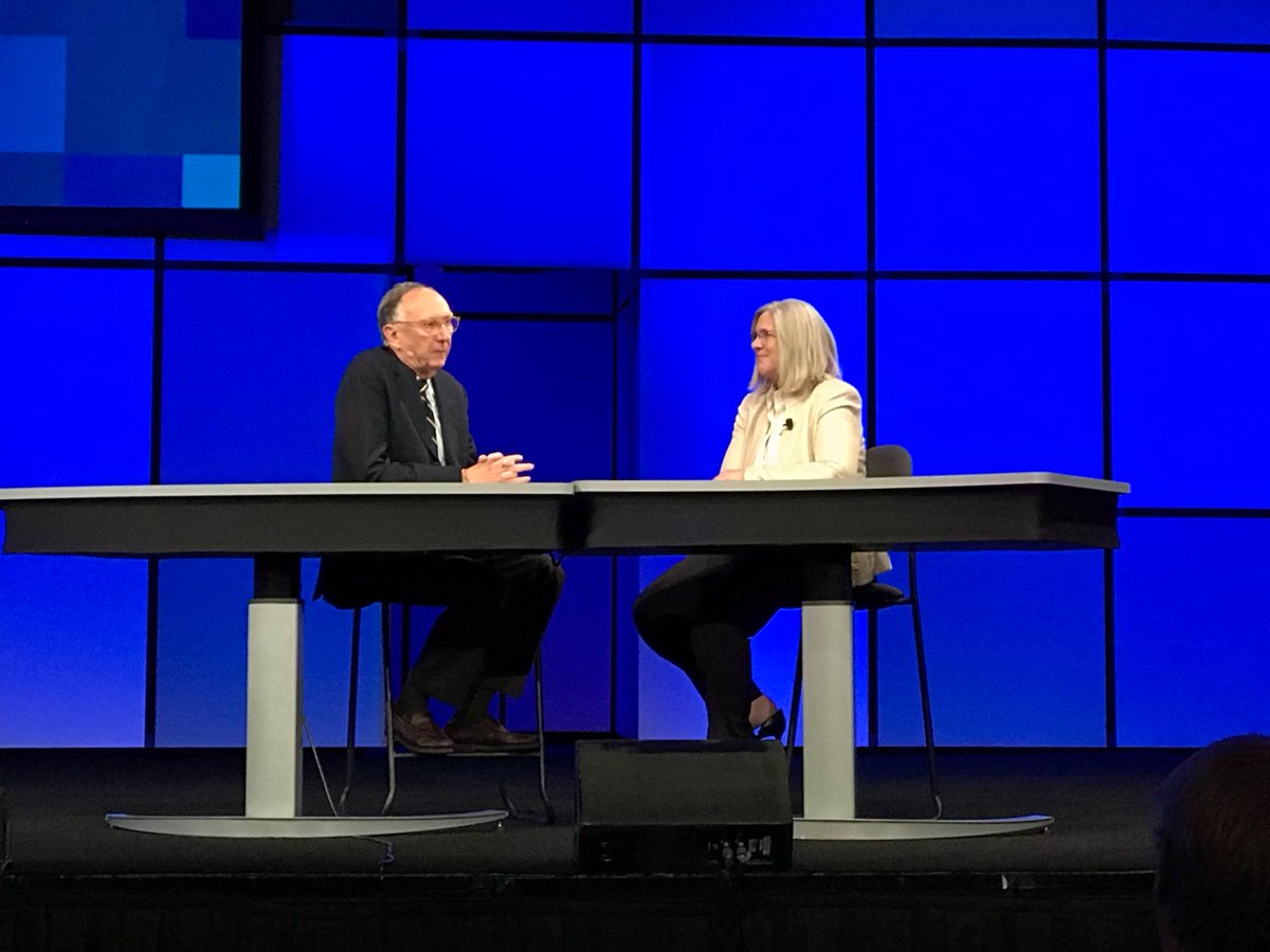
Jack and Sue Gordon, Principal Deputy Director of National Intelligence (PDDNI), get real with an intimate, sit-down discussion on stage. As they reminiscence on their acquaintance, Gordon refers to Jack as an inspiration, “He has a vision about what could be and then turns it into action that benefits America's interests.”
In response, Jack compliments Gordon for leading the NGA digital transformation and being the powerhouse behind the IC GIS Portal; a platform for analytics, collaboration, and data sharing that is used throughout the intelligence community—right down to the war fighter. Starting from zero, the IC GIS Portal now has 120,000 users worldwide.
Gordon shares her love for geography, “I really love geography and GIS because I think it’s accessible STEM. You are doing all those fundamental things in a way that allows you to see what you’re playing with.”
They talk candidly about the use of maps and GIS in the White House. Gordon explains how they put a map or some sort of spatial tabulation for almost every intelligence briefing.
Gordon shares the complexity and challenges of the world of GIS. She elaborates, “We don’t show human activity well enough,” referring to mass migration, human crisis in a map view, impacts to regions such as cultural changes.
"The combination of a map plus geospatial information presented differently is really powerful...Would love to show the President better - the feeling - taking story maps to another level." ~Susan Gordon, Principal Deputy Director of National Intelligence
Switching the topic, Jack compliments Gordon in her role as the PDDNI, “You create a place of nurturing. You reach out and show the way – Amazing.” He asks if she has any advice for others.
Her advice:
- Have to be good at your job.
- Be big.
- Be bold - No organization has enough energy to stop someone who does.
- Learn to make decisions.
- Give people responsibility. They work for you.
- Be kind - treat people decently.
She adds, “Tell your kids to get a STEM education… If you are a leader you need to be a technical leader.”
They transition into a conversation about self-driving cars. Gordon recollects a previous discussion with a friend who commented that children will not know how to drive a car. This led her to begin thinking about how we learn geography, “Most of us learn geography when we start driving cars…Geography is a foundational skill we need - how will people get that experience without driving?”
Jack discusses an initiative K-12 program to help integrate geography and GIS into early education.
Continuing Gordon asks, “What is science fiction in this field now?”
Jack replies, “AR/VR machine learning - starting to be realized now - was science fiction 5-years ago.”
Their conversation ended in a warm farewell as Gordon exited the stage and Jack gave a welcoming introduction of the American Red Cross presenters.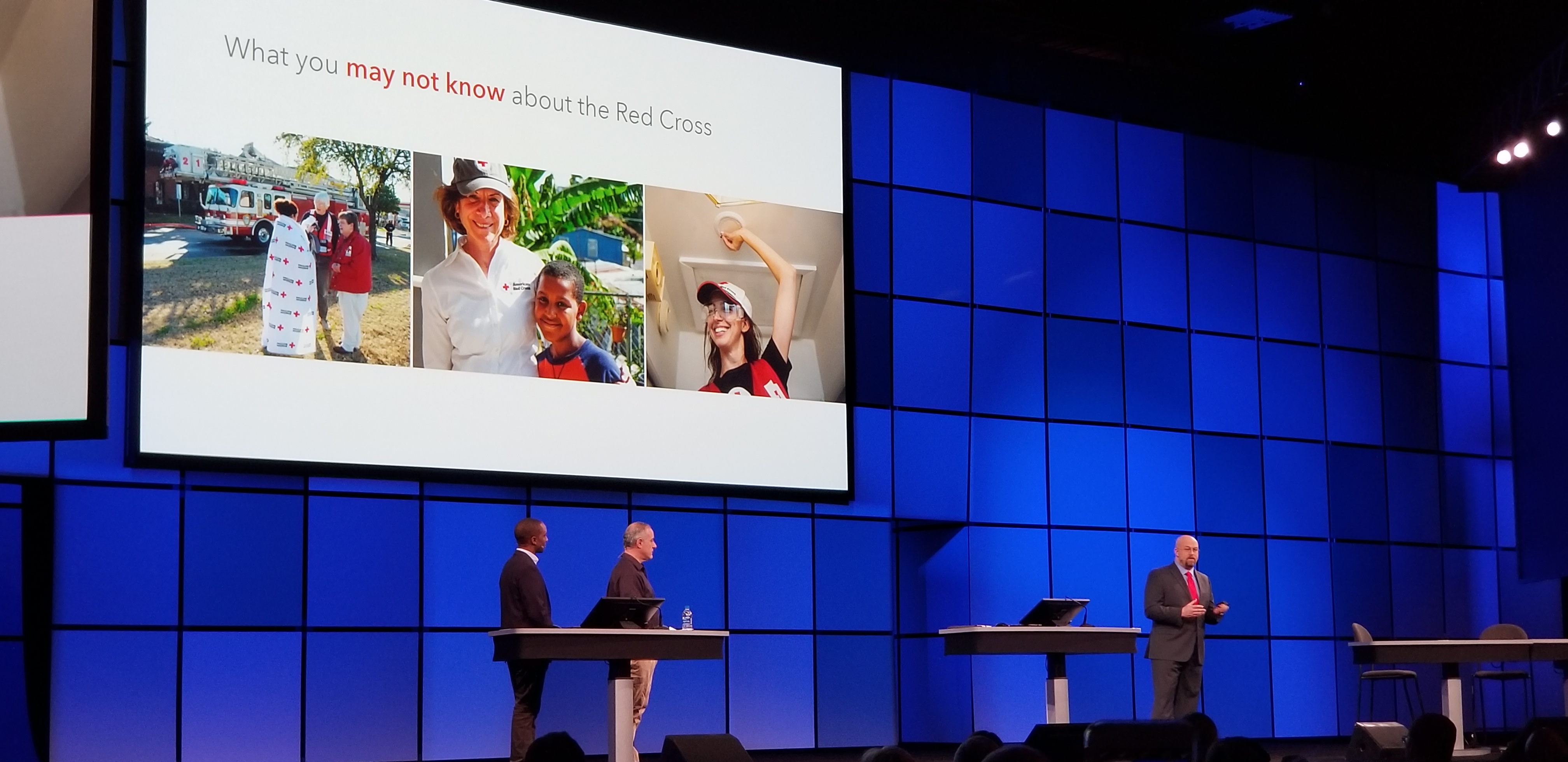

- Brad Kieserman, Vice President – Disaster Operations & Logistics
- Brian Keenum, Senior Director – Business Infrastructure
- Omari Sefu, Senior Associate – GIS and Disaster Data Analysis
In partnership with Esri, the American Red Cross has developed their RC View system to synthesize federal, state and local data sources to inform service delivery and streamline reporting on large national disaster relief operations. Mapping of home fires, preparedness efforts for our local communities, and disaster relief efforts continue to evolve. With RC View its data-driven decision-making capability increases readiness and better meets our mission: alleviate human suffering in the face of emergencies.
Brian Keenum, “We’re confident through data we can do a better job for the future.”
Brad Kieserman gives demonstration while Omari Sefu navigates the maps used for disaster recovery by the American Red Cross. Samples included fire damaged homes, use of mobile (Survey123 for ArcGIS) for volunteers, staff tracking in the field.
“Everything we do…is enabling our volunteer workforce to accomplish that mission.” ~ Brad Kieserman
Data, technology, GIS and data visualization are helping make a better Red Cross. RC View is a live map. We gather virtually and in our headquarters every day, and we look at the map. We respond to more than 360,000 disasters per year. We’re learning how we can provide more service to more people with compassion and quality -- providing shelter, feeding and comfort – because we can see the data.
We’re using your data and products. It ranges from weather, information about social vulnerability from the CDC, to flood maps from FEMA, and local authoritative information. The American Red Cross isn’t “the” team, we’re part of that team. You have helped alleviate suffering because we are using your data.
Nearly 50 percent of Americans can’t withstand an event that costs them $400. We organize so that these people don’t go over the tipping point and remain standing on their two feet.
On the Expo Floor
SafeGraph
After the Keynote Plenary, we headed to the Startup Zone on the Expo floor to talk with members of theEsri Startup Program. First, we talked with Ryan Squire of SafeGraph who is new to the FedGIS conference. SafeGraph is a Machine Learning tech company that works with Esri customers to collect human movement, the where and when of human activity, tracked via devices such as mobile phones.
This datasets collected by SafeGraph are used by Esri customers who use ArcGIS and need big data collections to understand markets, strategy planning, advertising, and so much more. They came to FedGIS to gather feedback from the Federal customers and learn how they can better provide data collection to help with city planning and government intelligence.
 Easy2Hike
We also had the pleasure to meet up with Easy2Hike at the Start Up zone. Easy2Hike is a new company working with Parks and Recreation services to build easy to use hiking trail maps for mobile devices. Easy2Hike partners, Uri Bar and Erez Talgam are avid hikers inspired by their own experiences on hiking trails all over the world. They wanted to develop a mobile app that anyone can use and is easy to update by park administrators without having to know code or GIS.
The Easy2Hike app provides geographic history and story-telling of the parks and trail locations, the ability to push alerts and communications to park goers, and even provides analytics such as the best places to have picnic tables or attractions. Uri and Erez are at FedGIS to get feedback and make connections with other Esri users and partners in an effort to expand their capabilities with their app.
Day One Workshop Session
GIS for Elected Officials
Day One we explored the Expo floor and sat in a workshop hosted by Bonnie Stayer and Lauren Lipovic. The session guest presenters representing different Senate offices demonstrated how government organizations are using GIS to leverage data for communications and understanding of constituents and making policies.
- Annie Hoefler, U.S. Senate Committee on Energy and Natural Resources
- Hoefler shared several projects tasked to the U.S. Senate Committee on Energy and Natural Resources to find more resourceful mapping sets for natural resources, disaster recovery, cybersecurity, and several other projects.
- Chance Costello, U.S. Senate Committee on Commerce, Science and Transportation
- Castello displayed slides of the Nationwide Local Ballot Measures by County for 2014-2017.
- Romel Nicholas, Office of U.S. Senator Orin Hatch
- In only 10-minutes, Nicholas developed a map of dissatisfied constituent correspondence from the State of Utah explaining how the information is then used to help guide communications for U.S. Senator Orin Hatch.
Day Two Workshops
ArcGIS for Local Government Solutions: An Overview
We wrapped up the Day Two afternoon with a workshop presented by Rachel Weedon on “ArcGIS for Local Government Solutions: An Overview.” The workshop introduced attendees to ArcGIS solutions, giving an overview of popular solution areas, demonstrating best practices for deployment and a sneak peek at future development initiatives. The workshop also highlighted case studies and examples from cities and counties that currently have ArcGIS for Local Government solutions deployed. Rachel also provided an overview of how MNCPPC has been using the ArcGIS Solution apps.
Evolving the GIS Professional: Modernizing Intelligence Production in ArcGIS
We followed with the final session of the evening presented by Renee Bernstein and Wendy Creighton on the “Evolving the GIS Professional: Modernizing Intelligence Production in ArcGIS.” The workshop showcased how a GIS professional can incorporate Esri's ArcGIS platform into intelligence production, analysis, and sharing for more informed decision-making at all levels.
Member Connections at the GeoNet area
It was great to meet many current government members of the Esri Community who stopped by the GeoNet booth. We enjoyed the conversations and hearing how you're using the community in your work. We also welcome all new members who signed up this week and invite you to check out the GeoNet Resource Hub for tips, tools and news.
One Last Hoorah! Social at the Smithsonian National Portrait Gallery
Finally, we attended the Esri final night social. It was a beautiful setting at the Smithsonian National Portrait Museum. Many connected, collaborated and even swapped business cards to continue their discussions outside of the conference.

You must be a registered user to add a comment. If you've already registered, sign in. Otherwise, register and sign in.
-
FedGIS 2017
4 -
FedGIS 2018
5 -
FedGIS 2019
1 -
FedGIS 2020
3 -
FedGIS 2021
4 -
FedGIS 2023
4 -
FedGIS 2024
3