Esri Technical Support Blog

cancel
Showing results for 
Show  only  | Search instead for 
Did you mean: 

Other Boards in This Place

Latest Activity

(383 Posts)
MeganSingleton
Occasional Contributor III

In 2014, we began My Esri as a one-stop shop for customers, a place for Esri’s global community to manage unique relationships with Esri. My Esri has grown steadily since launch, and we’re happy to announce that the site now includes support! Everything previously available on the legacy My Support site now calls My Esri home, and we’ve added some functionality, as well. Depending on your role within the organization, you can log cases, report bugs, view recent activity, and more.

There are many roles in My Esri, and this blog outlines some workflows and FAQs for of each participant: users, administrators, distributors, and Premium customers. Although we’ve segmented this post by user, the information under “For My Esri Users” contains valuable information for all. Note: If you don’t see the Support tab in My Esri, check out this blog post. If you’d like to know more how to use My Esri beyond what’s covered in this post, please see the Common Questions view in your Dashboard of My Esri (you must have an Esri account to view this page; see Get an Esri Account below). Additionally, you can take a tour of My Esri through the Take a Tour option. For My Esri UsersGet an Esri AccountTo use My Esri, you need an Esri account. To learn how to create an Esri account or to get account help, click here. Connect to an Organization6-21-2016-12-30-35-PM1-283x300.jpgYou can connect to an organization through:

  • Requesting permissions through My Organizations > Request Permissions
  • Contacting your administrator to invite you through token-based authentication or
  • Contacting you administrator to directly connect your username.  
Note: You can connect to multiple organizations in My Esri; follow one of the methods above to connect to an additional organization. Get an Overview of Your Support OrganizationFor a quick snapshot of your organization’s overall support status, check out the Overview page. On this page, you can see case and bug volume, contact information, a brief overview of recent activity, and more. For further detail, visit one of the other pages: Recent Activity, Cases, Bugs, or Authorized Callers.6-21-2016-2-01-44-PM-300x148.jpgView Recent ActivityThrough the Recent Activity subtab, users can get a snapshot of recent activity, including that of bugs and cases. For a more detailed analysis, see the pages for bugs, cases, and so forth. View Case and Bug InformationFor a more in-depth look at cases and bugs beyond what’s shown on the Recent Activity page, please visit the pages for Cases and Bugs, respectively. In these views, you can apply more filters to expedite search, view a specific activity report, and see more metadata related to the bug and/or case. Become an Authorized CallerIf you wish to become an authorized caller, please contact your administrator or navigate to My Organizations > Request Permissions—this will notify the administrator to determine your permissions. As an authorized caller, you can contact Esri through the phone or through My Esri. For Administrators Manage Authorized CallersYou can use the Authorized Callers subtab to add, edit, or delete authorized callers, as well as export the list of authorized callers. If you wish to add an authorized caller who is already part of your organization, navigate to the Authorized Caller page, and click the Add Caller button to elect an authorized caller. For Distributors 6-21-2016-1-25-40-PM-300x270.jpgAccess the Staff Tools MenuAs a distributor, you can review and manage permissions requests for customers with valid or invalid customer numbers. Additionally, you can find a list of all users who are connected to the organization. Note: All international users will be labeled as invalid, as these users are not shown the customer number field when submitting a request.
  • Unless you’re a distributor on Global Support, the Support feature set in My Esri is disabled by default. Once you subscribe to Global Support, you should submit a request to the My Esri team to enable the Support feature set.  
Note: If you are an authorized caller or administrator from a distributor and you wish to request a case or initiate a chat for a child organization, a representative from that child organization must become an authorized caller.Thanks again for your patience and feedback as we tailor your online support experience on this new platform—your efforts further embolden support on My Esri! If you’d like to send us additional questions or comments about Support on My Esri, please click the feedback link found at the bottom of each page on My Esri, or leave a comment on this post.
Megan S. - Online Support Resources 

more
2 0 2,485
JuliaLenhardt1
New Contributor III

Picture-264x300.jpgIn keeping with tradition, we want to introduce you to another member of Esri Support Services, Brian C.  We talked to Brian about what he's interested in, what hooked him on GIS, and what he likes about being in Support here in sunny Redlands, California. Keep an eye out for Brian at this year's User Conference!So Brian, how were you introduced to GIS and what grabbed your attention?

From a very young age, I was always fascinated by maps and would try to pinpoint where we were on family road trips. Later at the University of Akron, I was working towards a Secondary Education degree with a focus on History while enrolled in an Intro to Geography class. The professor talked about fields that utilized a degree in geography and mentioned GIS. I stayed after class and discussed it further with him. At the time, I was completely unaware that GIS existed, or that the University of Akron offered a degree program for it. The real draw for me was that I could learn to create maps similar to those I used growing up in Boy Scouts and on road trips. The following semester, I enrolled in a class about maps and map reading, as well as an Intro to GIS class. Midway through the first part of that semester, I made the decision to change my major, and I've never looked back.What’s your current role at Esri?

I’m a Desktop Support Analyst. I primarily support ArcGIS for Desktop, ArcGIS Online, and raster technologies.What’s the coolest thing about working for Esri?

Working with our customers. Everytime the phone rings, you get to see a different issue and possibly learn something new. Additionally, it’s really interesting to see how our customers are applying GIS to meet the needs of their organization.Where are you from originally, and what do you like about living in Redlands? What do you miss about home?

I was born in Topeka, Kansas, but if you ask me where I'm from, I would say the South (Alabama and Georgia) and Northeast Ohio. While I was growing up, my family moved a fair amount, but I spent my most impressionable years in the South and in Ohio. My favorite thing about Redlands is its proximity to the outdoor activities I enjoy. In less than an hour’s drive, I can be deep in the mountains or completely lost in Joshua Tree National Park. The thing I miss the most about home would be the seasons. Being able to watch the leaves change and the snow fall were always my favorite times of the year.If you could wake up tomorrow anywhere in the world, where would that be and why?

The Himalayas. Ever since I was a child, I have loved the mountains, and I would love to explore the regions that are home to some of the tallest mountains on the planet.Some day, Brian, some day... thanks for your time!


Julia L. - Desktop Group Lead

more
0 0 497
JuliaGuard
Esri Contributor

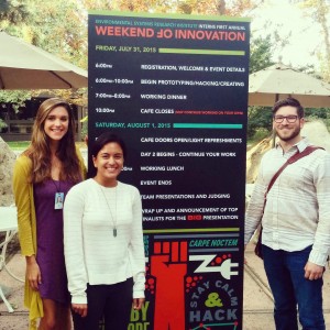
On the weekend of August 1st, the Esri summer interns came together to participate in a hackathon hosted in the Esri café. The weekend was designed to encourage innovation through the rapid creation of applications; the event was extremely successful. One of most interesting aspects of the hackathon was watching the diversity within each team harmonize to improve the overall quality of the final products. Each team included at least one developer to write the code and several other members from Marketing, Support Services, Professional Services, and other Esri departments to help with creative design, the use of GIS, and the delivery of the final presentation.

IMG_20150805_122230-300x300.jpg

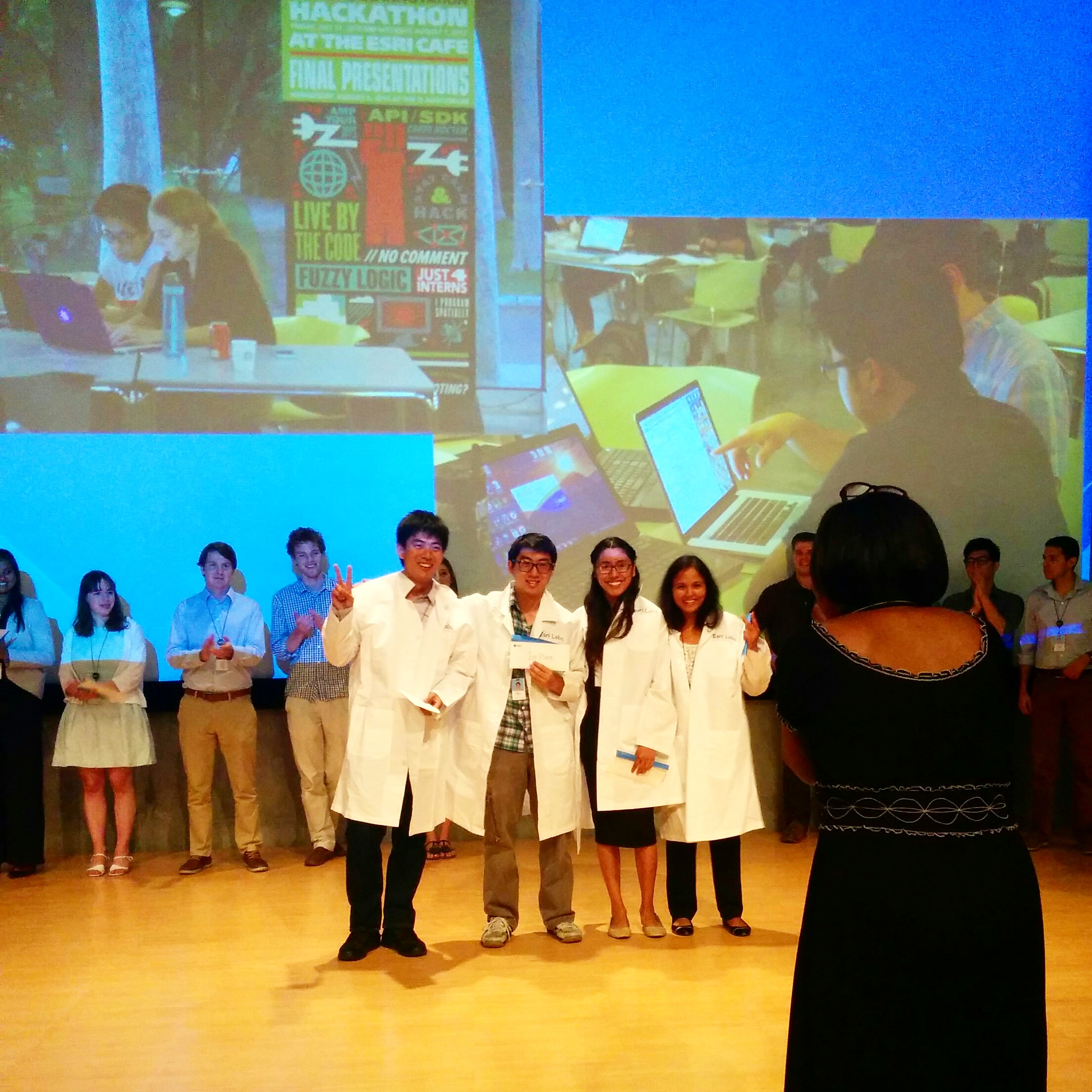
Team 'Geothinkers' took 1st place with the "Map My Friend" application


The interns may not have realized it, but they were inspirational to watch; they collaborated beautifully to find a common problem and showcased the functionality of web GIS to solve that problem.

Click the link below to see coverage of the weekend through an Esri Story Map:

Esri Intern Hackathon 2015 Story Map


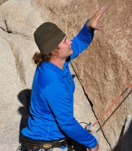
To assist the interns, four analysts from different teams at Esri Support Services were tasked to answer questions, provide troubleshooting tips, and address software issues encountered along the way. We worked alongside the interns throughout the weekend and were fortunate to collectively experience the challenges and rewards of working with Esri software. We also got a first-hand look at how fearlessly the ‘millennials’ approach the use of GIS and application development. Native-based applications constructed with AppStudio for ArcGIS or the ArcGIS Runtime SDK for Android were the most popular, and the importance of aesthetic design was a highlight.
IMG_20150801_190042-300x300.jpg

Esri Support Analysts onsite as mentors


Overall, the interns reminded us of how exciting it is to stay relevant and of the value of taking a chance with new products or new ways of thinking about our work.

AppStudio for ArcGIS, which was released in Spring 2015, is just one of the Esri products teams implemented while creating their apps. The tool allows you to create cross-platform apps in literally minutes (see this video from the Esri Developer’s Summit) and without any background in coding. You can get started with a pre-created template or create your own application from scratch using QML code. In just one weekend, many of the interns went from working with AppStudio for ArcGIS and QML for the first time to mastering the application interface, terminology, and workflows. It was truly inspirational watching the excitement and dedication the interns had towards learning something totally new and presenting their amazing products.

While AppStudio is currently still in Beta 3, you can already start creating apps to showcase your own ideas, maps, and data. Click this link for documentation to help you get started.

If there is anything this weekend proved, it is that application development is changing rapidly and can be a lot of fun. Esri is working hard to make the process a whole lot easier with the release of AppStudio for ArcGIS. Like the interns, if you take a bit of time to learn something new, you too can produce some amazing results. Just take a look at the apps the interns created in under 12 hours!

And, if you need help with AppStudio for ArcGIS or any other Esri products, contact Esri Support Services through a call, chat, or email. We are all very excited about this new product and can't wait to help you get started creating exciting and beautiful new apps!Resources:

Contact Esri Technical Support, or learn more about the Esri Internship Program.
Julia G. - Server Support AnalystSupriya K. - Geodata Support Analyst

more
0 0 940
38 Subscribers