- Home
- :
- All Communities
- :
- Worldwide
- :
- Esri Italia Community
- :
- Esri Italia Community Questions
- :
- Re: stream segmentation
- Subscribe to RSS Feed
- Mark Topic as New
- Mark Topic as Read
- Float this Topic for Current User
- Bookmark
- Subscribe
- Mute
- Printer Friendly Page
stream segmentation
- Mark as New
- Bookmark
- Subscribe
- Mute
- Subscribe to RSS Feed
- Permalink
- Report Inappropriate Content
when i am using arcgis hec-geohms tool processing procedure , the problem have occured at stream segmentation . 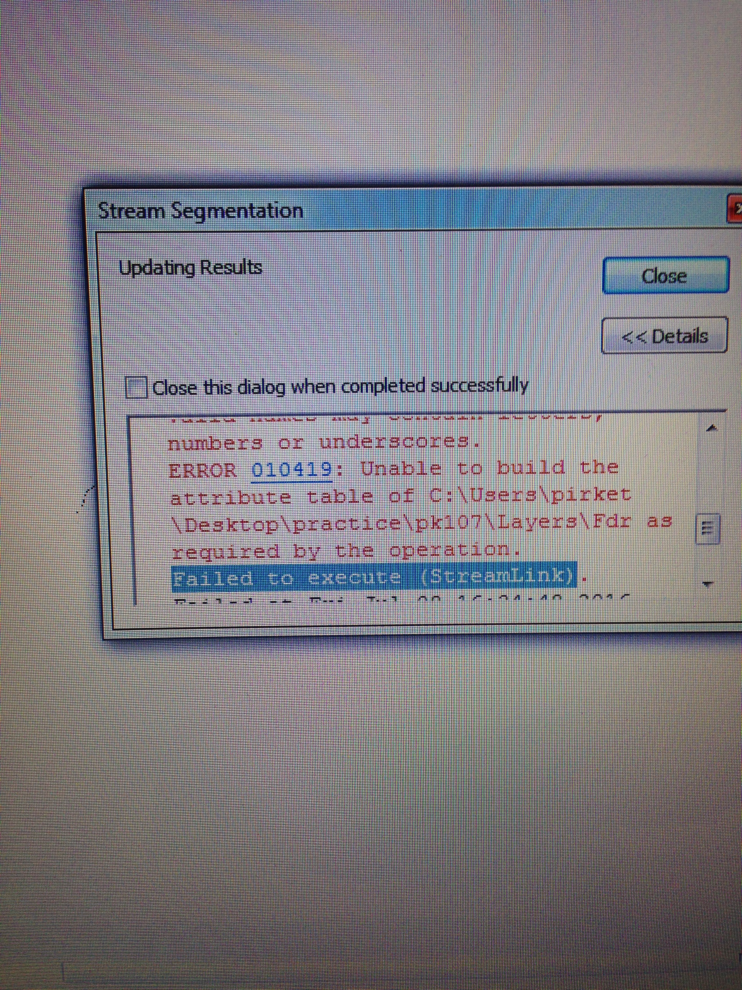
- Mark as New
- Bookmark
- Subscribe
- Mute
- Subscribe to RSS Feed
- Permalink
- Report Inappropriate Content
try saving the file to a simpler folder ie c:\test
many times it is either the source and/or destination file name that isn't appreciated by the software.
- Mark as New
- Bookmark
- Subscribe
- Mute
- Subscribe to RSS Feed
- Permalink
- Report Inappropriate Content
it doesn't work. same error shows up.
ERROR 010419: Unable to build the attribute table of C:\test\Layers\Fdr as required by the operation.
Failed to execute (StreamLink)
this problem bothers me a lot and i can't go on my project cause of this. can you just help me find out the solution. i really appreciate.
thank you
- Mark as New
- Bookmark
- Subscribe
- Mute
- Subscribe to RSS Feed
- Permalink
- Report Inappropriate Content
i try to create attribute table for Fdr(flow direction) , but in the usage they said that :
It is not possible to build a raster attribute table for a raster dataset that is a pixel type of 32-bit floating point。
and i went to check it . my dataset seems to a pixel type of 32-bit floating boat , what should i do?
- Mark as New
- Bookmark
- Subscribe
- Mute
- Subscribe to RSS Feed
- Permalink
- Report Inappropriate Content
That is indeed the error, you have to convert it to integer format, it seems that you have obtained floating point values for whatever reason. I would revisit your workflow to ensure that you are using the correct input file.
- Mark as New
- Bookmark
- Subscribe
- Mute
- Subscribe to RSS Feed
- Permalink
- Report Inappropriate Content
i download the input file from hec-geohms official website and it is a
example date . the format of DTM(DEM) is (w001001.adf) . i cant add this
data from GIS add data tool . i input the by pool file into GIS .
and how can i convert floating point to integral data?
thank you
- Mark as New
- Bookmark
- Subscribe
- Mute
- Subscribe to RSS Feed
- Permalink
- Report Inappropriate Content
if is was an esri grid (appears to be), it should have been contained in a folder, did you remove it?... you simply navigate to the folder, with tthe add data button and select it. It you ever do get it loaded, use the spatial analyst's Int tool. It will truncate any decimals, so if this is a problem, you can upscale by a factor of ten prior to taking the integer of it, but you will have to remember that you are working ith a scaled raster.
- Mark as New
- Bookmark
- Subscribe
- Mute
- Subscribe to RSS Feed
- Permalink
- Report Inappropriate Content
again same problem,
ERROR 010419: Unable to build the attribute table of
C:\Users\pirket\Desktop\practice\1234\Layers\Fdr as required by the
operation.
Failed to execute (StreamLink).
i am helpless