Turn on suggestions
Auto-suggest helps you quickly narrow down your search results by suggesting possible matches as you type.
Cancel
Using Callout Labels in ArcGIS
Subscribe
15574
4
06-29-2017 12:19 AM
- Subscribe to RSS Feed
- Mark as New
- Mark as Read
- Bookmark
- Subscribe
- Printer Friendly Page
- Report Inappropriate Content
06-29-2017
12:19 AM
The ArcMap application within ArcGIS allows you to create an amazing variety of fonts, colors, and types of labels that identify point, line, and area features. One of the most useful types of labels is the callout label. This label “calls out” from the label to an off-site location that is typically not on the feature itself, and sometimes helps make maps that are more clearly understood by students. Consider the following example for a lesson I created about the Philippines. Here, if the labels were placed on the islands, they would obscure the data I wanted the students to explore, which was the human development index by administrative area (province). Therefore, I used callout labels so that they would be offset in the ocean.
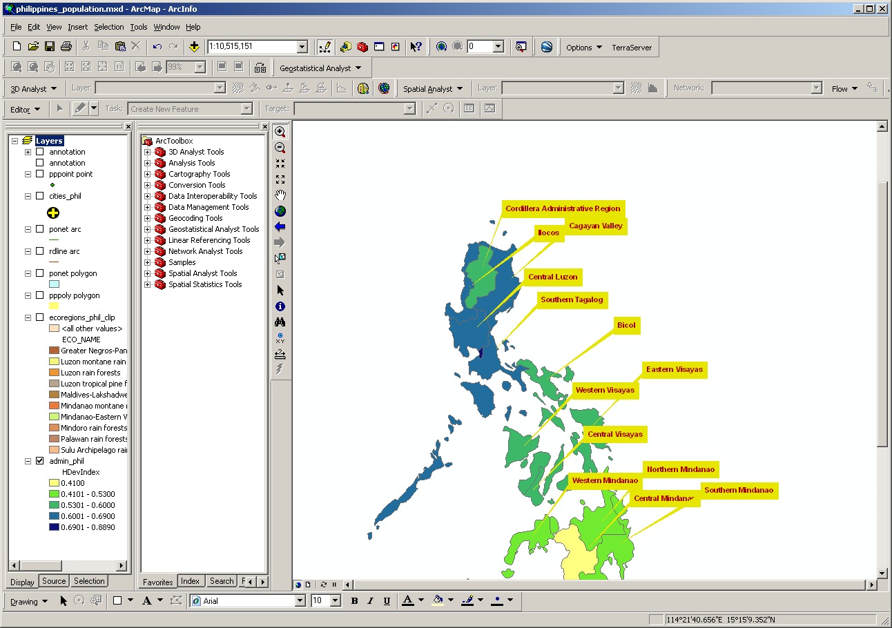
How did I create these labels? Under the Layer Properties, under Labels, I selected a “Banner” style label. Under Properties for the banner style, I selected Properties once again, and then bumped up the x offset to 45 and the y offset to 30. You will have to experiment with your own data set for the optimal offset, depending on your map units and the feature shapes that you wish to label. I set the colors for the background and for the text.
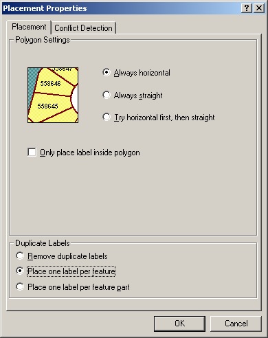
I did something else to create the above labels. Many provinces are split up into hundreds of islands. To prevent every single island from receiving a label, I accessed the Placement Properties tool under the Label tab in the Layer Properties. Under Duplicate Labels, I indicated that I wanted only one label per feature:
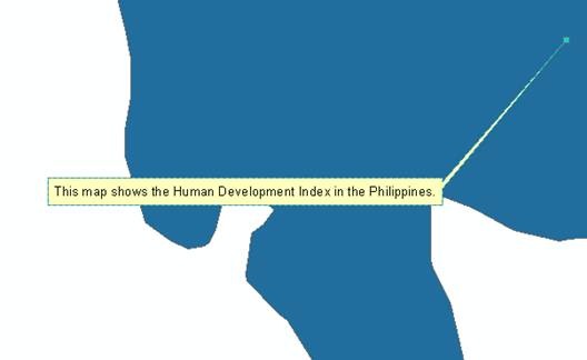
You can also use the label tool in the draw toolbar to create interactive text labels as callout boxes, as shown below:
After remembering sticking sticky-back callout labels on maps way back in cartography’s manual days with an Xacto knife, these ArcGIS tools show the progress that has been made over the past 25 years!
I invite you to explore label placement to help the maps do what they are designed to do—to communicate!
- Joseph Kerski, ESRI Education Manager
Labels
4 Comments
You must be a registered user to add a comment. If you've already registered, sign in. Otherwise, register and sign in.
About the Author
I believe that spatial thinking can transform education and society through the application of Geographic Information Systems for instruction, research, administration, and policy.
I hold 3 degrees in Geography, have served at NOAA, the US Census Bureau, and USGS as a cartographer and geographer, and teach a variety of F2F (Face to Face) (including T3G) and online courses. I have authored a variety of books and textbooks about the environment, STEM, GIS, and education. These include "Interpreting Our World", "Essentials of the Environment", "Tribal GIS", "The GIS Guide to Public Domain Data", "International Perspectives on Teaching and Learning with GIS In Secondary Education", "Spatial Mathematics" and others. I write for 2 blogs, 2 monthly podcasts, and a variety of journals, and have created over 5,000 videos on the Our Earth YouTube channel.
Yet, as time passes, the more I realize my own limitations and that this is a lifelong learning endeavor and thus I actively seek mentors and collaborators.
Labels
-
Administration
38 -
Announcements
45 -
Career & Tech Ed
1 -
Curriculum-Learning Resources
179 -
Education Facilities
24 -
Events
47 -
GeoInquiries
1 -
Higher Education
519 -
Informal Education
266 -
Licensing Best Practices
46 -
National Geographic MapMaker
17 -
Pedagogy and Education Theory
187 -
Schools (K - 12)
282 -
Schools (K-12)
185 -
Spatial data
24 -
STEM
3 -
Students - Higher Education
231 -
Students - K-12 Schools
86 -
Success Stories
22 -
TeacherDesk
1 -
Tech Tips
83
- « Previous
- Next »