Turn on suggestions
Auto-suggest helps you quickly narrow down your search results by suggesting possible matches as you type.
Cancel
- Home
- :
- All Communities
- :
- Industries
- :
- Education
- :
- Education Blog
- :
- New Book: Tribal GIS: Supporting Native American D...
New Book: Tribal GIS: Supporting Native American Decision Making
Subscribe
935
1
03-31-2012 11:43 PM
- Subscribe to RSS Feed
- Mark as New
- Mark as Read
- Bookmark
- Subscribe
- Printer Friendly Page
- Report Inappropriate Content
03-31-2012
11:43 PM
A new book from Esri Press entitled Tribal GIS: Supporting Native American Decision Making, will be published in June 2012. In it, tribal leaders tell their stories about implementing and using GIS to address their unique challenges as sovereign Nations. The book covers applications in natural resources and the environment, transportation, cultural and historical preservation, economic development, health, public safety, agriculture, and perhaps most interesting to the GIS education community, two chapters on K-12 and higher education. Showing how tribal governments responsible for the stewardship of their land and resources and the health and well-being of their People use enterprise GIS to make decisions, Tribal GIS supports tribes new to GIS and those with GIS experience. It also will be useful for the general GIS community, showing the many scales and disciplines in which GIS can be applied.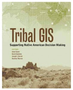
It was an honor to work on this book with so many visionary people who are making a positive difference in the lives of people, in their communities and on their lands, and beyond. The book includes dozens of stories written by educators, scientists, administrators, managers, and others, showing the diversity of their backgrounds but also a common vision for the benefits that spatial analysis and GIS bring to their everyday decision making. Editors of the book include Anne Taylor, who coordinates Esri’s Tribal program, David Gadsden, who coordinates Esri’s nonprofit organization program, Joseph Kerski, who serves in Esri’s education program, and Heather Warren, who is the marketing coordinator for the federal government industry at Esri.
The education chapters include stories such as students at the Alamo Navajo School collecting water well location and water quality information for the tribal government, students at Santa Fe Indian School measuring soil erosion and analyzing land use, students at Haskell Indian Nations University researching the geology of Antarctica and developing an accessibility map for their own campus, and much more.
Space does not permit me to say too much here, but the stories speak for themselves. Pick up a copy of the book, read these stories, and share them with your students. How have the spatial perspective and GIS made a positive difference and aided with decision making? How might you be able to use these stories to generate ideas for your own GIS-based projects?
--Joseph Kerski, Esri Education Manager
1 Comment
You must be a registered user to add a comment. If you've already registered, sign in. Otherwise, register and sign in.
About the Author
I believe that spatial thinking can transform education and society through the application of Geographic Information Systems for instruction, research, administration, and policy.
I hold 3 degrees in Geography, have served at NOAA, the US Census Bureau, and USGS as a cartographer and geographer, and teach a variety of F2F (Face to Face) (including T3G) and online courses. I have authored a variety of books and textbooks about the environment, STEM, GIS, and education. These include "Interpreting Our World", "Essentials of the Environment", "Tribal GIS", "The GIS Guide to Public Domain Data", "International Perspectives on Teaching and Learning with GIS In Secondary Education", "Spatial Mathematics" and others. I write for 2 blogs, 2 monthly podcasts, and a variety of journals, and have created over 5,000 videos on the Our Earth YouTube channel.
Yet, as time passes, the more I realize my own limitations and that this is a lifelong learning endeavor and thus I actively seek mentors and collaborators.
Labels
-
Administration
38 -
Announcements
45 -
Career & Tech Ed
1 -
Curriculum-Learning Resources
179 -
Education Facilities
24 -
Events
47 -
GeoInquiries
1 -
Higher Education
519 -
Informal Education
266 -
Licensing Best Practices
46 -
National Geographic MapMaker
11 -
Pedagogy and Education Theory
187 -
Schools (K - 12)
282 -
Schools (K-12)
185 -
Spatial data
24 -
STEM
3 -
Students - Higher Education
231 -
Students - K-12 Schools
86 -
Success Stories
22 -
TeacherDesk
1 -
Tech Tips
83
- « Previous
- Next »