- Home
- :
- All Communities
- :
- Industries
- :
- Education
- :
- Education Blog
- :
- Integrating Arts into STEM: Cowboy Boots of Wimber...
Integrating Arts into STEM: Cowboy Boots of Wimberley, Texas
- Subscribe to RSS Feed
- Mark as New
- Mark as Read
- Bookmark
- Subscribe
- Printer Friendly Page
- Report Inappropriate Content
I have created a “Famous Boots of Wimberley, Texas” story map, and I did so for four reasons: First, I wanted to show educators and the general public how to integrate art, history, science, technology, geography, and GIS. My colleagues and I receive frequent inquiries from people asking how to integrate art into STEM (Science Technology Engineering and Mathematics) educational programs, and Wimberley's giant boots are a good illustration of this integration. This went beyond art and STEM, though, as it incorporates history and geography as well. Second, I wanted to test the capabilities of the side accordion story map configurable app. This app is an easy and compelling way to tell a story. With the new ArcGIS story maps, I could have used the new tab capabilities as another option.
Third, I wanted to demonstrate that every community has a story, and story maps are a visually compelling, easy-to-create way of telling that story. When I visited the town for the first time after a series of presentations I gave at the geography department of nearby Texas State University, I learned about the boot project from my town walkabout. It was so interesting to me that I began collecting information, photographs, and video, and a short time later, I had created the story map that integrates all of these types of multimedia. The boot project brought together local artists, the Chamber of Commerce, local businesses, and the entire community, and serves as a source of city pride as well as a tourist attraction. Fourth, it is my hope that my brief story map (see my video) can in some small way inspire people in another location to think creatively about a place-based arts project that can help build pride in their own community.
If I can do this for a community that I had just discovered, how much more can you and your students tell a story of a topic on which you conduct more in-depth research and may even have local knowledge about!
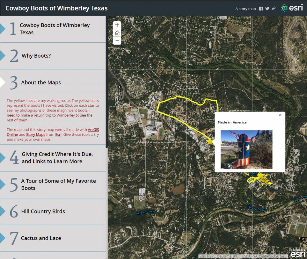
Cowboy Boots of Wimberley Texas story map.
You must be a registered user to add a comment. If you've already registered, sign in. Otherwise, register and sign in.
-
Administration
38 -
Announcements
45 -
Career & Tech Ed
1 -
Curriculum-Learning Resources
179 -
Education Facilities
24 -
Events
47 -
GeoInquiries
1 -
Higher Education
519 -
Informal Education
266 -
Licensing Best Practices
46 -
National Geographic MapMaker
11 -
Pedagogy and Education Theory
187 -
Schools (K - 12)
282 -
Schools (K-12)
185 -
Spatial data
24 -
STEM
3 -
Students - Higher Education
231 -
Students - K-12 Schools
86 -
Success Stories
22 -
TeacherDesk
1 -
Tech Tips
83
- « Previous
- Next »