- Home
- :
- All Communities
- :
- Industries
- :
- Education
- :
- Education Blog
- :
- GIS Day 2017: Celebrating People and Projects tha...
GIS Day 2017: Celebrating People and Projects that are Making a Positive Difference
- Subscribe to RSS Feed
- Mark as New
- Mark as Read
- Bookmark
- Subscribe
- Printer Friendly Page
- Report Inappropriate Content
GIS Day provides an international forum for users of geographic information systems (GIS) technology to demonstrate real-world applications that are making a difference in our society. The stories are still flowing in from the over 1,200 events that were held on or around GIS Day 2017, but a few of them are featured here. Did you host an event in 2017? If so, feel free to add it to the "How did you celebrate GIS Day" story map.
Did you miss out? It is not too early to start planning for next year, 14 November 2018.
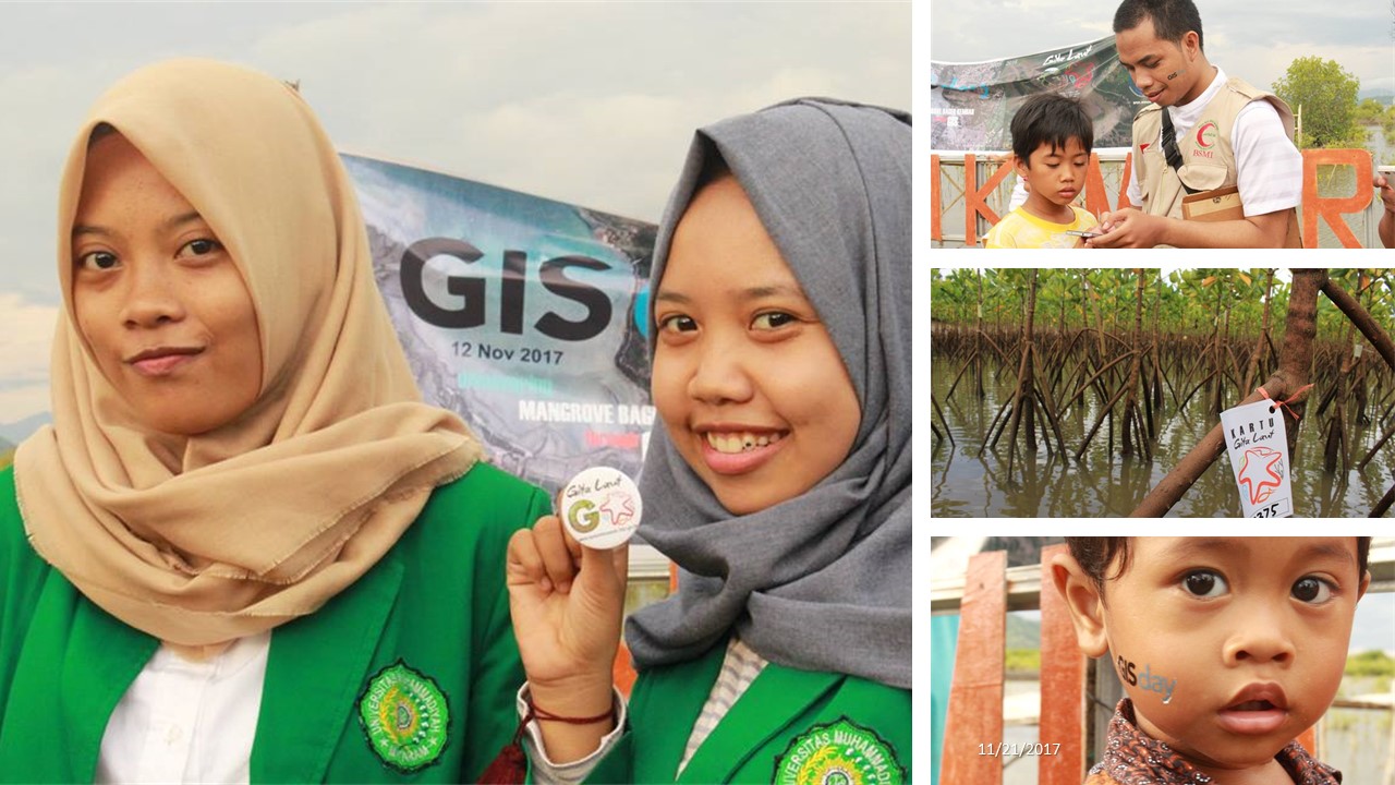
In Indonesia, in the Begek Kembar ecotourism area of mangroves, GIS Day was held out in the field, combined with a location game called Gita Laut GO! (a bit like Pokemon GO). Organizer Muhammad Barmawi of the Ministry of Marine Affairs and Fisheries reported that, "One goal of the event was to build community awareness about the unique environment of the coastal berekosistem mangrove."
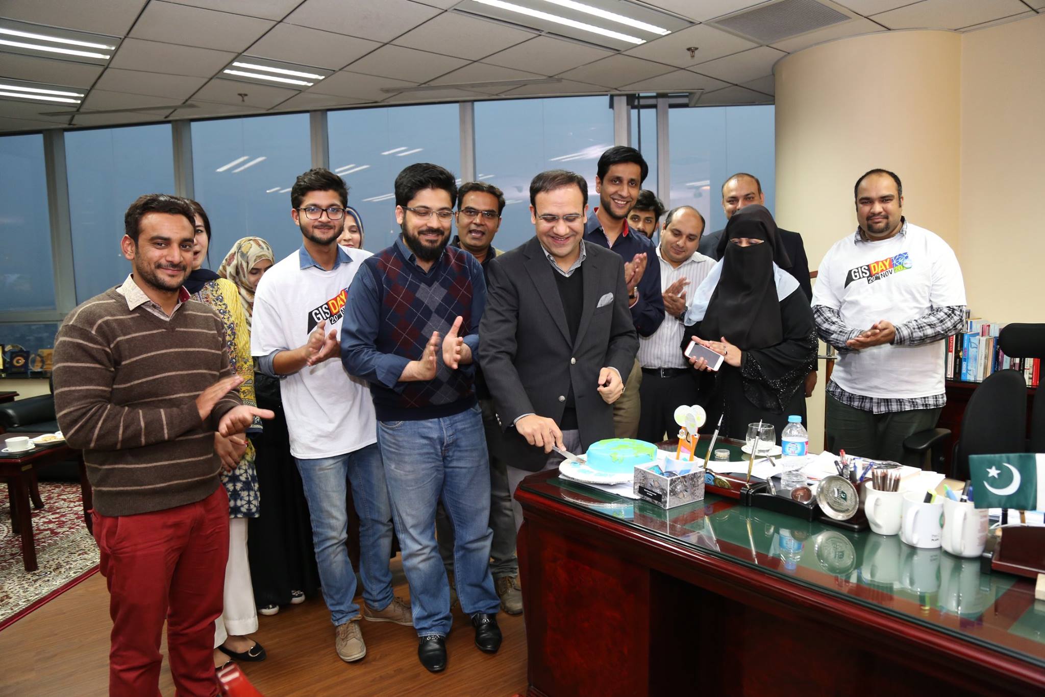
Syed Zaheer Hussain, Punjab Information Technology Board, Lahore, Pakistan, sent this picture of cutting the GIS Day cake at the Punjab Information Technology Board and the Software Engineering group.
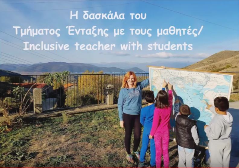
In Greece, Vivi Antoniou, who is working at the 9th Primary School Kastorias as Primary Administrator at the Ministry of Education, shared this video, showing students learning about the world via GIS, maps, globes, and also out in the field.
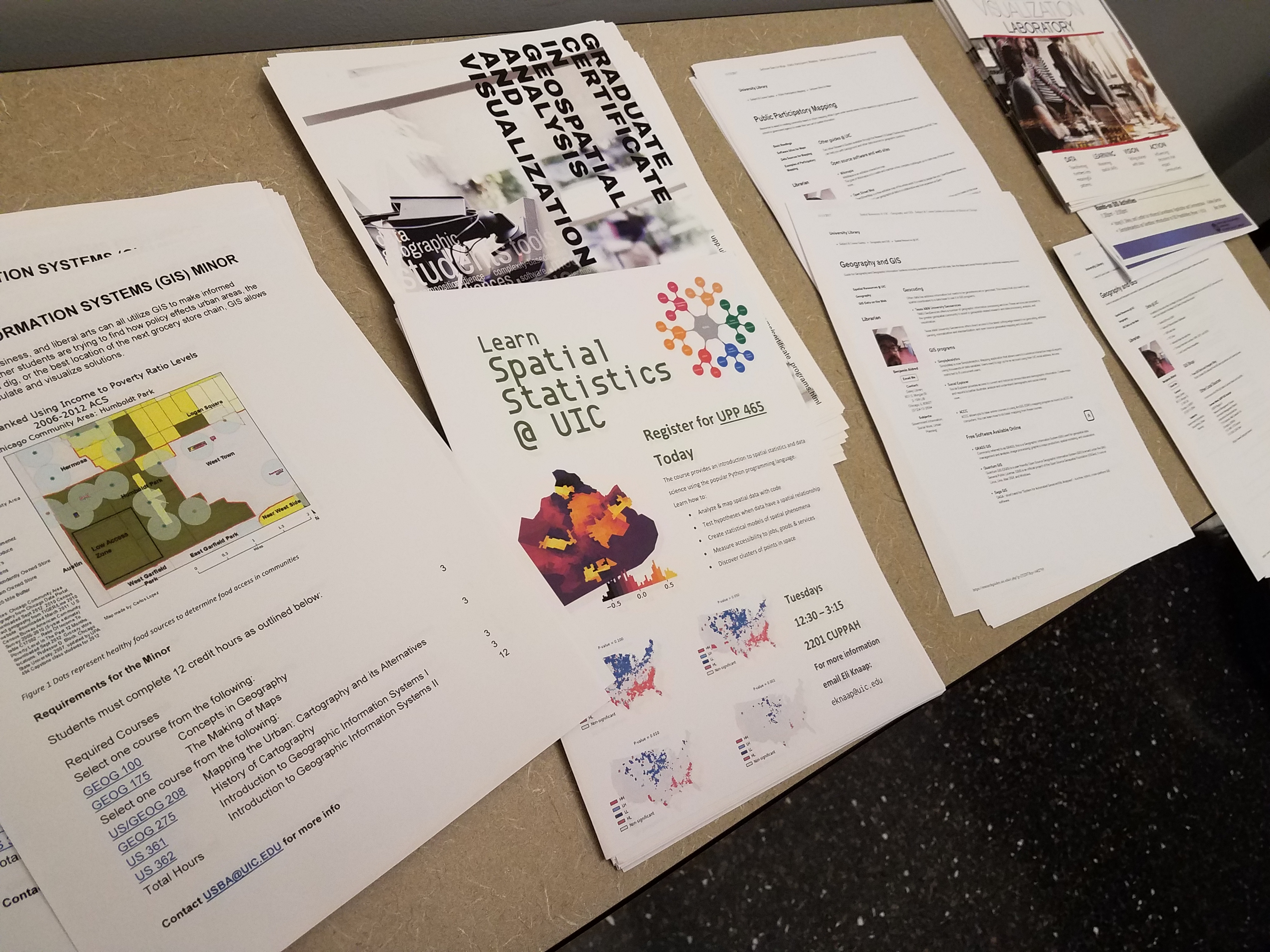
Moira Zellner, Associate Professor at the University of Illinois Chicago's (UIC) Department of Urban Planning and Policy, and Director of the Urban Data Visualization Lab (UDVL), said, that "GIS Day at UIC was a dynamic and engaging event, with presentations that spanned a wide variety of topics: Validating images captured remotely by robots, assessing flooding susceptibility and food access in the Chicago region, examining the mechanisms of gentrification over time, estimating the best location for green infrastructure and electric vehicle charging stations, developing water-themed visual story telling tools, and exploring evolving data infrastructure needs. The event ended with two demonstrations on how to use existing GIS platforms, and how to create your own applications. Of the 80 attendees, more than half were from outside the university, representing governmental agencies, NGOs, private companies and other academic institutions in the Chicago region. The event gave everyone the chance to exchange ideas and discuss new applications. This year’s event was dedicated to the memory of Al Scorsch, III, the founder of the UDVL at UIC, and a champion of visualization technology to advance science and policy. He passed away a couple of weeks before the event."
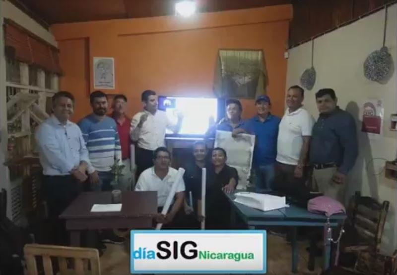
Elvis Danilo Perez shared the story of GIS Day in Managua, Nicaragua, that included a talk on technology trends, presentation of the GEOFUMADAS blogger, a video conference by Professor Rafael Beltran of UNIGI, and Elvis Pérez of blog geopz.com, via this video.
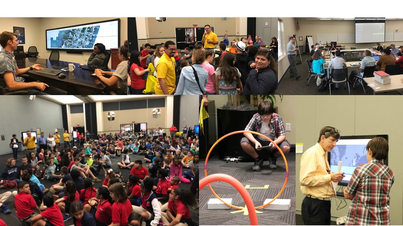
I participated in the GIS Day event at the University of Central Florida. Dr Timothy Hawthorne and his Citizen Science GIS team invited 375 primary and secondary students to the campus to fly and learn about drones, and investigate their community and their world using interactive web maps in ArcGIS Online. His university students also gave a presentation on what they are doing with UAV and GIS technologies in Belize; we held a GIS career panel, and Dr Hawthorne; and I presented to education and sociology faculty at the university, showing them how they could use GIS in their own instruction and research. I also was honored to give a keynote address on 5 forces acting on GIS, 5 GIS trends, and the 5 most valuable skills for those seeking to use GIS in their career, available here (as a story map : - )).

Perhaps the most significant event shared on the crowdsource story map that occurred on GIS Day was the arrival of a GIS analyst's first born daughter! That one is hard to top!
For more stories, keep an eye on this GeoNet space, and also see the "How did you celebrate GIS Day" story map.The GIS Day story map is still open for you to submit your GIS Day stories!
You must be a registered user to add a comment. If you've already registered, sign in. Otherwise, register and sign in.
-
Administration
38 -
Announcements
44 -
Career & Tech Ed
1 -
Curriculum-Learning Resources
178 -
Education Facilities
24 -
Events
47 -
GeoInquiries
1 -
Higher Education
518 -
Informal Education
265 -
Licensing Best Practices
46 -
National Geographic MapMaker
10 -
Pedagogy and Education Theory
187 -
Schools (K - 12)
282 -
Schools (K-12)
184 -
Spatial data
24 -
STEM
3 -
Students - Higher Education
231 -
Students - K-12 Schools
85 -
Success Stories
22 -
TeacherDesk
1 -
Tech Tips
83
- « Previous
- Next »