Fun with GIS 215: Trajectories
- Subscribe to RSS Feed
- Mark as New
- Mark as Read
- Bookmark
- Subscribe
- Printer Friendly Page
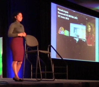
Roxana Ayala was the opening speaker of the student team on stage at Esri's 2013 User Conference. Having just completed 11th grade at the Math, Science, and Technology Magnet Academy of Roosevelt High School and LAUSD, in the Boyle Heights neighborhood of East Los Angeles, Roxana and her 90 classmates had worked with GIS for only four months, in a pair of adjoining classrooms (Social Studies and English) housing 15 laptops between them, on a wireless network that ground to a halt when a 12th computer signed on.
But she and they persevered, digging deep into learning about their community by gathering data of personal interest and analyzing it in ArcGIS Online. Some continued the next year, and because of her work, Roxana got to speak to educators, and governors, and even stand in the White House and shake President Obama's hand. At college, she continued using GIS, getting into summer internships in support of her double major in environmental science and urban studies.
To help mark the 25th year of Esri's program for K12 schools, Roxana agreed to come back and talk about how GIS had helped her discover and steer toward some big goals.
Roxana Ayala, senior at University of California Irvine
"I hope that in the future I go to graduate school and attain a Master's in the field of environmental science, and continue using GIS in order to demonstrate to the world how precious and vulnerable the planet is, and how important it is to fight for our planet. I also do hope to become a role model for many low-income, first generation students of color, and empower them to dream big, just like I did ... GIS has the power to create powerful maps that tell stories, and that can be translated throughout the world, and I really do hope to continue this legacy, and ... continue telling stories in an effort to build a better tomorrow."
Roxana Ayala, summer Intern at University of Minnesota
Two days after her EdUC talk, and four years after her initial appearance on the main stage of the Esri conference, Roxana strode out after a terrific presentation by three 4-H youth from Tennessee, to help the world connect the dots about deep learning with GIS in school. Students like Roxana, who get exposed to powerful ways of seeing the world, and get to dive into personal projects with it, can make a tremendous difference, for their future, for many others in communities near and far, and for the planet.
Just a little change in trajectory early enough can help someone change the world. Jump in to GIS in your class, and help someone else begin to in theirs. Imagine a future in which all students join Roxana in changing the world.
Charlie Fitzpatrick, Esri Education Manager
You must be a registered user to add a comment. If you've already registered, sign in. Otherwise, register and sign in.
-
Administration
78 -
Announcements
80 -
Career & Tech Ed
1 -
Curriculum-Learning Resources
259 -
Education Facilities
24 -
Events
72 -
GeoInquiries
1 -
Higher Education
596 -
Informal Education
281 -
Licensing Best Practices
91 -
National Geographic MapMaker
33 -
Pedagogy and Education Theory
226 -
Schools (K - 12)
282 -
Schools (K-12)
273 -
Spatial data
35 -
STEM
3 -
Students - Higher Education
246 -
Students - K-12 Schools
129 -
Success Stories
36 -
TeacherDesk
1 -
Tech Tips
120
- « Previous
- Next »
