Turn on suggestions
Auto-suggest helps you quickly narrow down your search results by suggesting possible matches as you type.
Cancel
- Home
- :
- All Communities
- :
- Industries
- :
- Education
- :
- Education Blog
- :
- Facilitating 7 Ways of Learning: Connections to GI...
Facilitating 7 Ways of Learning: Connections to GIS in Education
Subscribe
970
0
03-26-2015 10:57 PM
- Subscribe to RSS Feed
- Mark as New
- Mark as Read
- Bookmark
- Subscribe
- Printer Friendly Page
- Report Inappropriate Content
03-26-2015
10:57 PM
A fascinating and practical book entitled Facilitating Seven Ways of Learning by James R. Davis and Bridget D. Arend is a resource for more purposeful, effective, and enjoyable university teaching. In addition, I believe that the seven ways presented by the authors provide a useful framework for instruction focused on spatial thinking and geotechnologies. The seven ways include behavioral learning, cognitive learning, learning through inquiry, learning with mental models, learning through groups and teams, learning through virtual realities, and experiential learning. Each way of learning is associated with intended learning outcomes, or what students learn, and is accomplished through specific methods. For example, the intended learning outcomes in learning through inquiry are developing critical, creative, and dialogical thinking, and is accomplished through question-driven inquiries and discussions.
As we have discussed numerous times in this blog, teaching and learning with GIS invites students to ask questions, solve real-world problems with real data, and think critically about why and how they are solving that problem. Every single one of the seven ways of learning identified in this book have been used by educators and students who analyze spatial relationships, patterns, and trends through GIS, as is evident in these and other case studies. Furthermore, all of the methods identified in the Seven Ways book, including tasks and procedures, practice exercises, presentations, explanations, inquiries, discussions, problems, case studies, labs, projects, group activities, team projects, role playing, simulations, games, internships, and service learning, are the "bread and butter" of teaching with GIS. No one single method is used, which illustrates the versatility of GIS in instruction to meet different learning objectives. We use all of them when we model effective teaching with GIS at our annual T3G instructor institutes.
I recently met with one of the authors, Dr. Arend, who is the Director of University Teaching at the Office of Teaching and Learning at the University of Denver, and I believe that the Seven Ways can be used effectively by instructors (1) to make a strong case to their administrators on campus that teaching and learning with GIS meets numerous instructional objectives and learning styles, and (2) as a guideline in their own instruction, to ensure that they take full advantage of the 7 ways, and the result will truly be more purposeful, effective, and enjoyable teaching!
How might you be able to use this book and framework in your own instruction?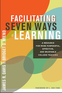
Facilitating 7 Ways of Learning: Book.
You must be a registered user to add a comment. If you've already registered, sign in. Otherwise, register and sign in.
About the Author
I believe that spatial thinking can transform education and society through the application of Geographic Information Systems for instruction, research, administration, and policy.
I hold 3 degrees in Geography, have served at NOAA, the US Census Bureau, and USGS as a cartographer and geographer, and teach a variety of F2F (Face to Face) (including T3G) and online courses. I have authored a variety of books and textbooks about the environment, STEM, GIS, and education. These include "Interpreting Our World", "Essentials of the Environment", "Tribal GIS", "The GIS Guide to Public Domain Data", "International Perspectives on Teaching and Learning with GIS In Secondary Education", "Spatial Mathematics" and others. I write for 2 blogs, 2 monthly podcasts, and a variety of journals, and have created over 5,000 videos on the Our Earth YouTube channel.
Yet, as time passes, the more I realize my own limitations and that this is a lifelong learning endeavor and thus I actively seek mentors and collaborators.
Labels
-
Administration
38 -
Announcements
44 -
Career & Tech Ed
1 -
Curriculum-Learning Resources
178 -
Education Facilities
24 -
Events
47 -
GeoInquiries
1 -
Higher Education
518 -
Informal Education
265 -
Licensing Best Practices
46 -
National Geographic MapMaker
10 -
Pedagogy and Education Theory
187 -
Schools (K - 12)
282 -
Schools (K-12)
184 -
Spatial data
24 -
STEM
3 -
Students - Higher Education
231 -
Students - K-12 Schools
85 -
Success Stories
22 -
TeacherDesk
1 -
Tech Tips
83
- « Previous
- Next »