Campus Tour Story Maps
- Subscribe to RSS Feed
- Mark as New
- Mark as Read
- Bookmark
- Subscribe
- Printer Friendly Page
- Report Inappropriate Content
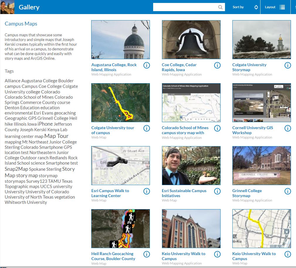
When I arrive on a university or community college campus to conduct a series of invited workshops or presentations, I typically create a story map or web map on my way to the building in which I am speaking. I create some of these on a tablet or laptop before my presentation begins, and I use photos and videos I took on my phone with the location services "on". I have compiled some of these maps into a gallery shown here. I call these "introductory" story maps because the purpose of these maps are to help my audiences realize that these web maps can be created in very little time and yet can tell a compelling story. Because I want to demonstrate that each took me just 10 to 30 minutes to create, I resist the temptation to edit them later and improve their cartography or content. It is my hope that in so doing, those I show these maps to when I am on those campuses can think of the issues or themes that they would like to gather data on, to map, and to study. By the way, you can find out how to create a gallery of your own maps here like the one I created.
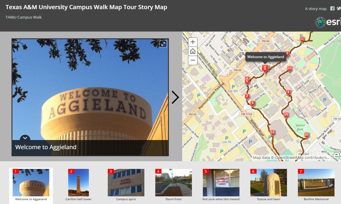
An example of one of a map I created while I was on a campus is shown below (Texas A&M University - Gig' em Aggies!) and is linked here.
A set of maps for a different purpose that focus on college and school campuses is this set. This set was compiled to show different uses of story maps at educational institutions, for example, to feature webcams or 3D scenes, to show how campus administrators are using mapping tools for managing campus safety and infrastructure, and to help new students to find their way around campus. As such, they typically require more time to create and maintain than my simple examples above, but even these do not require massive investments of time.
Whatever your goals are in your research, instruction, or administration on a campus, I encourage you to explore the many options available using ArcGIS Online web mapping applications such as story maps.
You must be a registered user to add a comment. If you've already registered, sign in. Otherwise, register and sign in.
-
Administration
38 -
Announcements
44 -
Career & Tech Ed
1 -
Curriculum-Learning Resources
177 -
Education Facilities
24 -
Events
46 -
GeoInquiries
1 -
Higher Education
518 -
Informal Education
264 -
Licensing Best Practices
46 -
Pedagogy and Education Theory
187 -
Schools (K - 12)
282 -
Schools (K-12)
183 -
Spatial data
24 -
STEM
3 -
Students - Higher Education
231 -
Students - K-12 Schools
84 -
Success Stories
22 -
TeacherDesk
1 -
Tech Tips
83
- « Previous
- Next »