By Anastasiia Savchenko and Tom DeWitte
In May, we published the first progress update about a new Esri initiative to create District Heating and Cooling Data model. This post is the continuation of the effort to keep you informed about the District Energy data model's latest developments.
The newest release of the data model is Alpha 4, and it includes the updated sample data, attribute rules, terminals, subnetworks, and heat exchanger configurations. Let's discuss all these changes in more detail.
DOWNLOAD THE ALPHA 4 PACKAGE
Sample Data Progress
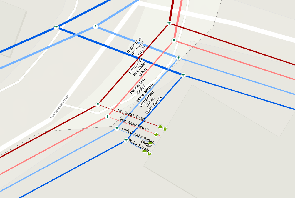
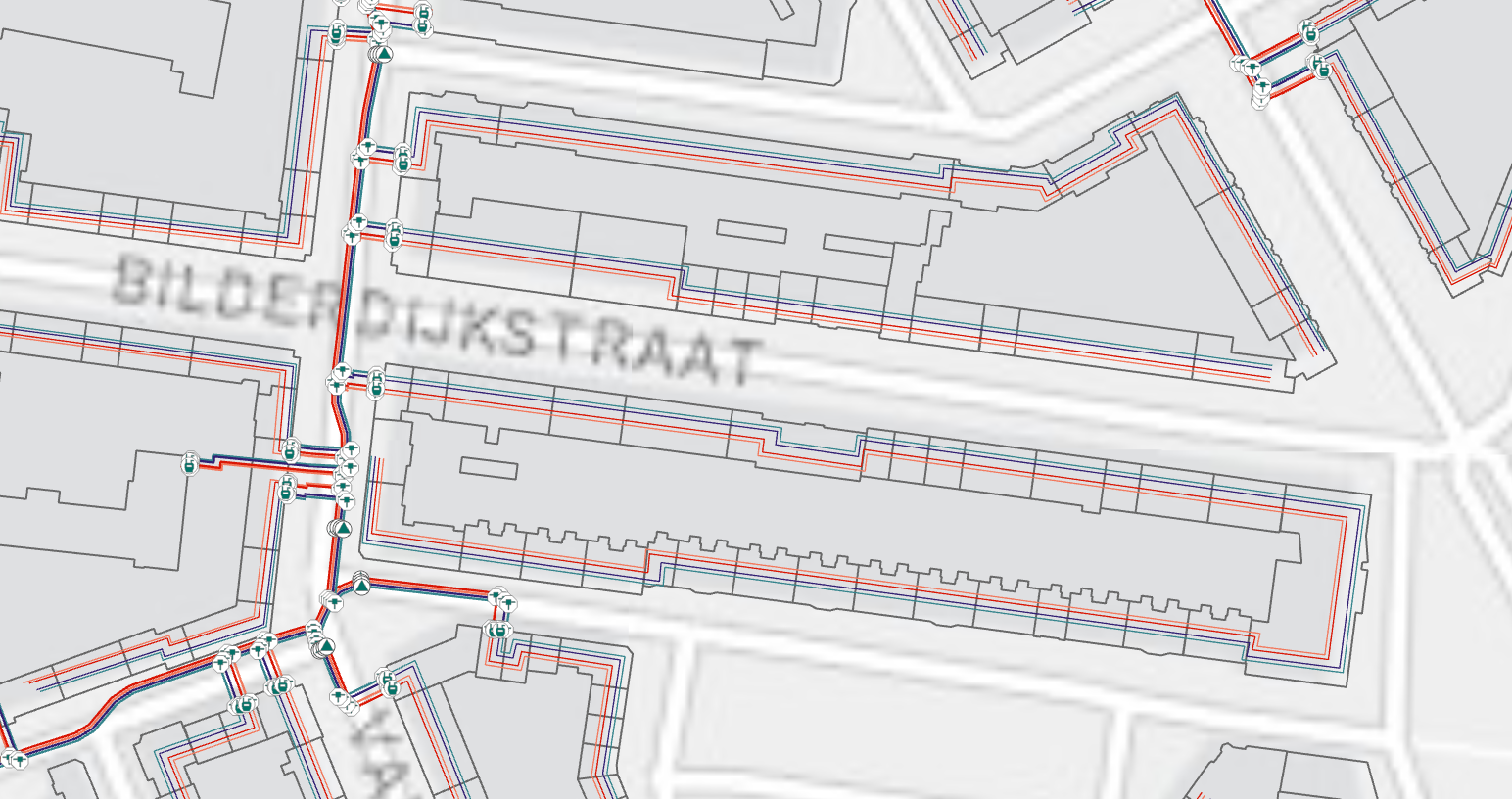
It is vital to provide a sample dataset, a well-thought digital twin of the several district energy system configurations. Thus, the sample data's newest version includes the supplemental configuration of the hot water and chilled water systems. Modeling this way is suitable when the district energy system serves several buildings (for example, row houses), but it measured by one meter. In this scenario, the meter measures consumption at the end of the service line, from which energy transported to multiple buildings through the network of customer pipes. Often urban areas with high population density have limited underground space, making it essential to use such system configurations.
Introduction of the Business Rules
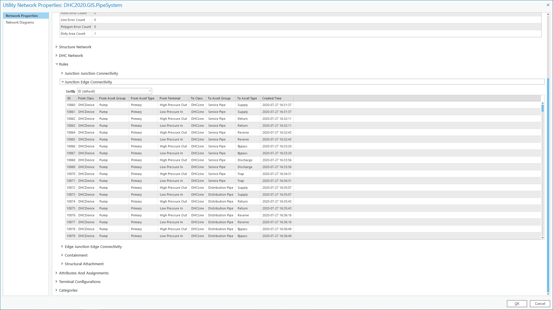
Improving the editor's experience through automation and a strong rule base to help the editor enter the information correctly the first time is a key benefit of business rules.
Alpha 4 is the beginning of the inclusion of attribute rules to the data model template. Attribute rules are a principal geodatabase capability of the Utility Network technology. Adding these rules is essential. They will make sure that your digital twin satisfies the business-specific requirements of the industry.
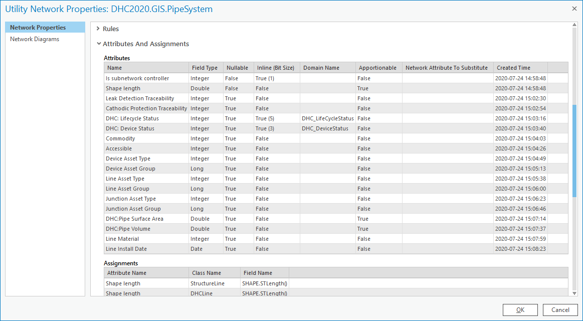
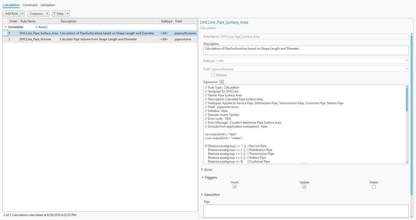
The Alpha 4 release of the DHC data model includes a set of calculation attribute rules. Calculation attribute rules are responsible for an automatic population of the attribute based on the defined expression. An excellent example of this is the rules which will calculate pipe surface area and pipe volume based on the pipe shape length and diameter.
More attribute rule calculations and attribute rule constraints will be added in the beta release of the data model template.
Introduction of the Contingent Values
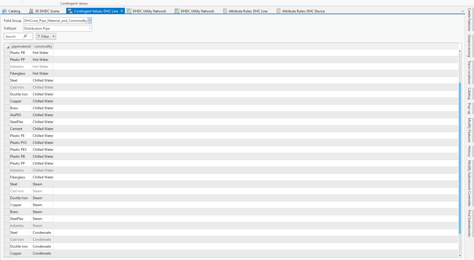
In addition to the attribute rules, the Alpha 4 DHC data model includes contingent values. Contingent values are the recently-added capability of the geodatabase. Their primary function is to prevent users from entering invalid values by restricting the list of valid values for the attribute field.
For example, the pipe selection of the materials available to the user changes based on the type of the system the pipe belongs to – whether it is hot water, steam, condensate, or chilled water system.
Terminal Configurations
In Utility Network, it is possible to model devices with a higher degree of realism by defining terminals. In the district energy system, terminals represent the incoming and outgoing flow of the hot water, chilled water, steam, or condensate.
The newest DHC Alpha 4 data model includes terminal configurations for the bypasses, customer connections, and heat exchangers. The newly added terminal configuration of heat exchangers is critical to tracing analytics with this data model template. It allows for downstream traces that follow thermal energy flow through the heat exchanger and follow water flow, circulating into the heat exchanger, and then loop back.

Subnetwork Configurations
Besides attribute rules and terminals, the Alpha 4 DHC data model continues to build the subnetwork configurations. Subnetworks model the subsystems of a District Energy pipe system such as thermal energy system zones, pressure zones, and circulation zones. Subnetwork consists of all the participating features in the topological subset of the tier. These features include devices, lines, and junctions.

Modeling of thermal energy flow vs. water flow
In the district energy system, the commodity: hot water, chilled water, or steam; being transported thru the pipe system is not consumed directly by the end consumer. Instead, commodity transports and delivers the thermal energy it carries. In comparison, in other utility systems, the commodity consumed at the customer location. For example, drinking water runs from the tap; electricity provides light and power to the appliances; gas feeds the stoves and heating units. In these typical examples, the commodity runs from the source to the consumer device where it is consumed (sinks).
The customer does not consume the district energy commodity. Instead, commodity warms or cools the surroundings through which it runs due to a combination of thermal processes - convection, conduction, and radiation. The heat exchanger is the device used to transfer the thermal energy without also continuing the flow of the commodity, which creates a unique modeling situation for district energy systems. The flow of thermal energy is not always the same as the flow of the water or steam!
The Alpha 4 release is the first release to provide a configuration that allows users to perform traces of the water flow through the pipe system and trace the thermal energy flow through the pipe system. Here are some videos to show you downstream traces of the thermal energy and the water flow.
You can run the trace for water flow through circulating with the heat exchanger (scenario 1).
Or you can run the trace of the thermal flow through the heat exchanger (scenario 2).
Not Done Yet
There is still lots to be done! Although it is summer and work is usually slow due to vacation, the goal of the community is to stay productive and continue evolving this data model template.
As the model moves from alpha to beta, you will see further refinement of the subnetwork definitions, summary attributes, and network attributes. You will also see the addition of more attribute rules and connectivity rules. Stay tuned!
Conclusion
Even though there is much yet to do, this effort is on schedule. But we are always looking for more volunteers with industry knowledge to help with this effort. If you work in or support the Steam, Heated Water, or Chilled Water utility organizations and are interested in joining one of our working groups, please let us know. You can contact us via geonet or directly via email: tdewitte@esri.com, asavchenko@esri.com.