DevSummit Conference Blog

cancel
Showing results for 
Show  only  | Search instead for 
Did you mean: 

Latest Activity

(28 Posts)
CandaceLoya
Occasional Contributor III

That's a wrap. It is the final day of the 2018 Esri Developer Summit. And we had so much fun. Here are some highlights from the final day.

This year's DevSummit had many accomplishments:

  • Largest DevSummit ever - more than 2,100 attendees this year
  • 18 pre-summit training courses with many hands-on for Python, Angular, Xamarin, Typescript, AppStudio,Pro SDK, Insights, etc.
  • 250+ sessions and demo theaters - all will be posted on YouTube and E360 video.esri.com in a few weeks for FREE
  • Lightning Talks,
  • Speedgeeking
  • Showcase
  • An amazing party
  • And a final day of tech sessions and a great closing session lunch

Fun Facts for 2018 DevSummit:

  • 4,272 lbs of chicken consumed
  • 7,000 enchiladas made and eaten
  • 2,344 lbs of sauces
  • 3,180 donuts devoured
  • 3,904 pieces of fruit (Trying to be healthy)
  • 4,062.5 lbs of greens (Must have your greens)
  • 6,500 lbs of vegetables (Must eat our veggies, too)
  • 2,845 lbs cheese
  • 11,500 appetizers
  • 1,284 gallons of water (It is the desert)
  • 1,657 gallons of coffee (Couldn't have survived without it)
  • 357 bottles of wine
  • 72 kegs of beer (up from 60 in 2017)
  • 38 tons of recyclable waste (Go Green!)

GeoNet also had activity

27 countries watched the Plenary live stream

  • 10,000 unique viewers

Didn't get to attend? Good news, we have other Developer Summits already scheduled.

  • 24 March - Washington D.C. 
  • 23-25 October - Berlin, Germany
  • 5-8 March 2019 - Palm Springs, CA

Your feedback

  • Slides - text too small, colors too washed out, template
  • Need surveys in Events Apps for pre-conference
  • Bring back Meet the Teams
  • Excitement during the plenary - apparently there was construction for new solar panels being installed during the plenary and the house lights came on.
  • Showcase was great - good to have the 1-to-1 time to discuss with Esri staff and experts
  • Length of conference is good - 1 week of fun
  • Kudos for having sign-language during the Plenary

Dodgeball winners - Team DTS

Picture courtesy of Glenn Letham on Twitter
#DevSummit

Congratulations to Team DTS on their Dodgeball victory. The festivities of the night before are cleared out. Did you enjoy the dipped donuts and cotton candy treats?

Farewell to DevSummit post

Picture courtesy of @gpoulis on Twitter 
#DevSummit2018

Left over attendees take in a few last tech sessions and enjoy the warm Palm springs pre-Spring temperatures of 86°F while many others begin their trek home. 

The closing session was great. Good food, great conversation, new connections, and many questions answered by the panel of speakers.  

DevSummit Closing Panel

Euan Cameron is challenged to draw an ArcMap on the whiteboard

Euan Cameron was even challenged to draw an ArcMap on a whiteboard.

Attendees ask video questions for DevSummit Closing Q&A

Several attendees posted Q&A on social media and video while at DevSummit. 

This question had the entire panel answering. Thank you steve gourley‌ for a great question.

Slack posting for DevSummit QA 

Still have questions after DevSummit? You can post your questions below and we will help get them to the right person or group for an answer.

Your feedback, conversations, connections, and presence is truly appreciated.

more
3 0 1,130
CandaceLoya
Occasional Contributor III

The GeoNet Community tag on the wall.Did you know that today is not only an exciting day at DevSummit with User presentations, Esri Showcase activity, demos, and the Esri Thursday night party and dodge ball tournament, but it is also International Women's Day! So much happening at DevSummit 2018.

We stopped by the DevSummit signature wall to answer the question, "What would you love to map?" Chris Catania‌ added "The GeoNet Community." Did you see it?

Presenter Leah Newman‌ gave a great user presentation on "Put the "You" in UI: Creating Intuitive User Interfaces using ArcGIS and Survey123." She shared that she had no knowledge of how to use Survey123 for ArcGIS and found answers on GeoNet. In an interview with Chris Catania‌, she explains how she learned to use Survey123.

Chris Catania Interview with Leah Newman

We caught a few users and GeoNet Community Members in the hall and at the booth to say "Hi."

GeoNet Fans

Later in the day, we listened in on the presentation from Bryan Grill - EBA Engineering on WAB & React - Develop a Web AppBuilder for ArcGIS Widget with React and Webpack. He gave a shout out to the GitHub group, React Bootstrap. He demonstrated the code used in a webpack.config.js as externals. 

Bryan Grill giving a WAB and React presentation at DevSummit

And we closed our visits with a user presentation from Adam Drackley‌ on Fully Offline Mobile Apps with AppStudio for ArcGIS. He added some humor by explaining that the image on the ancient MAC+ was the first Esri website ever. Continuing, he discussed the use of the Open Mobile Map and Map Viewer. Drackley wrapped up his presentation with the end goals to create the template application. 

Adam Drackley Demonstrates Esri Original Website

Celebrating International Women's Day, we hiked across the Palm Springs Convention Center asking women every where if we could snap there photo or video a few words. 

Finally, The Party Has Started! 

DevSummit party crowd

more
5 0 1,091
ChrisCatania
Esri Community Team


B Candace Loya


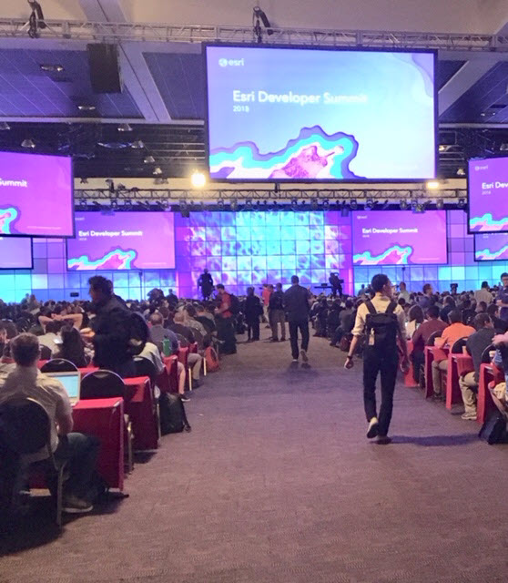
Welcome to Day Two of the GeoNet DevSummit  2018 daily updates! First up is the keynote presentation featuring Joseph Sirosh, Corporate VP, Artificial Intelligence and Research Group, Microsoft Azure 


Sirosh began his Microsoft career nearly five years ago as the VP of Information Management. His passion and understanding for the development of machine learning to improve efficiency has aided in the advancement of AI programs and development of AI products at Microsoft. Prior to his career with Microsoft he led teams at Amazon, FICO and other previous software companies seeking to improve business efficiency and customer experiences 


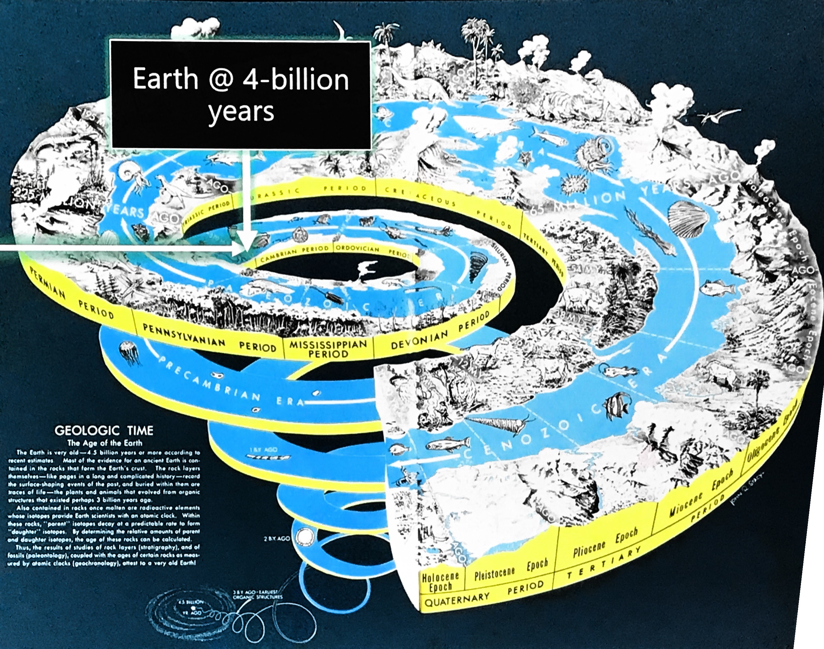
Sirosh kicks off the morning keynote session with a slide presenting Earth's evolution and the start of life as a single cell. He continues to explain how, like human life, software is evolving and will continue to evolve as we make it smarter to improve efficiencies and intelligence. 


After asking how many people in the audience are using AI he explains the definition of AI, “Artificial Intelligence is the opposite of natural stupidity.”  


Sirosh further elaborates on the Microsoft AI Platform, bringing AI to Azure and the best pieces of Azure to AI; the services, infrastructure, and tools. Things like chatbot AI is an innovation that allows for better task completion and efficiency. 


Sirosh was excited to announce the general availability of Geo AI Data Science Virtual Machine, giving data scientists easier access to AI, machine learning and data science tools. By integrating geography and location, the Science of Where, with data, data scientists can gain a new understanding of the world around them. The newGeoAI Data Science VM integrates and supports Esri ArcGIS platforms. 


Sirosh introducesLucas Joppa, Chief Environmental Scientist of Microsoft who shares how he spends most of his time trying to figure out how we can apply AI to improve life on the Earth. 

Joppa counters Captain Kirk's famous quote, “Space is the final frontier with, as he explains, “a one-sided argument of how to apply artificial intelligence to spatial data in order to change the way we, as a society, manage and ultimately think about the space all around us; or as Jack Dangermond and our friends at Esri would say, the Science of Where?” 


He continues with an explanation of how we are using machine learning to extract data in astronomy to map outer space and addresses a concern on our ability to understand and solve critical environmental challenges on Earth to sustainably manage a growing population. He explains, “that is why, from the very beginning, Microsoft has turned to Esri’s GeoSpatial Tool Kit” to teach AI computers how to collect and understand data extracted from the vast library of raster data and change how we are contributing the human experience on Earth.  


Sirosh returns to demonstrate, “How can AI help?” sharing that AI helps us understand data, learn and form conclusions from data, developing models and forming conclusions. 

Microsoft cognitive services in the Cloud include: 

  • Vision - picture, identification, optical recognizer 
  • Speech - Customizes speech to your language and domain 
  • Language translation - used to communicate with others around the world 
  • Knowledge 
  • Search - Bing search is used... 


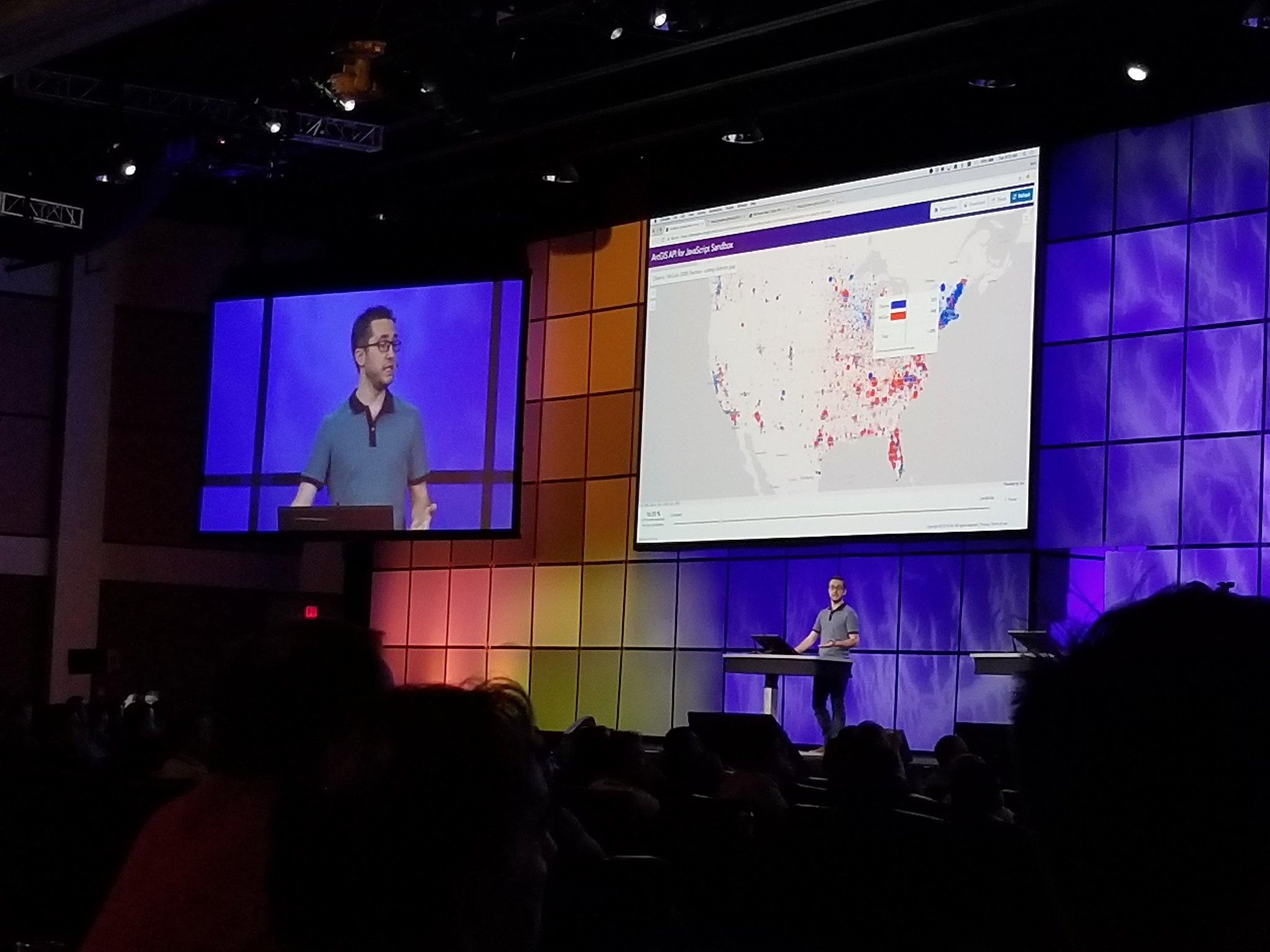
Sirosh gives a demonstration of the AI experience using the release of the JFK records to connect how AI is used to ingest information, enrich the information with cognitive services, and translate in a way that anyone can efficiently search the information.  


Any unstructured data can be translated into understandable data,” says Sirosh. 


He introduces Omar Maher, to demonstrate how Azure AI and ArcGIS can help predict accidents.  


Omar states, “The first question we have to ask, "What would cause an accident? 

With Machine learning, we can develop a model to prep data sets, feature engineering train and evaluate models, deploy the model to production and then share the information.  


Sirosh returns to talk about interacting using Bots. Microsoft AI Platforms are capable of building sentiment applications using cognitive services 


AI is the new normal. "You touch AI every time you touch your mobile phone." 


He presents a video of how Microsoft is building an application that helps mothers communicate with their autistic children. "Helpicto" uses bots to combine language and pictures to create speech that is understood. 


Seeing AI – a talking camera app for the visually impaired, is another Microsoft application developed to see the world with AI 


Azure AI Gallery provides a large number of examples of capabilities that can be viewed. Many machine learning models are within the AI Gallery for predictive maintenance.  


Microsoft is rolling out a new program called AI for Earth. Developers with innovative solutions to use AI to advance sustainability can apply for a grant. 


Sirosh ends providing the following resources 


Questions from the audience: 


Q: Are we going to see more docker in the architecture for the AI?  

Sirosh: Docker platforms actually made it amazingly easy to containerize, not just an AI model, but also its dependencies…so you can have a very nice encapsulated object…one of the directions we are going after is to containerize AI. 


Q: I see a lot of examples of learning from images straight down, how about machine learning of obliques at an angle, 45 degree angle, 90 degree angle…?  

Sirosh: We actually have examples of that…It won’t be perfect. We can create synthetic data…and it makes it possible. 


Q: What sorts of problems would an AI not be great for exploring?   

SiroshAI is advanced statistics, it is learning statistical and problemistic models from data. If you don’t have good data it can become garbage data. Need good data. 


Q: What about using AI to take non-spatial data, and converting it to usable data?  

Sirosh: It is possible, but again, it goes back to the training data. You have to start with taking the AI to school. 


Q: Can you share your thoughts on the ethical posed by these technologies? 

Sirosh: Microsoft has a term used, FATE, Fair > Accountable > Transparent > Ethical. AI is a learning system. If the data has biases, it can be a problem. He compares it to medicine in pharmaceuticals. Prescribed versus over the counter. Must debug the data. 


Q: Last year Microsoft shut down the Photo Synth project in your lab. What does that mean? Are you rolling into something else?  

Sirosh: Today we have the vision AI…a capturing AI. We continue to launch new capabilities. 


Q: Twenty plus years ago AI and neuro networks were a very hot topic, aside from some of the wonderful computation infrastructures we have in platforms today what did you see as being some of the significant advancements in AI that we are now starting to exploit that we didn't have a while back? 

Sirosh: Mentions the he studied in neuro networks before the Neuro Net Winter started.  

Neuro networks needed tremendous amounts of data and with new learning algorithms to work. In the last 10 years, it has advanced…we now have vast amounts of dataas new things coming together to make it possible. 


Q: Between today and the next Developer Summit, what can we see improve on this current Azure Geo AI Infrastructure?  

Sirosh: I am hoping that a lot of the developers here apply AI... such as what the developer developed for autistic children and their mothers. 


What did you enjoy from the keynote? Post your comments and questions below and stay tuned for more coverage from Day Two!
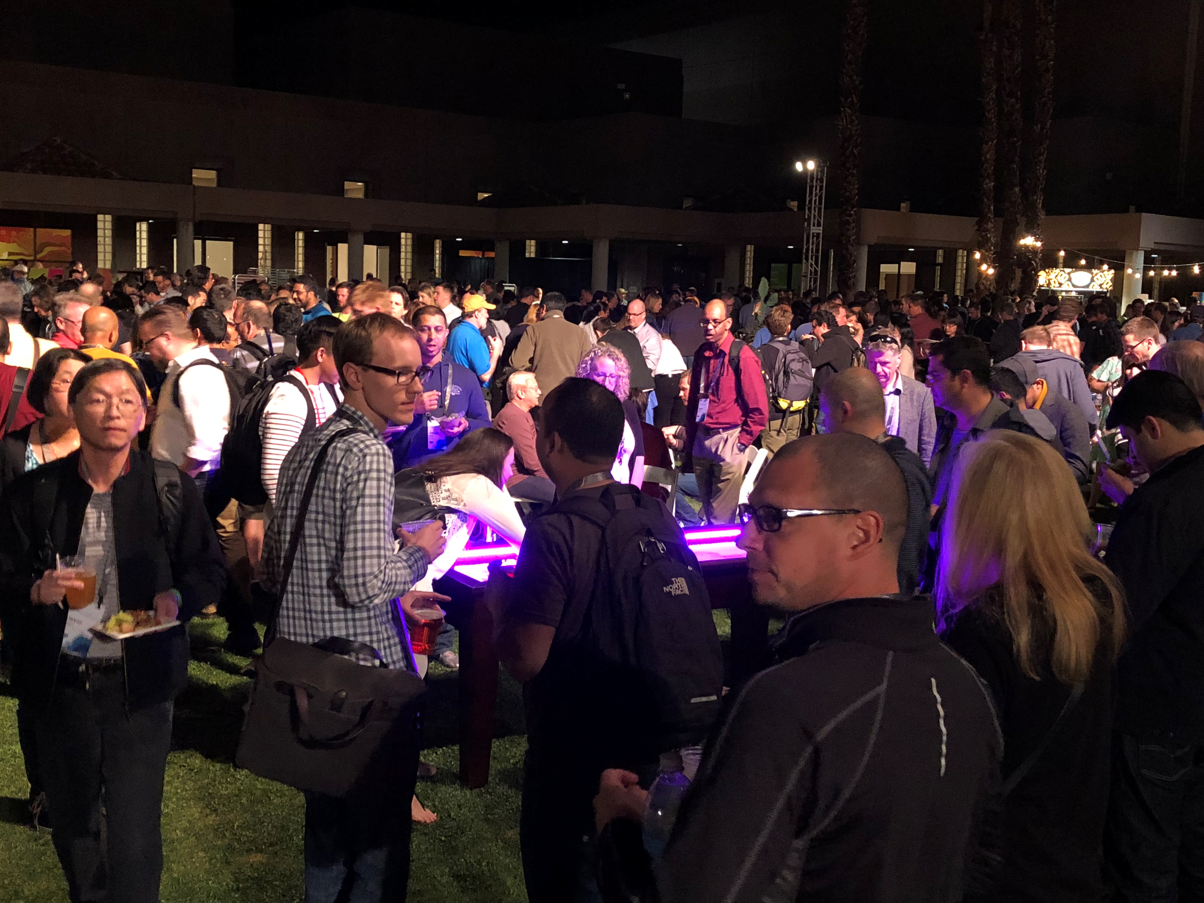


more
2 0 1,018
CandaceLoya
Occasional Contributor III

DevSummit kicked off pre-summit activities on Saturday, March 3rd with a 3-day SAP-Esri hack-a-thon when Team Brontosaurus took home the grand prize for their creative use of SAP and Esri tools using microscopes and machine learning to detect bacteria in drinking water. The hack-a-thon began on Saturday at the Riviera Hotel in Palm Springs, California. They were joined by several others from Critigen, Southern California Edison, UC Santa Barbara, Bolt Geographics and several other representatives from Esri Partners. 

Team Brontosaurus takes home the grand prize at the SAP-Esri Hack-a-thon
SAP-Esri Hack-a-thon

On Monday, March 5th, Jack Dangermond announced this year's Esri Partner Conference winners at the EPC plenary.

2018 Esri Partner Conference Award Winners

  • Being Release Ready - Staying aligned with the latest releases of the ArcGIS Platform
  • Bringing Insights Implementing Systems of Insight
  • Creating Realistic Context Producing 3D content and analysis for realistic context
  • Delivering in Real-Time Delivering real-time capabilities using the ArcGIS Platform
  • Driving Enterprise Platform Adoption 
  • Engaging Communities Working with governments and nonprofits to support community engagements and initiatives. 
  • Innovating Solutions with New Capabilities Leveraging the latest capabilities of the ArcGIS Platform to create innovative solutions.
  • Leading Web.  GIS Transformations Leading customers through their transition to Web GIS.
  • Partnering to Lead New Strategies Leading the market for new strategies, preparing the market, and implementing for success.
  • Partnering to Lead New Strategies Leading the market for new strategies, preparing the market, and implementing for success.
  • Quick to Market Configuring capabilities of the ArcGIS Platform to quickly develop and deliver new point solutions to market.
  • Taking GIS to the Field Implementing mobile solutions leveraging ArcGIS Apps for the Field.
  • Turning Pro Transitioning products and services to ArcGIS Pro.


Other activities included pre-summit sessions, including a session with Christopher Catania‌ and Sandi Peterson‌ sharing the top ten tips for building online communities, which included learnings and experiences from growing the GeoNet community.  

Day one of the 2018 Esri DevSummit kicked off with the plenary live blogged by the GeoNet Team: https://community.esri.com/community/events/devsummit/blog/2018/03/06/live-from-the-devsummit-plenar...

The day continued as new and current members stopped by the GeoNet showcase area to sign-up, give feedback on the future GeoNet homepage, pick up some swag, share success stories and get tips and tricks from Michelle Mathias. It was great to spend time talking with Jeff PaceRobert Scheitlin, GISP‌, Rebecca Strauch, GISP‌, and Blake Terhune‌, Stacey E Crowe,   and Nick Floersch‌. And we hope to see more of you during the week! 

The day wrapped as Speedgeeking sessions sped through various developer projects and topics in the Santa Rosa room.

Check out the video of the most recent excitement from DevSummit below:

Update: 

We almost forgot one more fun part of the Monday pre-DevSummit events. Lightning Talks.

What are the Lightning Talks? The Lightning Talks are 5-minute user submitted presentations showcasing successes in GIS with Esri products. Monday’s Lightning talks featured numerous presentations from Esri customers and partners. They included stories, fascinating facts and intriguing uses of GIS.

Professor Yu Zhou teaches Geography at Bowling Green State University and uses the ArcGIS mobile apps and story maps to engage his geography students.

Professor Yu Zhou at Lightning Talks

“With story maps on cell phones…it is a great way to improve teaching geography…Not difficult to make.”

Raj Singh, IBM, shared a presentation using machine learning platforms to speed up the development of ArcGIS Applications using IBM Data Science.

Raj Signh Lightning Talk Presenter

And that's a wrap for today! We couldn't get to it all, so tell us what you loved and learned the most today in the comments below. Thanks for sharing the day with us!


more
6 0 1,657
CandaceLoya
Occasional Contributor III

Welcome to the 2018 Esri #DevSummit Plenary!  We will be sharing the latest news and updates during the plenary. Thanks for following along and we look forward to seeing your feedback and contributions in the comments below! 

Be sure to check out each DevSummit 2018 daily recap.

8:10 - DevSummit Attendees have entered the room and seats are filling fast.

This Summit is expected to be the largest DevSummit audience ever, more than 2,000 for 2018.

Picture: GeoNet team ready to feed you the action from the DevSummit Plenary.

Right to left: Candace Loya‌, Chris Catania‌, and Michelle Mathias

GeoNet Team live at DevSummit Plenary

8:28 - Let the show begin!

Jim McKinneyArcGIS Program Manager, CTO ArcGIS Desktop, opens the plenary with a few words and introduces Jack Dangermond, Esri Founder and CEO 


Jack welcomes attendees to the DevSummit 2018 and shares the focus for this year’s conference. And keeping with tradition he asks attendees to stand and introduce themselves to someone new.

Before exiting the stage Jack quotes McKinney, "There is a human connection." 

McKinney congratulates the winners of the SAP-Esri Hack-a-Thon from Saturday to Monday during the EPC. He continues with an overview of the plenary and DevSummit events, highlights, and how to be part of the closing sessions.


McKinney introduces Sud Menon, first speaker of the morning.

Saying hello!

Jack Dangermond and Jim McKInney - DevSummit 2018

8:40 AM- ArcGIS: A Platform for Developers with Platform Overview  

Product: ArcGIS Online 

Speaker: Sud Menon, Director of Software Development 

Esri’s Director of Software Development, Sud Menon, introduces an amazing overview video on the ArcGIS Platform and is now describing the capabilities of ArcGIS as a platform for developers including highlights of significant improvements and expansion capabilities. 

Menon explains mapping behind the scenes with things like dynamic feature tiles, apps in the field for field mobility of mobile workers, and location analytics through Insights for ArcGIS online also includes App Builders that allow you to build apps on any device. Runtime APIs are for building native apps for mobile devices.

"ArcGIS Enterprise includes are of these capabilities."

Menon continues explaining the full capacity of tools available through ArcGIS.

Sud Menon on ArcGIS

9:00 AM – Mapping  - How to Smart Map 

Product: ArcGIS Runtime SDKs, ArcGIS API for JavaScript

Speaker: Jeremy Bartley, Software Product Development 

Jeremy Bartley starts immediately with a demo on How to Smart Map, showing mapping of Zillow data for house pricing and peak month dates. He is using the simple user experience and tells how he can also make the updates with Python


You can follow more on Mapping in the ArcGIS Runtime SDK for Java‌.

Jeremy Bartley

9:07 AM - Data exploration  with Arcade

Speaker: Kristian Ekenes 

Kristian Ekenes gives a key demonstration the experience of using the Arcade expression-based scripting language including attribute pop-ups. He reminds everyone that all capabilities remain the same.

9:12 AM - Client-side processing of the feature

Speaker: Yann Cabon

Cabon captivates the audience with client-side queries, loading data and the projection engine with a demonstration of New York construction.  

Follow Yann Cabon‌ and see all the question he answers.

Yann Cabon on client-side query

9:17 AM - 3D Viewer Apps and 3D is JS API

Speaker: Javier Gutierrez and Russ Roberts

Using 3D Viewer apps for mobile allows developers to use scene viewer for iPad to building attributes. Roberts displays his iPad experience for residential buildings in Raleigh, NC 3D. He also shows point cloud seem layers for Mud Creek to see the progression that CalTrans made to make new roads.

Roberts hands over to Gutierrez for a demonstration of 3D in JavaScript API using code developed for the Swiss National Park using line symbology, call outs and images on maps for hiking trails that can be applied to responsive web apps.

See a video of Javier's demonstration at #EsriDevSummit.

9: 25 AM - Widgets

Speaker: Juan Carlos Franco 

Juan Carlos Franco  or “Franco” as he is introduced, presents on the exciting world of Widgets discussing  some of the comings enhancements

  • Legend widgets 
  • Coord conversion widget 
  • Customize layer list widget 
  • Search 

9:31 AM - ArcGIS Configurable Apps in 4X API

Speaker: Kelly Hutchins 

"You get all this capability with just a few lines of code."

Widgets are easily searched. They are accessible via the keyboard. The 4x API is building better apps with typescript and easy to use the latest features in JavaScript, nice code assist with typescript, and can get a "Read more..." help topic to assist.

Kelly Hutchins demonstration

9:35 AM – Building API with webpack 

Speaker: Rene Rubacalva 

Rene Rubalcava demonstration

9:38 AM – Analytics 

Products: Insights for ArcGIS, ArcGIS Pro, ArcGIS API for Python

Speaker: Jim McKinney 

Jim McKinney reminisces on commands in ArcInfo glued together with AML or ArcView and Navigator, or the emergences of over 1,200 geoprocessing tools. The analytics options available now and in the future bring a lot of powerful tools for developers.  

ArcGIS is a platform for geoanalytics, spatial statistics, and data science. Esri development leads and engineers demonstrate new tools and improved capabilities of proven tools, such as Insights for ArcGIS and using Python notebooks to improve the flow of analysis as well as provide open interoperability with third party packages. 

Analytics in the Platform

9:40 AM - Insights 

Speakers: Linda Beale & Art Haddad

Beale demonstrates data exploring fatal accident data in Los Angeles, California including the patterns visible in tables, charts, and maps. She also looks at the demographics against education, income and employment exploring multiple numeric variables. She further explains that her data can also be shared for further analysis. There is one feature in Insights that is different...sharing multiple relationships in one map allows data to joined together and explored to get answers.

9:49 AM - Analysis in ArcGIS Pro 

Lauren Bennett and Marjean Pobuda 

 “Pro is one of the most powerful tools in your toolkit as analysts and data scientists…It is a fully integrated analytics workstation… that makes it easy to… apply the Science of Where.” 

Bennett explains that Esri is constantly working to add new capabilities to the platform. She then demonstrates the data-based clustering provided by Waze. 

Marjean Pobuda explains how entwining geoprocessing tools, charts and python and R - ArcGIS  Bridge to create a powerful analysis of workflows and expands all data types. She then references a model sample of locations where African Cape Buffalo have been observed in South Africa. She uses ArcGIS for R to determine a location suitable for conservation preservation. 

Pro is connected to the rest of the platform allowing data scientists to share their results of analysis. 

Lauren Bennett

Lauren Bennett

Waze mapping

Waze Mapping Data

10:00 AM – Python API 

Speakers: Jay Theodore & Rohit Singh 

Data science, R Analytics answers the 5Ws to gather data.  

Theodore quote, “Data Science is data driven.”  

Three stages of Data Science: 

  • Data Preparation 
  • Analysis 
  • Dissemination 

Data science is a collaborative exercise between 

  • Business analysts 
  • Data engineers 
  • Data scientist 
  • Developers 
  • DevOps
3 stages of data science

Singh continues demonstrating how government departments such as fire, police, and other field crews used workforce management to collaborate in the field during the Thomas Fire. 

Extent of damage from Thomas Fire

Extent of damage from Thomas Fire demonstrated

Thomas Fire Visual Burn Scars

Break - Jim McKinney returns to the stage to release the audience for break until 10:45 AM.

During the Break

During the break we connected with Bruce, Madison and Shane (left to right,) graduate students from the University of Redlands attending their first DevSummit.

What did they enjoy the most during the first half?

"The 3D stuff is really cool! We're excited to learn more about machine learning, too," said Madison and Bruce.

"I liked the Edge rendering on 3D models; it added some needed texture," explained Shane. "We also use the Jupyter notebook. It really helps us to understand the script. We use it in all our projects."

10:45 AM - Jim McKinney Welcome back from break and introduces David Cardella

10:46 AM - Developer Experience

Product: ArcGIS Online Developers

Speaker: David Cardella

Esri's developer technologies product manager Dave Cardella briefs our developer community on new and improved options for licensing the use of developer tools and deployment that include them. He will also demonstrate and describe improvements to the developer website and self-help learning and productivity resources.

ArcGIS developer technologies and toolkits for desktop, server, web, and mobile.

Two questions are often asked, "What can ArcGIS do for me?" and "How do I get started?"

Improvements

  • New Home page
  • Success stories
  • Feature pages
  • ArcGIS Developer Program
  • DevLabs
  • Example apps

Cardella talks further about success stories such as CommandX leveraging ArcGIS identities.

How are the success stories implemented? Cardella explains who the ArcGIS API for JavaScript is used to tell the story. Suggests developer audience signing up for the developer program.

David Cardella

10:53 AM – Extending & Automating Your Enterprise

Product: ArcGIS Pro, ArcObjects, ArcGIS API for Python

Speaker: Jim McKinney 

In this section, Esri presenters discuss and demonstrate continued support for ArcObjects developers, as well as the expansion of the capabilities of ArcGIS Pro and the ArcGIS API for Python.

The focus is desktop software and using Python. More information can be found on these GeoNet spaces and groups.

ArcGIS Pro for Utility Management

10:54– ArcGIS Pro for Utility Networks

Speaker: Rich Ruh

Using trace location data to create maps in Pro SDK

Demo of Utility in ArcGIS Pro

Demo of Utility in ArcGIS Pro

Demo of Utility in ArcGIS Pro

11:08 AM – The Power of Python in ArcPy

Speaker: Shaun Walbridge

Walbridge introduces encrypted toolboxes and looks at the ways to work faster with ArcPy. He gives a demonstration in VisualStudio to help with debugging.

11:13 AM – Broader Scope of Automation

Speaker: Jay Theodore & Atma Mani

Sharing the stage, Jay and Atma demonstrate the broader scope of automation.

Using ArcGIS Enterprise, Mani walks the audience through the steps to get a distributed system going, configuring the system and content. He continues demonstrating how government departments such as fire, police, and other field crews used workforce management to collaborate in the field during the Thomas Fire.

Theodore recaps on the workflow demonstrated by Mani.

11:25 AM – Native app development (Why native?)

Product: Native App Developers

Speaker: Euan Cameron

ArcGIS Runtime is now a native app development platform that all can use, and is ready for capabilities that used to be served by ArcGIS Engine. Building apps for online/offline use, consistent user experience across desktop and mobile, as well as some new examples of using ArcGIS with augmented reality and virtual reality are demonstrated. 

Why native?

  • Runtime is the native SDK
  • Benefits of native development
  • Esri apps also built with Runtime

Native Dev options:

  • Field Apps
  • AppStudio
  • Runtime SDKs

11:28 - Working with Maps in ArcGIS Runtime

11:30 AM – Layers types with Runtime

Speaker: Divesh Goyal

with the geopackage, Goyal demonstrates connected and disconnected layers on his iPad using featured data within many apps. He shows how to display tiles from the FAA Visual flight rules and dynamic data for no fly zones for drones in The Netherlands. 

11:38 AM – 3D Mapping with Runtime

Speaker: Kerry Robinson

Robsinson demos of Runtime open for business with 3D layers and additional scene layers analysis, shapefiles of observer locations run, and LOS/viewshed all on a mobile device.

Robinson continues to demonstrate code for GeoElementsLineOfSight. The Runtime 3D allows you to develop code for mobile devices.

11:45 AM – AR and VR

Speaker: Adrien Meriaux, joined by Rex Hansen

Meriaux and Hansen demonstrates the use of mapping with VR visiting downtown San Diego while still on stage including the use of viewshed. 

Virtual Reality walk through San Diego

This is just one of the new experiences you can build using VR. If you would like to apply for the Beta Program, please email arcgisruntimerarvrbeta@esri.com.

11:50 AM - Wrap Up from Euan Cameron and Summary from Jim McKInney.

Thank you for attending the #EsriDevSummit.

more
10 4 4,587
CandaceLoya
Occasional Contributor III

Plenary Live Blog, Daily Updates and More!

DevSummit 2018 is right around the corner! This year we invite you to follow the action in the DevSummit space and connect with the GeoNet Community in Palm Springs. Check out the live blogging, daily updates and showcase meet-up details below.

Tuesday, March 6

Plenary Live Blog & Video Livestream

View the DevSummit plenary livestream and join the conversation as the GeoNet Team live blogs the event on the DevSummit Conference space.

March 6-9

DevSummit Daily Updates

Follow the GeoNet team and guest contributors in the DevSummit space as we share daily updates including what we learn and experience throughout the week.

Attending DevSummit? You can share your DevSummit experience by adding your comments to the daily update posts.

March 5-9

GeoNet area at the Esri Showcase – Oasis 1 & 2

Stop by the GeoNet area to: 

  • Learn how GeoNet Community members are working better, sharing ideas and finding solutions
  • Connect with other GeoNet members
  • See what's coming to GeoNet in 2018

We'll be hosting specific meet-up times below:

Monday through Thursday: 2 - 3 pm, 4:30 - 5:30 pm
Oasis 1-2 near the Python and the Esri Lab Exhibit Booths

Map of Esri Showcase GeoNet spotlight

Know a fellow Esri user who should join GeoNet? Bring them along. We welcome all to the Community.


Follow @EsriGeoNet on Twitter for even more #DevSummit commentary.

We look forward to connecting with you throughout the week.
See you at DevSummit.

more
4 1 1,079
CandaceLoya
Occasional Contributor III

You can be the next inspirational thought leader at the 2018 Esri Developer Summit. It takes only 5 minutes to share your GIS success story. Showcase a successful geodev project, describe an innovative customization you made using ArcGIS or SDKs, speak of challenges you overcame with GIS Technology, and contribute to the overall excitement of the 2018 DevSummit.

Present your story and be the inspiration that sparks innovation. Submissions are reviewed on a first come, first serve basis. Space is limited. Email your proposal before March 3, 2018 to LightningTalks@esri.com.

When & Where

DevSummit PS Lightning Talks
Monday, March 5 | 3:00 p.m. — 4:00 p.m.
Palm Springs Convention Center | Mesquite B-C Rooms

Guidelines

    • Share one great idea — Tell a story, motivate, and inspire.
    • Make it quick — Presentations must be five minutes or less.
    • No live demos — We want to hear about the idea directly from you.
    • Be creative — You can use slides, videos, or Prezi to present your talk.
    • Avoid sales pitches — Refrain from advertising products and services.
    • Hurry and sign up! — There are only 18 slots, so submit your lightning talk soon!

      Lightning Talk submissions are reviewed on a first come, first serve basis and space is limited. Email your Lightning Talk proposal to LightningTalks@esri.com by the March 3, 2018 deadline, including the following:

        • Your full name, title, organization, email address, and phone number.
        • Your final Lightning Talk PowerPoint slides, video, or Prezi.
        • A short description of your talk (500 characters or less).
        • A brief, interesting fact about yourself that we can share with the Lightning Talks audience.
    • Have fun! — This is your chance to share your passion for your great idea. For inspiration, read How to Give a Great Ignite Talk or watch a lightning talk on writing Unix daemons to see how a seemingly dull topic can be made exciting.

more
0 0 992
ChrisCatania
Esri Community Team

We're excited to announce that next week we'll be onsite at the Developer Summit 2017 conference in Palm Springs, CA.  During the week we'll be live blogging, sharing updates and starting collaborative session conversations here in the Developer Summit space and other groups throughout the GeoNet community.  (Make sure to click "follow" in the top right corner of the DevSummit space overview page to get the updates.)


Whether you're attending the event or following along virtually, we invite you to join the DevSummit conversation on GeoNet. What topics, sessions and conference events are you most excited about? 


Thanks for joining and we look forward to seeing you and your contributions!    

more
1 0 807
34 Subscribers