Turn on suggestions
Auto-suggest helps you quickly narrow down your search results by suggesting possible matches as you type.
Cancel
- Home
- :
- All Communities
- :
- Products
- :
- Data Management
- :
- Data Management Questions
- :
- The fields of the attribute table of the raster in...
Options
- Subscribe to RSS Feed
- Mark Topic as New
- Mark Topic as Read
- Float this Topic for Current User
- Bookmark
- Subscribe
- Mute
- Printer Friendly Page
The fields of the attribute table of the raster in the ccatalog window
Subscribe
758
3
05-25-2012 09:58 AM
05-25-2012
09:58 AM
- Mark as New
- Bookmark
- Subscribe
- Mute
- Subscribe to RSS Feed
- Permalink
- Report Inappropriate Content
The fields of the attribute table of the raster in the catalog window
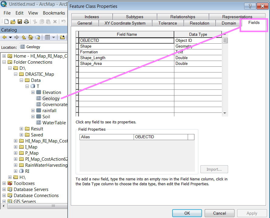
I�??m wondering why the �??catalog view�?� of doesn�??t show the fields of the attribute table of raster as main component of its properties while it does so for polygons, polyline and points?
[ATTACH=CONFIG]14652[/ATTACH], [ATTACH=CONFIG]14653[/ATTACH]
Thank you for the help,
Best
Jamal
I�??m wondering why the �??catalog view�?� of doesn�??t show the fields of the attribute table of raster as main component of its properties while it does so for polygons, polyline and points?
[ATTACH=CONFIG]14652[/ATTACH], [ATTACH=CONFIG]14653[/ATTACH]
Thank you for the help,
Best
Jamal
----------------------------------------
Jamal Numan
Geomolg Geoportal for Spatial Information
Ramallah, West Bank, Palestine
Jamal Numan
Geomolg Geoportal for Spatial Information
Ramallah, West Bank, Palestine
3 Replies
05-29-2012
10:55 AM
- Mark as New
- Bookmark
- Subscribe
- Mute
- Subscribe to RSS Feed
- Permalink
- Report Inappropriate Content
Jamal,
You can't have a feature class of point, line, or polygon without also having an attribute table. "Fields" is something that is common to all of those and thus they have a shared UI. Raster data on the other hand, does not always have a table. Multiband imagery doesn't support tables, nor does 32 bit float. Integer data can support a table, but depending on the data it may be built automatically or it could be up to you to run the Build Raster Attribute Table tool to force a table to be built. Because of the lack of uniformity among the various types of raster data with respect to attribute tables, they do not have a shared "Fields" tab in the properties dialog.
Regards,
Eric
by
Anonymous User
Not applicable
05-29-2012
01:37 PM
- Mark as New
- Bookmark
- Subscribe
- Mute
- Subscribe to RSS Feed
- Permalink
- Report Inappropriate Content
Original User: Jamal432@gmail.com
I appreciate your continuous help Erc.
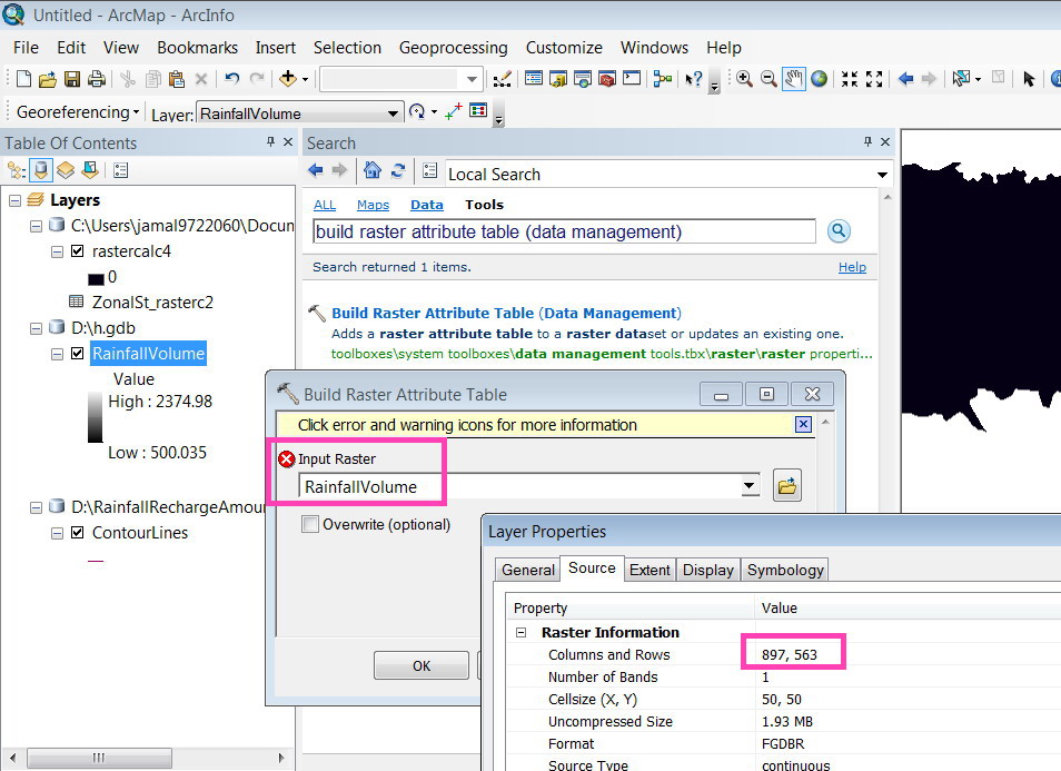
I tried to create a table for the �??rainfallvolume�?� raster but sounds not to work.
What might be the reason in this case?
[ATTACH=CONFIG]14733[/ATTACH]
Jamal,
You can't have a feature class of point, line, or polygon without also having an attribute table. "Fields" is something that is common to all of those and thus they have a shared UI. Raster data on the other hand, does not always have a table. Multiband imagery doesn't support tables, nor does 32 bit float. Integer data can support a table, but depending on the data it may be built automatically or it could be up to you to run the Build Raster Attribute Table tool to force a table to be built. Because of the lack of uniformity among the various types of raster data with respect to attribute tables, they do not have a shared "Fields" tab in the properties dialog.
Regards,
Eric
I appreciate your continuous help Erc.
I tried to create a table for the �??rainfallvolume�?� raster but sounds not to work.
What might be the reason in this case?
[ATTACH=CONFIG]14733[/ATTACH]
05-29-2012
01:39 PM
- Mark as New
- Bookmark
- Subscribe
- Mute
- Subscribe to RSS Feed
- Permalink
- Report Inappropriate Content
That raster is floating point. You must have an integer raster to build attribute tables.
Eric
Eric