- Home
- :
- All Communities
- :
- Products
- :
- Data Management
- :
- Data Management Questions
- :
- Raster Wireframe Not Displaying Until Zoomed In/Ot...
- Subscribe to RSS Feed
- Mark Topic as New
- Mark Topic as Read
- Float this Topic for Current User
- Bookmark
- Subscribe
- Mute
- Printer Friendly Page
Raster Wireframe Not Displaying Until Zoomed In/Other RMD issues
- Mark as New
- Bookmark
- Subscribe
- Mute
- Subscribe to RSS Feed
- Permalink
- Report Inappropriate Content
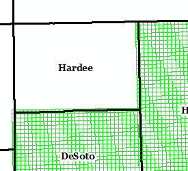
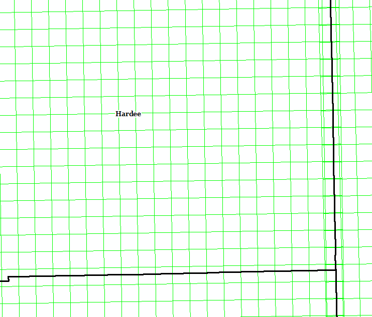
I am adding .sids to a raster mosaic dataset in ArcMap 10.6.1 and am having some difficulty. I'm going county by county and when I come to this particular county (Hardee), the rasters are added, but I am unable to see them like I can see the other counties until I zoom in:
1:900,000:
1:200,000:
It also appears that the rasters are not added to the attribute table -- I am only able to see them in the attribute table if I select them on the map, which is quite frustrating. When I add them at first, they do not have MinPS or MaxPS values, so I have to manually select them and then use the Field Calculator to set those values. The image does display when I zoom in, but I'm concerned about how this will affect my overviews when I finally get to building them. If the overviews fail, I pretty much have to start over and I'm already having to add these county by county (67 counties) since I get random errors if I try to add too many at a time.
Any help is greatly appreciated!!
Edit: removed superfluous details