- Home
- :
- All Communities
- :
- Products
- :
- Data Management
- :
- Data Management Questions
- :
- I have a coordinate system projection problem ......
- Subscribe to RSS Feed
- Mark Topic as New
- Mark Topic as Read
- Float this Topic for Current User
- Bookmark
- Subscribe
- Mute
- Printer Friendly Page
I have a coordinate system projection problem ...part 2
- Mark as New
- Bookmark
- Subscribe
- Mute
- Subscribe to RSS Feed
- Permalink
- Report Inappropriate Content
I have a similar issue, wondering if you can help: A new(er) GIS map doc, the data frame coordinate system and all data was captured (GPS) and drawn in NAD_1983_UTM_Zone_15N (matching the ESRI World Imagery). All datasets, aerials, parcels, street centerlines, etc. match, no issues there.
UTM Zone 15N is in meters, I am displaying my units in feet. What I'm not understanding is that, for instance, I have a sewer main that measures (in reality and in my GIS) at ~533'; it displays (in the main's SHAPE_length field) as only 165. I can do the math, knowing that this is given to me in meters, approx. 1/3 of the actual distance.
No matter what I do, I cannot get the map to display and measure everything in feet, representing the reality of field measurements. I've set all my datasets, aerials, parcels, and map document into my preferred coordinate system (NAD_1983 StatePlane Kansas South FIPS 1502) (which is in US Feet), then everything gets even more screwy - a mile section only measures about 1600 map units...
Ideas?
- Mark as New
- Bookmark
- Subscribe
- Mute
- Subscribe to RSS Feed
- Permalink
- Report Inappropriate Content
You keep on using the word 'changed' in reference to coordinate systems.
So in order for Neil and I to fully understand... when we say to 'Project' the data, we mean use the Project tool in ArcToolbox's Data Management tools (skip catalog...it is gone in Pro anyway).
This produces a brand new file (as you know... but this is for the benefit of others too).
It would be very wise at this point to put it into a new geodatabase if that is what you use, or to a shapefile. Choice is yours, as long as it is not in with other stuff and fluff that might have an impact on the coordinate system and/or its interpretation. Projection-on-the-fly is what should be avoided until you are sure that you have a clean file.
Assuming that you have a clean, isolated, truly projected new file... this can be added to a new project without any other stuff. It will set the coordinate system of the data frame. Examine the coordinates on screen, and those in the properties of both the file and the data frame.
Any static fields containing geometry information need to be recalculated of course. Shape_Length etc should be in feet.
What does the above produce? If everything is fine, then you can mix other data into the project, just not before.
- Mark as New
- Bookmark
- Subscribe
- Mute
- Subscribe to RSS Feed
- Permalink
- Report Inappropriate Content
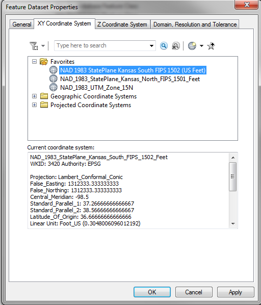
By 'change', I mean, I previously (in Catalog) had right-clicked on the dataset I needed to re-project, went to Properties, XY Coordinate System tab, and changed my coordinate system from NAD_1983_UTM_Zone_15N to the NAD 1983 StatePlane Kansas South FIPS 1502 (US Feet) coordinate system by simply clicking the one I wanted in my favorites. That yielded no change except I then had feet as my map units but without the correct measurements.
The last time tried the re-projection (a couple hours ago), I used the Project tool in the Data Management Toolset (through Catalog but using Toolbox); I was able to drag and drop the entire dataset in the interface (except for the ones that had an existing geometric network, had to delete that before I could do this). It created a new dataset, e.g. the new dataset named SanitarySewer_Project, and all feature classes inside were given the added name of _1 at the end. There is a chance I'd re-projected my datasets after I'd already 'changed' their XY Coordinate system manually through the dataset's properties... may have been my issue earlier.
I did as directed above: created a test.gdb, re-projected the same SanitarySewer dataset to the necessary CS, put it in the new test.gdb, inserted the feature classes into a new .mxd and same outcome - now it does have the reprojected dimensions/lengths in feet. Do you think I had something corrupted?

The issue now for me is to re-project everything... I was using Esri's LGIM .gdb setup - and there are a LOT of datasets/feature classes... so eventually, I'll have to re-project all my datasets in this way, to ensure everything is up to speed...
- Mark as New
- Bookmark
- Subscribe
- Mute
- Subscribe to RSS Feed
- Permalink
- Report Inappropriate Content
I suspect a 'define' occured along the way, instead of a 'project'. This is where shapefiles can come in handy... if they don't have a *.prj file to define its coordinate system, you can be sure that the units are the units. Your numbers seemed metric, which means they were metric and not converted to non-metric. I never trust what something looks like... I only trust what it is. I would proceed cautiously until you are sure that you have the data in the coordinates you want. A much simpler option... join the metric world  but that is a different story.
- Mark as New
- Bookmark
- Subscribe
- Mute
- Subscribe to RSS Feed
- Permalink
- Report Inappropriate Content
I wish the US would have adopted the metric system in the first place.... Anyway, thank you for your help, and I agree about shapefiles and the .prj files - it's obvious how things are when you look at them.
- Mark as New
- Bookmark
- Subscribe
- Mute
- Subscribe to RSS Feed
- Permalink
- Report Inappropriate Content
Thank you very much for your help!
- Mark as New
- Bookmark
- Subscribe
- Mute
- Subscribe to RSS Feed
- Permalink
- Report Inappropriate Content
This question has been branched
- « Previous
-
- 1
- 2
- Next »
- « Previous
-
- 1
- 2
- Next »