- Home
- :
- All Communities
- :
- Products
- :
- Data Management
- :
- Data Management Questions
- :
- Re: How to Extract Raster by Polygon without "No D...
- Subscribe to RSS Feed
- Mark Topic as New
- Mark Topic as Read
- Float this Topic for Current User
- Bookmark
- Subscribe
- Mute
- Printer Friendly Page
How to Extract Raster by Polygon without "No Data" cells?
- Mark as New
- Bookmark
- Subscribe
- Mute
- Subscribe to RSS Feed
- Permalink
- Report Inappropriate Content
Apologies if this is a simple question, but it's the first time I've really needed to do this. I'm using ArcMap 10.2.
I have a large raster mosaic I created using four image tiles, but the extent area for my project (which falls at the intersection of the four tiles) is only about 25% of the full image. I am trying to extract a new raster dataset (.tif) based on a polygon I created.
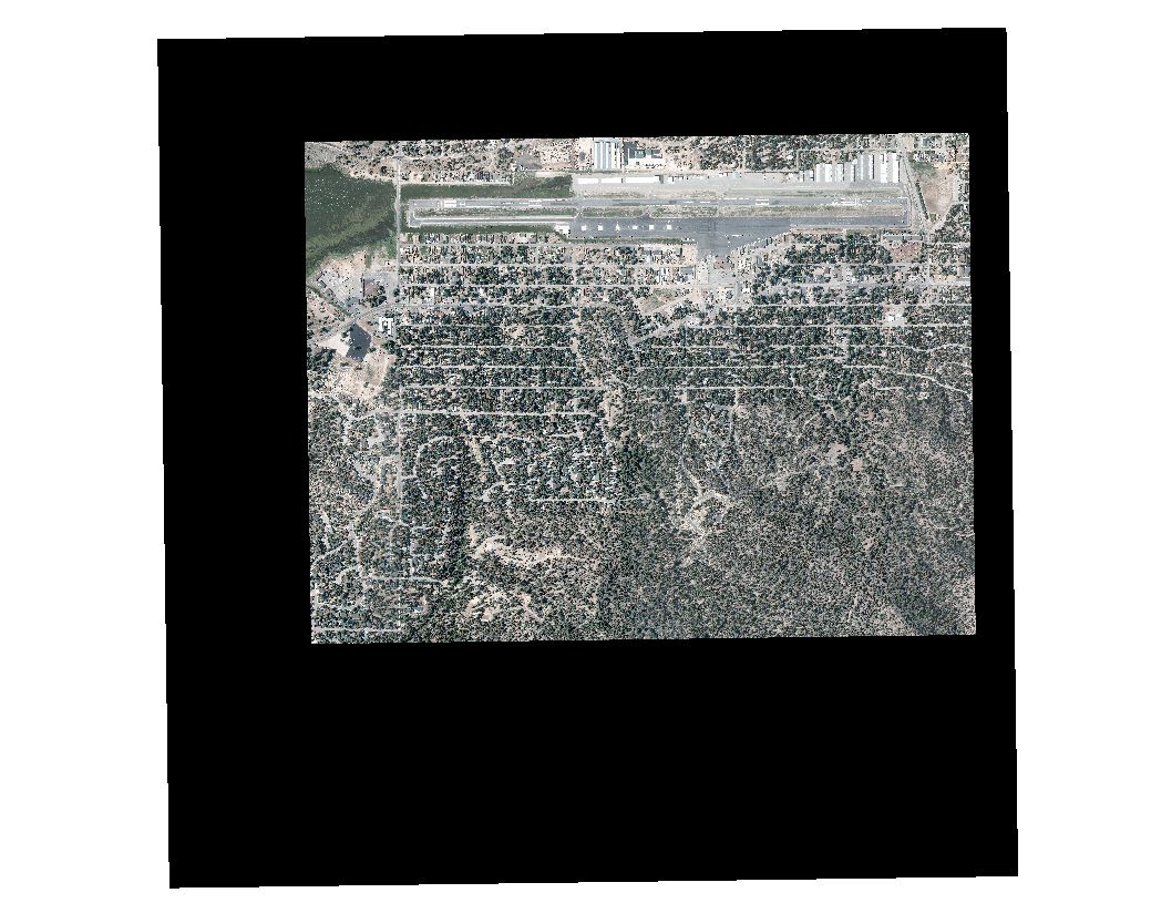
Here's the problem: After looking at several tools (Clip, Extract Raster), I find that the *entire* extent area of the original input raster is preserved as "No Data" cells for the areas that fall outside my polygon mask. To enhance performance and reduce file size, I would simply like to create a smaller raster "without the baggage of the original extent". Ideally, my end result would be a reduced-size, reduced-extent raster based on the satellite view shown below.
Can anyone tell me which tool to use in order to accomplish this? Or perhaps I am not selecting the correct settings in the tools I used? In the image below, the black area represents the full-extent raster, and the satellite imagery is what I want to export as a stand-alone raster. Everything I've tried still preserves the original extent in the output file. Any help would be appreciated! Thanks!
- Mark as New
- Bookmark
- Subscribe
- Mute
- Subscribe to RSS Feed
- Permalink
- Report Inappropriate Content
if the polygon file is smaller than the raster file, you set the analysis extent to it in the Environments tab. This applies to any tool used in Arctoolbox
- Mark as New
- Bookmark
- Subscribe
- Mute
- Subscribe to RSS Feed
- Permalink
- Report Inappropriate Content
...or use ExtractByMask if you have a Spatial Analyst or 3D license.
- Mark as New
- Bookmark
- Subscribe
- Mute
- Subscribe to RSS Feed
- Permalink
- Report Inappropriate Content
Thanks for your help! Finally got it to work testing both methods. The final .tif output was intended to be imported into a georeferenced Civil3D .dwg file, so keeping the file size down was important since I've noticed Civil3D refuses to import .tif images over about 700MB.
Matt