Turn on suggestions
Auto-suggest helps you quickly narrow down your search results by suggesting possible matches as you type.
Cancel
- Home
- :
- All Communities
- :
- Products
- :
- Data Management
- :
- Data Management Questions
- :
- Geo-Referenced Photos: Problem with Raster catalog...
Options
- Subscribe to RSS Feed
- Mark Topic as New
- Mark Topic as Read
- Float this Topic for Current User
- Bookmark
- Subscribe
- Mute
- Printer Friendly Page
Geo-Referenced Photos: Problem with Raster catalog - Shifting East by one UTM Zone
Subscribe
477
0
05-17-2013 10:52 AM
05-17-2013
10:52 AM
- Mark as New
- Bookmark
- Subscribe
- Mute
- Subscribe to RSS Feed
- Permalink
- Report Inappropriate Content
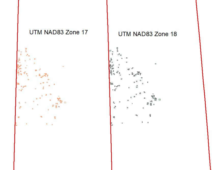
Hello All,
I have State of Georgia geo-referenced (historic) aerial photos in State Plane (NAD83) system.
Of course Georgia falls in two State Plane zones (Georgia East & Georgia West) and the photos cover both of them.
In order to re-project them into UTM (NAD83) zones - 16 & 17, I first created a Raster Catalog (adding the aerials) with Geographic (WGS84) coordinate system and using Cartography -> Data Driven pages -> Calculate UTM Zones was able to separate out the list of aerials falling in UTM Zone 16 or UTM Zone 17.
Using this list I re-projected the aerials to UTM (Zones 16 & 17).
To QA/QC the results the created another set of raster catalogs.
The UTM Zone 16 catalog foot prints overlay on the re-projected aerials. But the UTM Zone 17 catalog falls one zone away in Zone 18. What is the problem?
[ATTACH=CONFIG]24447[/ATTACH]
0 Replies