Turn on suggestions
Auto-suggest helps you quickly narrow down your search results by suggesting possible matches as you type.
Cancel
- Home
- :
- All Communities
- :
- Products
- :
- Data Management
- :
- Data Management Questions
- :
- Re: Creating seamless mosaic with aerial photograp...
Options
- Subscribe to RSS Feed
- Mark Topic as New
- Mark Topic as Read
- Float this Topic for Current User
- Bookmark
- Subscribe
- Mute
- Printer Friendly Page
Creating seamless mosaic with aerial photography tiles
Subscribe
872
1
10-11-2012 07:20 PM
10-11-2012
07:20 PM
- Mark as New
- Bookmark
- Subscribe
- Mute
- Subscribe to RSS Feed
- Permalink
- Report Inappropriate Content
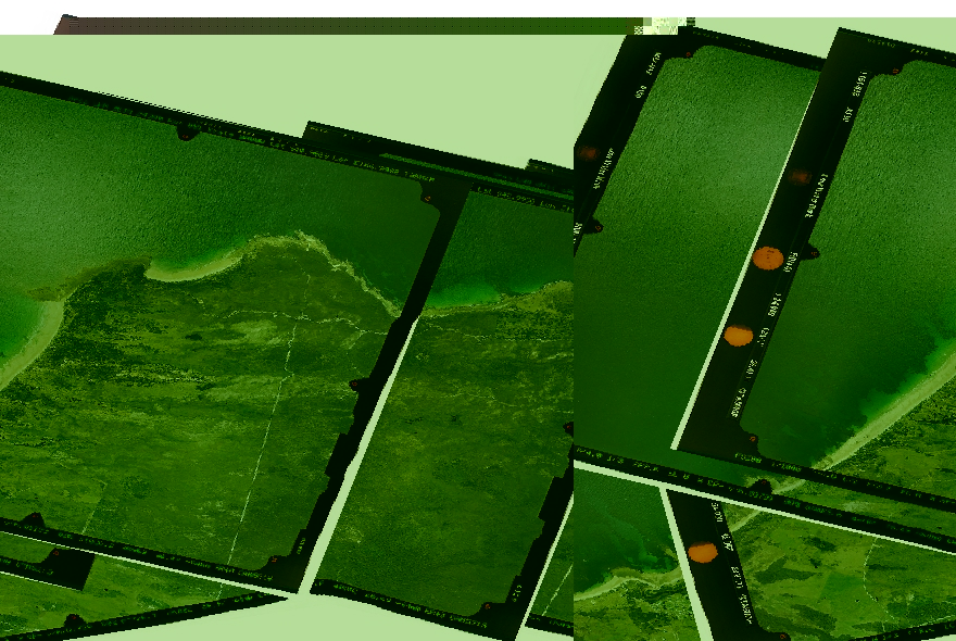
I have some aerial photography captured using a film camera, not digital.
As a result the image tiles I have all have a black border around them with various details on the photography.
What I would like to do is remove these black borders so that I can seamlessly mosaic the overlapping tiles together.
Does anyone know how this might be possible? The 'nodata' areas have already been made transparent, and do not include the black borders.
[ATTACH=CONFIG]18378[/ATTACH]
1 Reply
10-11-2012
10:54 PM
- Mark as New
- Bookmark
- Subscribe
- Mute
- Subscribe to RSS Feed
- Permalink
- Report Inappropriate Content
What you can do will depend on the Version/license level of ArcGIS for Desktop you are using ...
Are you using a Mosaic Dataset for this task?
Did you probably store the data as lossy JPEGs and now the "no-Data" to "Data" borders have started "bleeding"?
If you use a Mosaic dataset you could either extend the no-Data definition to include some of the "bleeding" OR you could use the "Build Footprints" Tool and just shrink your image footprints (seems they have a lot of overlap - so this shouldnt hurt) ...
So please check out these options first ...
regards
Guenter