- Home
- :
- All Communities
- :
- Products
- :
- Data Management
- :
- Data Management Questions
- :
- Re: best way to convert a csv file with UTM to lat...
- Subscribe to RSS Feed
- Mark Topic as New
- Mark Topic as Read
- Float this Topic for Current User
- Bookmark
- Subscribe
- Mute
- Printer Friendly Page
best way to convert a csv file with UTM to lat long
- Mark as New
- Bookmark
- Subscribe
- Mute
- Subscribe to RSS Feed
- Permalink
- Report Inappropriate Content
I have a huge amount of .csv files each with hundreds of rows and each has its own value of an easting and northing
How can i quickly change these UTM coordinates and convert them to a lat/long coordinate value using ArcMap.
What might you suggest is the most efficient method? Im very new to this, so any help and details is greatly apprecaited
- Mark as New
- Bookmark
- Subscribe
- Mute
- Subscribe to RSS Feed
- Permalink
- Report Inappropriate Content
I have fond that the winning combination for tackling these kind of issues is using ArcGIS + FME which handles files wonderfully and can make the transformations you are looking to make a breeze. It works wonders by reprojecting You can download a fully working trial at FME Desktop | Data Integration & Productivity | Safe Software
Give it a try and let me know how it goes. You can try using the tool AttributeReprojector: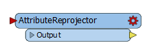
Sorry if I mention another tool instead of solving the issue with ESRIs software, but I really had great experience working with this software combo. BTW, I'm just a regular FME user and not affiliated with them.
- Mark as New
- Bookmark
- Subscribe
- Mute
- Subscribe to RSS Feed
- Permalink
- Report Inappropriate Content
Thanks for the information Hector, the tools look awesome from FME, unfortunately the cost ranges from $6400 to 20k, this is a bit expensive for my company and will not pass go! Even using the trial only band aids my problem, im looking for a long term solution this this using the tools that I have, i appreciate your help in any event
thank you kindly
marina
- Mark as New
- Bookmark
- Subscribe
- Mute
- Subscribe to RSS Feed
- Permalink
- Report Inappropriate Content
Oh yes, I know what you mean. I made the case to my bosses on the basis $2250USD would save a lot in processing time and faster workarounds for the analysis and we are now seriously considering buying the standard desktop version. but I digress...
Have you tried using the Project—Data Management toolbox | ArcGIS for Desktop tool?
I find it difficult in ArcGIS to have a CSV file and convert it to SHP to show the points on my map, I use FME for this 
- Mark as New
- Bookmark
- Subscribe
- Mute
- Subscribe to RSS Feed
- Permalink
- Report Inappropriate Content
If you want to stay fully within ArcMap, convert your CSV to a layer using Make XY Event Layer. Then, calculate lat/longs using Add Geometry Attributes, specifying WGS 1984 as the coordinate reference system. Both tools can be run using batch processing to loop through your files.
edit: forgot to mention event layers are temporary layers. You will likely need to run Copy Features to save the file to disk at some point.
- Mark as New
- Bookmark
- Subscribe
- Mute
- Subscribe to RSS Feed
- Permalink
- Report Inappropriate Content
Hi Darren, I think that is the most efficient way to go about this, i appreciate your help
- Mark as New
- Bookmark
- Subscribe
- Mute
- Subscribe to RSS Feed
- Permalink
- Report Inappropriate Content
While I agree with Darren, you might want to read before you go ahead...here is the tips about .csv files
CSV, TXT, and GPX files—ArcGIS Online Help | ArcGIS
Another good information for you to read ... https://brocku.ca/maplibrary/Instruction/Part_One_GPS_Data_Collection.pdf
I do not remember if I was able to load the .csv to DNR Garmin and save it as a shapefile in a quick way...it has been a while I last used...but worth trying to research it.
Import CSV: Data loss and rounding. <---- it talks about import .csv to DNR Garmin how to use it..
- Mark as New
- Bookmark
- Subscribe
- Mute
- Subscribe to RSS Feed
- Permalink
- Report Inappropriate Content
This is possible with DNRGPS (new version of DNR Garmin), but it's difficult if not impossible to run in batch mode. Also, you'd need to convert all of your easting/northing field names to x_proj/y_proj. It's just not set up well for this.
- Mark as New
- Bookmark
- Subscribe
- Mute
- Subscribe to RSS Feed
- Permalink
- Report Inappropriate Content
Yeah, unless if Marina is comfortable and knows how to deal with it or not... I was just giving another way around to make the job easier..
- Mark as New
- Bookmark
- Subscribe
- Mute
- Subscribe to RSS Feed
- Permalink
- Report Inappropriate Content
Thanks Robert, I will check out the information, there's always more than one way to accomplish something!