- Home
- :
- All Communities
- :
- Products
- :
- Data Management
- :
- Data Management Questions
- :
- Re: Aggregate nearby lines
- Subscribe to RSS Feed
- Mark Topic as New
- Mark Topic as Read
- Float this Topic for Current User
- Bookmark
- Subscribe
- Mute
- Printer Friendly Page
Aggregate nearby lines
- Mark as New
- Bookmark
- Subscribe
- Mute
- Subscribe to RSS Feed
- Permalink
Hello
I have some GPS tracks of routes to the same point. Becauce of this routes are splited in the suburbs of the town some of them overlay in the City area.
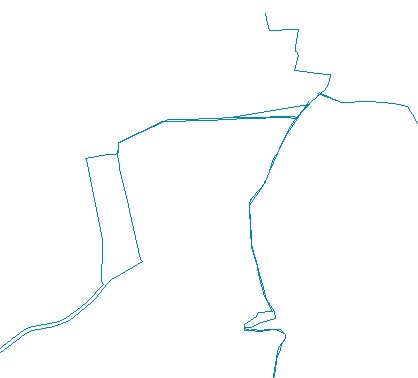
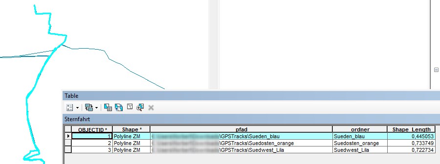
(it's an excerpt)
The lines are merged in dissolved with a own model by the folders in which they are saved. The folders contains e. g. the tracks for the routh from south ("Sueden_blau"):
For a nice map and calculat the length of the route network, i want them to aggegate to one line.
I find Toolbox > Cartography Tools > Generalization. But e. g. this tools doen't help me.
Cane somebody help me?
Best Regards
GISTutor
- Mark as New
- Bookmark
- Subscribe
- Mute
- Subscribe to RSS Feed
- Permalink
A problem that comes up once in a while.
Generalize, as you have discovered, only generalizes one line. You want to combine multiple lines, and simplify the resultant where the the tracks are close together. There is no clean simple way to do this that will apply in all situations.
You could try
1 Collapse Dual Lines To Centerline—Help | ArcGIS for Desktop best for parallel lines, might work for some segments
2 there are various buffer alternatives that I have tried with varying degrees of success... so I can't recommend any
3 convert the routes to a raster using a cell size that hopefully will produce a raster version of your routes. Convert the raster back to vector and generalize
4 buffer your routes dissolve the overlaps to form a polygon... then use a median axis or to get the polygon skeleton... sorry... there aren't any available tools to do that back to the first 3
- Mark as New
- Bookmark
- Subscribe
- Mute
- Subscribe to RSS Feed
- Permalink
Thank you for the answer. I tried no. 1 before I asked here without succsess.I thinked about No. 3 but i doesn't seem to make precise data to overlay with an basemap.
If that is so, i think it is better to condtion the data before using ArcMap. Than a gpx track contains only the stretch of way to the point of intersection with an other gpx track.
Regards
GISTutor