Turn on suggestions
Auto-suggest helps you quickly narrow down your search results by suggesting possible matches as you type.
Cancel
- Home
- :
- All Communities
- :
- User Groups
- :
- Coordinate Reference Systems
- :
- Questions
- :
- Successful projection produces unreadable file wit...
Options
- Subscribe to RSS Feed
- Mark Topic as New
- Mark Topic as Read
- Float this Topic for Current User
- Bookmark
- Subscribe
- Mute
- Printer Friendly Page
Successful projection produces unreadable file with "k" prefix
Subscribe
318
0
10-02-2019 06:43 PM
10-02-2019
06:43 PM
- Mark as New
- Bookmark
- Subscribe
- Mute
- Subscribe to RSS Feed
- Permalink
- Report Inappropriate Content
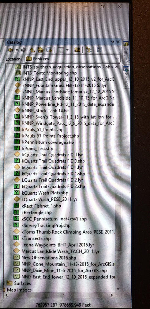
I added a table from an Excel spreadsheet, exported it as a shapefile, and wanted to change the coordinate system from WGS84 to NAD83. I ran the Project tool and it successfully executed. The output file has a "k" prefix, a "?" file type, and can't be opened. I don't understand the problem or how to fix it.
BTW, a bunch of previously created and usable shapefiles also suddenly acquired the k prefix and unknown file type.
Thanks,
Dan
0 Replies