- Home
- :
- All Communities
- :
- User Groups
- :
- Coordinate Reference Systems
- :
- Questions
- :
- NCAT vs ArcMap coordinate conversions
- Subscribe to RSS Feed
- Mark Topic as New
- Mark Topic as Read
- Float this Topic for Current User
- Bookmark
- Subscribe
- Mute
- Printer Friendly Page
NCAT vs ArcMap coordinate conversions
- Mark as New
- Bookmark
- Subscribe
- Mute
- Subscribe to RSS Feed
- Permalink
- Report Inappropriate Content
Our enterprise data (typical local gov datasets) is in NAD_1983_StatePlane_Nevada_West_FIPS_2703_Feet and datum=D_North_American_1983. We have some new 3DEP lidar data that uses D_NAD_1983_2011, so I want to understand the differences between the two datums.
I've used the nifty NGS NCAT program to calculate the absolute XY shift between the two datums in our vicinity: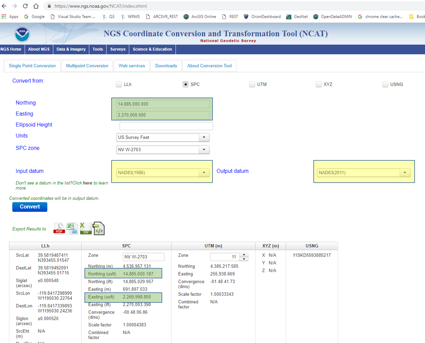
My question is: Why can't I get the same result in ArcMap?
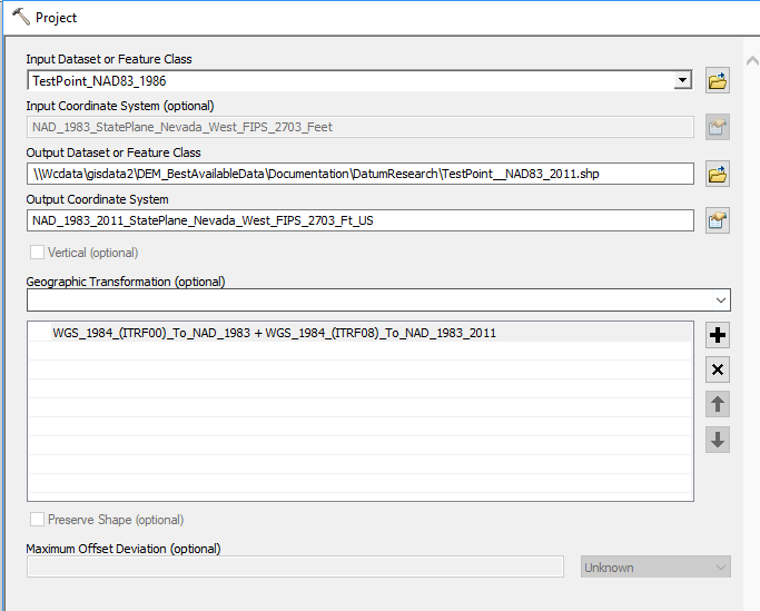
The transformation used above was automatically plugged in by ArcMap - I didn't select it. Resulting coordinates in NAD1983_2011 are shown as X2 and Y2 below.

One ASSUMPTION I've used is that ESRI's D_North_American_1983 means NAD1983(1986); that isn't explicitly stated anywhere I've seen. What am I missing here?
Washoe County GIS
Solved! Go to Solution.
Accepted Solutions
- Mark as New
- Bookmark
- Subscribe
- Mute
- Subscribe to RSS Feed
- Permalink
- Report Inappropriate Content
NCAT is likely using NADCON 5 files which means it's stepping through these GCS:
NAD 1983 (1986) to HARN (1994)
HARN to FBN (2nd HARN, 1999)
FBN to NSRS2007
NSRS2007 to 2011
All four would be file-based transformations. Esri currently supports 2 steps only so we can't use the same path. Instead, we're using a 2000 era conversion between NAD83 (it's closer to HARN/CORS96) to "WGS 84" the a 2nd transformation to convert from "WGS 84" to NAD83 (2011). So they're not equivalent paths and won't give similar answers. We plan to add the NADCON 5 files, hopefully this year.
You will probably get closer answers by using
1st part
NAD_1983_To_HARN_Nevada
NAD_1983_HARN_To_NSRS2007_GEOCON_CONUS
2nd part
NAD_1983_NSRS2007_To_2011_GEOCON11_CONUS
This misses the conversion between HARN and FBN, unfortunately.
Melita
- Mark as New
- Bookmark
- Subscribe
- Mute
- Subscribe to RSS Feed
- Permalink
- Report Inappropriate Content
Thanks Melita - excellent info. I realize we are only talking a couple of inches at most, but I feel better at least understanding some of what is "behind the curtain".
Washoe County GIS