- Home
- :
- All Communities
- :
- User Groups
- :
- Coordinate Reference Systems
- :
- Questions
- :
- Georeferencing with model builder.
- Subscribe to RSS Feed
- Mark Topic as New
- Mark Topic as Read
- Float this Topic for Current User
- Bookmark
- Subscribe
- Mute
- Printer Friendly Page
Georeferencing with model builder.
- Mark as New
- Bookmark
- Subscribe
- Mute
- Subscribe to RSS Feed
- Permalink
- Report Inappropriate Content
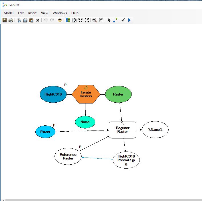
Hello! I am new to the GIS Community and am looking for some help. I am an Intern working on georeferencing historic aerial photos. How I would normally go about the process is by using control points and manually georeferencing each individual photo. The photos are consecutive and overlap consistently. I've also used the auto registration tool on the georeferencing toolbar to speed up the process a bit. My goal is to make the process even quicker and try to automate it using a model. Since all the photos overlap I figured it could work if the photos had a reference raster. The problem is that whenever I run the model it cant seem to find any matching points. However, when I run the auto registration tool from the toolbar, it finds points just fine. I'm wondering what changes can be made, am I missing something? I'd appreciate any help, Thanks.