Turn on suggestions
Auto-suggest helps you quickly narrow down your search results by suggesting possible matches as you type.
Cancel
- Home
- :
- All Communities
- :
- Developers
- :
- ArcObjects SDK
- :
- ArcObjects SDK Questions
- :
- Re: Insert feature causes Out of memory exception
Options
- Subscribe to RSS Feed
- Mark Topic as New
- Mark Topic as Read
- Float this Topic for Current User
- Bookmark
- Subscribe
- Mute
- Printer Friendly Page
Insert feature causes Out of memory exception
Subscribe
5759
28
03-13-2013 07:42 AM
03-13-2013
07:42 AM
- Mark as New
- Bookmark
- Subscribe
- Mute
- Subscribe to RSS Feed
- Permalink
- Report Inappropriate Content
Hi!
I'm developing the 3D modeling GIS software. For 3D city models i use generated from vector data building models and 3d files (Google Earth and SketchUp) with geographic coordinates within. I import such files' geometries with IImport3DFile and store them in multipatch featureclass in file geodatabase.
At last I recieved an exception "Out of memory" during IFeatureCursor.InsertFeature. Have to say that there was no such a problem before (with other files). Error appears constantly after processing definite number of files. Geometries i load from them are correct, i processing their footprints and if i don't save them to my featureclass i process them all with no exceptions. After the exception appears program can't work properly at all until restart (looks like ArcObjects crash).
How you could understand i use insert cursor with featurebuffer. Tried edit sessions, load mode for featureclass, direct write with WriteFeature and so on... No differences. May anybody help me? Any suggestions?
Sorry for my English )
28 Replies
03-21-2013
12:21 PM
- Mark as New
- Bookmark
- Subscribe
- Mute
- Subscribe to RSS Feed
- Permalink
- Report Inappropriate Content
Here is part 2:
        private static IFeatureClass GetFeatureClass(string GDBFilename, string Dataset, ISpatialReference DatasetSpatialReference)
        {
            IWorkspaceFactory wsf = null;
            IWorkspace datasetWorkspace = null;
            IFeatureClass objectiveFeatureClass = null;

            try
            {
                wsf = new FileGDBWorkspaceFactoryClass();
                datasetWorkspace = wsf.OpenFromFile(GDBFilename, 0);

                if (!((IWorkspace2)datasetWorkspace).get_NameExists(esriDatasetType.esriDTFeatureClass, Dataset))
                    objectiveFeatureClass = CreateFeatureClass(Dataset, DatasetSpatialReference, datasetWorkspace);
                else
                    objectiveFeatureClass = ((IFeatureWorkspace)datasetWorkspace).OpenFeatureClass(Dataset);

            }
            finally
            {
                if( wsf != null )
                    Marshal.ReleaseComObject(wsf);

                if( datasetWorkspace != null )
                    Marshal.ReleaseComObject(datasetWorkspace);
            }

            return objectiveFeatureClass;
        }

        private static IFeatureClass CreateFeatureClass(string Dataset, ISpatialReference DatasetSpatialReference, IWorkspace datasetWorkspace)
        {
            IFeatureClass objectiveFeatureClass = null;
            IField shapeField = null;
            IGeometryDef geometryDef = null;
            IField oidField = null;
            IFields fcFields = null;
            IEnumFieldError enumFieldError = null;
            IFields validatedFields = null;
            IFieldChecker fieldChecker = null;
            IObjectClassDescription objectDescription = null;

            try
            {
                shapeField = new FieldClass();
                IFieldEdit fieldEdit = (IFieldEdit)shapeField;
                fieldEdit.Name_2 = "Shape";
                fieldEdit.Type_2 = esriFieldType.esriFieldTypeGeometry;

                geometryDef = new GeometryDefClass();
                IGeometryDefEdit geometryDefEdit = (IGeometryDefEdit)geometryDef;
                geometryDefEdit.GeometryType_2 = esriGeometryType.esriGeometryMultiPatch;
                geometryDefEdit.GridCount_2 = 1;
                geometryDefEdit.set_GridSize(0, 0);
                geometryDefEdit.HasZ_2 = true;
                geometryDefEdit.HasM_2 = false;
                geometryDefEdit.SpatialReference_2 = (DatasetSpatialReference != null) ? DatasetSpatialReference : geometryDefEdit.SpatialReference_2 = new UnknownCoordinateSystemClass();
                fieldEdit.GeometryDef_2 = geometryDef;

                oidField = new FieldClass();
                fieldEdit = (IFieldEdit)oidField;
                fieldEdit.Name_2 = "OID";
                fieldEdit.Type_2 = esriFieldType.esriFieldTypeOID;
                fieldEdit.Precision_2 = 0;

                fcFields = new FieldsClass();
                IFieldsEdit fcFieldsEdit = (IFieldsEdit)fcFields;
                fcFieldsEdit.AddField(shapeField);
                fcFieldsEdit.AddField(oidField);

                fieldChecker = new FieldCheckerClass();
                fieldChecker.ValidateWorkspace = datasetWorkspace;
                fieldChecker.Validate(fcFields, out enumFieldError, out validatedFields);

                objectDescription = new FeatureClassDescriptionClass();

                objectiveFeatureClass = ((IFeatureWorkspace)datasetWorkspace).CreateFeatureClass(
                    Dataset,
                    validatedFields,
                    null,
                    objectDescription.ClassExtensionCLSID,
                    esriFeatureType.esriFTSimple,
                    shapeField.Name,
                    "");
            }
            finally
            {
                if (shapeField != null)
                    Marshal.ReleaseComObject(shapeField);

                if (geometryDef != null)
                    Marshal.ReleaseComObject(geometryDef);

                if (oidField != null)
                    Marshal.ReleaseComObject(oidField);

                if (fcFields != null)
                    Marshal.ReleaseComObject(fcFields);

                if (enumFieldError != null)
                    Marshal.ReleaseComObject(enumFieldError);

                if (validatedFields != null)
                    Marshal.ReleaseComObject(validatedFields);

                if (fieldChecker != null)
                    Marshal.ReleaseComObject(fieldChecker);

                if (objectDescription != null)
                    Marshal.ReleaseComObject(objectDescription);
            }
            return objectiveFeatureClass;
        }
    }
03-21-2013
11:47 PM
- Mark as New
- Bookmark
- Subscribe
- Mute
- Subscribe to RSS Feed
- Permalink
- Report Inappropriate Content
Here is part 2:private static IFeatureClass GetFeatureClass(string GDBFilename, string Dataset, ISpatialReference DatasetSpatialReference) { IWorkspaceFactory wsf = null; IWorkspace datasetWorkspace = null; IFeatureClass objectiveFeatureClass = null; try { wsf = new FileGDBWorkspaceFactoryClass(); datasetWorkspace = wsf.OpenFromFile(GDBFilename, 0); if (!((IWorkspace2)datasetWorkspace).get_NameExists(esriDatasetType.esriDTFeatureClass, Dataset)) objectiveFeatureClass = CreateFeatureClass(Dataset, DatasetSpatialReference, datasetWorkspace); else objectiveFeatureClass = ((IFeatureWorkspace)datasetWorkspace).OpenFeatureClass(Dataset); } finally { if( wsf != null ) Marshal.ReleaseComObject(wsf); if( datasetWorkspace != null ) Marshal.ReleaseComObject(datasetWorkspace); } return objectiveFeatureClass; } private static IFeatureClass CreateFeatureClass(string Dataset, ISpatialReference DatasetSpatialReference, IWorkspace datasetWorkspace) { IFeatureClass objectiveFeatureClass = null; IField shapeField = null; IGeometryDef geometryDef = null; IField oidField = null; IFields fcFields = null; IEnumFieldError enumFieldError = null; IFields validatedFields = null; IFieldChecker fieldChecker = null; IObjectClassDescription objectDescription = null; try { shapeField = new FieldClass(); IFieldEdit fieldEdit = (IFieldEdit)shapeField; fieldEdit.Name_2 = "Shape"; fieldEdit.Type_2 = esriFieldType.esriFieldTypeGeometry; geometryDef = new GeometryDefClass(); IGeometryDefEdit geometryDefEdit = (IGeometryDefEdit)geometryDef; geometryDefEdit.GeometryType_2 = esriGeometryType.esriGeometryMultiPatch; geometryDefEdit.GridCount_2 = 1; geometryDefEdit.set_GridSize(0, 0); geometryDefEdit.HasZ_2 = true; geometryDefEdit.HasM_2 = false; geometryDefEdit.SpatialReference_2 = (DatasetSpatialReference != null) ? DatasetSpatialReference : geometryDefEdit.SpatialReference_2 = new UnknownCoordinateSystemClass(); fieldEdit.GeometryDef_2 = geometryDef; oidField = new FieldClass(); fieldEdit = (IFieldEdit)oidField; fieldEdit.Name_2 = "OID"; fieldEdit.Type_2 = esriFieldType.esriFieldTypeOID; fieldEdit.Precision_2 = 0; fcFields = new FieldsClass(); IFieldsEdit fcFieldsEdit = (IFieldsEdit)fcFields; fcFieldsEdit.AddField(shapeField); fcFieldsEdit.AddField(oidField); fieldChecker = new FieldCheckerClass(); fieldChecker.ValidateWorkspace = datasetWorkspace; fieldChecker.Validate(fcFields, out enumFieldError, out validatedFields); objectDescription = new FeatureClassDescriptionClass(); objectiveFeatureClass = ((IFeatureWorkspace)datasetWorkspace).CreateFeatureClass( Dataset, validatedFields, null, objectDescription.ClassExtensionCLSID, esriFeatureType.esriFTSimple, shapeField.Name, ""); } finally { if (shapeField != null) Marshal.ReleaseComObject(shapeField); if (geometryDef != null) Marshal.ReleaseComObject(geometryDef); if (oidField != null) Marshal.ReleaseComObject(oidField); if (fcFields != null) Marshal.ReleaseComObject(fcFields); if (enumFieldError != null) Marshal.ReleaseComObject(enumFieldError); if (validatedFields != null) Marshal.ReleaseComObject(validatedFields); if (fieldChecker != null) Marshal.ReleaseComObject(fieldChecker); if (objectDescription != null) Marshal.ReleaseComObject(objectDescription); } return objectiveFeatureClass; } }
I have to ask because I'm very curious about this, when you are releasing COM objects you always do something like this:
try
{
 row = cursor.NextRow();
 while(row != null)
 {
  //some logic
  Marshal.ReleaseComObject(row)
  row = null;
  row = cursor.NextRow();
 }
}
finally
{
 if(row =! null)
  Marshal.ReleaseComObject(row);
 Marshal.ReleaseComObject(cursor);
}
Now let's analyze this, in loop you are releasing the row object every time and assinging it's value to null - because as you said/wrote somewhere you want to make sure the row object will be destroyed/released. But what about the finally section: if the row object is not null you are releasing it by ReleaseComObject method...but the ReleaseComObject method only decreases the amount of references by 1, so there is a slight possibility that a row object won't be released completely, right? Should we use the FinalReleaseComObject method then? I know that your code examples for releasing COM objects are helping but I'm just willing to learn as much as I can, since COM objects generate so much problems for .net developers in esri products.
Regards,
MDruzgala
03-22-2013
05:59 AM
- Mark as New
- Bookmark
- Subscribe
- Mute
- Subscribe to RSS Feed
- Permalink
- Report Inappropriate Content
I have to ask because I'm very curious about this, when you are releasing COM objects you always do something like this:try { row = cursor.NextRow(); while(row != null) { //some logic Marshal.ReleaseComObject(row) row = null; row = cursor.NextRow(); } } finally { if(row =! null) Marshal.ReleaseComObject(row); Marshal.ReleaseComObject(cursor); }
Now let's analyze this, in loop you are releasing the row object every time and assinging it's value to null - because as you said/wrote somewhere you want to make sure the row object will be destroyed/released. But what about the finally section: if the row object is not null you are releasing it by ReleaseComObject method...but the ReleaseComObject method only decreases the amount of references by 1, so there is a slight possibility that a row object won't be released completely, right? Should we use the FinalReleaseComObject method then? I know that your code examples for releasing COM objects are helping but I'm just willing to learn as much as I can, since COM objects generate so much problems for .net developers in esri products.
Regards,
MDruzgala
I would be happy to explain. I'll add comments to the code.
try
{
        // increments RCW's ref count for the current instance of
        // row by 1
 row = cursor.NextRow();

 while(row != null)
 {
                // some code

  // decrement RCW's ref count by 1 (it was only incremented
                // by 1 as seen above)
  Marshal.ReleaseComObject(row)

                // set the row equal to null in case the following statements
                // throw an exception if the an exception is thrown before
                // row is assigned to a new instance we will enter the
                // finally-block on our way out of the method. if this happens
                // and we're still point to the current row its reference count
                // will be decremented a second time so it will now be -1
  row = null;

                // set row to the next row and increments its RCW's ref
                // count for the current instance of row by 1
  row = cursor.NextRow();
 }
}
finally
{
        // in non-exceptional cases, row will be null and we
        // will not have to call release. if an exception occurs
        // and row is not equal to null, then it wasn't released (we
        // know this because we always set it to null after we release it)
 if(row != null)
  Marshal.ReleaseComObject(row);

        // I don't see where cursor was set... if you don't increment
        // the RCW's ref count (it was passed in as a parameter from
        // managed code), you don't decrement it
 Marshal.ReleaseComObject(cursor);
}
Now, you are probably wondering why we care if the ref count goes below zero--it won't throw an exception. It is the same reason that we should never use FinalReleaseComObject.
1) RCWs for an instance of a COM object are shared across the AppDomain
e.g. If I execute the following statement in two different classes that are being used together, they actually use the same RCW that now has a ref count of 2: 1 for the first class and 1 for the second class.
IMxDocument mxDoc = (IMxDocument)app.Document; (app is IApplication)
2) When an RCW's ref count reaches 0, it detaches the underlying COM object. RCW's, which reside on the managed heap, are just proxies to the actual COM object, which resides on the unmanaged heap.
3) The RCW does not get garbage collected when the COM object is detached. It will be released non-deterministically when the garbage collector finds that it is no longer rooted
4) If you attempt to use an RCW that has detached its COM object, you get the following exception: "COM object that has been separated from its underlying RCW cannot be used"
5) FinalReleaseComObject sets the RCW's ref count to 0, which causes the underlying COM object to be detached
Conclusion: You should never release RCWs more that you have incremented the reference count; otherwise you run the risk of detaching the COM object and causing other code that still has a reference to the RCW to throw an exception when it attempts to use it.
04-02-2013
06:33 AM
- Mark as New
- Bookmark
- Subscribe
- Mute
- Subscribe to RSS Feed
- Permalink
- Report Inappropriate Content
Hi, Jason.
I was away on business and couldn't to proceed with testing. So now i able and would like to go on it.
So, I use the included file geodatabase in my test app. I use it in the actual command too. As is easy to see i delete it each execution time and create the new one. In the command i invoke the Import3DFiles method of the test app.
I tried your suggestions to release GDB and IFieldChecker. Also i found out that i open it in the Main procedure. It was commented. All of that reduced the memory increase registered in the umdh log for a half. But it is still almost 250MB (instead of ~500MB).
Also i tried to make the second capture after all releases that decreased the amount of memory with the result "Total decrease ==253812936 requested + 25696 overhead = 253838632". The last portion of the log contains the above-mentioned memory decrease about 250MB. But, it seems to me such a method is not correct as the registered memory decrease produced by the releasing the featurebuffer itself (exactly determined).
Also I executed your code and it finished with no exceptions. BUT!!! You omitted the catch block. At last the main result of the execution and the confirmation of the successful import completion is the GDB featureclass with the imported model within. But the resulting nor mine nor yours GDB does not contain it. If i give the catch block back the exception is registered.
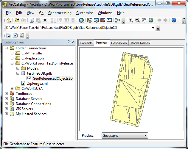
Please check up the GDB featureclass for the imported model. It's table should contain the single row, moreover you should be able to zoom to it and to visualize it in the ArcGlobe app, otherwise the code execution did not succeed.
I attached the umdh logs made with different captures (after all releases, in the catch block - after the InsertFeature exception, after releasing the FeatureBuffer)
I was away on business and couldn't to proceed with testing. So now i able and would like to go on it.
So, I use the included file geodatabase in my test app. I use it in the actual command too. As is easy to see i delete it each execution time and create the new one. In the command i invoke the Import3DFiles method of the test app.
I tried your suggestions to release GDB and IFieldChecker. Also i found out that i open it in the Main procedure. It was commented. All of that reduced the memory increase registered in the umdh log for a half. But it is still almost 250MB (instead of ~500MB).
Also i tried to make the second capture after all releases that decreased the amount of memory with the result "Total decrease ==253812936 requested + 25696 overhead = 253838632". The last portion of the log contains the above-mentioned memory decrease about 250MB. But, it seems to me such a method is not correct as the registered memory decrease produced by the releasing the featurebuffer itself (exactly determined).
Also I executed your code and it finished with no exceptions. BUT!!! You omitted the catch block. At last the main result of the execution and the confirmation of the successful import completion is the GDB featureclass with the imported model within. But the resulting nor mine nor yours GDB does not contain it. If i give the catch block back the exception is registered.
Please check up the GDB featureclass for the imported model. It's table should contain the single row, moreover you should be able to zoom to it and to visualize it in the ArcGlobe app, otherwise the code execution did not succeed.
I attached the umdh logs made with different captures (after all releases, in the catch block - after the InsertFeature exception, after releasing the FeatureBuffer)
04-02-2013
11:27 AM
- Mark as New
- Bookmark
- Subscribe
- Mute
- Subscribe to RSS Feed
- Permalink
- Report Inappropriate Content
Hi, Jason.
I was away on business and couldn't to proceed with testing. So now i able and would like to go on it.
So, I use the included file geodatabase in my test app. I use it in the actual command too. As is easy to see i delete it each execution time and create the new one. In the command i invoke the Import3DFiles method of the test app.
I tried your suggestions to release GDB and IFieldChecker. Also i found out that i open it in the Main procedure. It was commented. All of that reduced the memory increase registered in the umdh log for a half. But it is still almost 250MB (instead of ~500MB).
Also i tried to make the second capture after all releases that decreased the amount of memory with the result "Total decrease ==253812936 requested + 25696 overhead = 253838632". The last portion of the log contains the above-mentioned memory decrease about 250MB. But, it seems to me such a method is not correct as the registered memory decrease produced by the releasing the featurebuffer itself (exactly determined).
Also I executed your code and it finished with no exceptions. BUT!!! You omitted the catch block. At last the main result of the execution and the confirmation of the successful import completion is the GDB featureclass with the imported model within. But the resulting nor mine nor yours GDB does not contain it. If i give the catch block back the exception is registered.
Please check up the GDB featureclass for the imported model. It's table should contain the single row, moreover you should be able to zoom to it and to visualize it in the ArcGlobe app, otherwise the code execution did not succeed.
I attached the umdh logs made with different captures (after all releases, in the catch block - after the InsertFeature exception, after releasing the FeatureBuffer)
Welcome back, Alexey.
I looked at your UMDH logs and I really wasn't able to get anymore information than I already have.
I'm not sure what our configuration differences are, but my code is definitely succeeding. I've attached screenshots and all of the code (without the model.) Perhaps you can try my project and see if you have better luck with it?
Let me know if the screenshots look as you would expect them to (in the case of success.) Also, let me know if the project I sent you does any better.
Thanks!
04-05-2013
03:12 AM
- Mark as New
- Bookmark
- Subscribe
- Mute
- Subscribe to RSS Feed
- Permalink
- Report Inappropriate Content
Welcome back, Alexey.
I looked at your UMDH logs and I really wasn't able to get anymore information than I already have.
I'm not sure what our configuration differences are, but my code is definitely succeeding. I've attached screenshots and all of the code (without the model.) Perhaps you can try my project and see if you have better luck with it?
Let me know if the screenshots look as you would expect them to (in the case of success.) Also, let me know if the project I sent you does any better.
Thanks!
Hi, Jason!
So what about my achievements in the test.
As would be expected I run your test app and it did not succeeded.
At last i have downloaded and installed the ArcGIS 10.1 with SDK. Both apps (mine and yours) succeeded with it. The model was imported to the GDB featureclass. But it is viewed without textures with the ArcScene and ArcGlobe.
The model imported using the Add-in command in ArcGIS 10 has textures.
It is not a critical issue (i mean the lost textures) since the model has been imported. It more important for me that the import fails with the ArcGIS 10 since I'm constrained to use the 10th version by the customer.
Maybe you have some thoughts else about the problem. Also i think it's a bug that is necessary to report.
Worst of all that such a problem was encountered by me to this moment fairly often with the models of different siz
04-05-2013
06:08 AM
- Mark as New
- Bookmark
- Subscribe
- Mute
- Subscribe to RSS Feed
- Permalink
- Report Inappropriate Content
Hi, Jason!
So what about my achievements in the test.
As would be expected I run your test app and it did not succeeded.
At last i have downloaded and installed the ArcGIS 10.1 with SDK. Both apps (mine and yours) succeeded with it. The model was imported to the GDB featureclass. But it is viewed without textures with the ArcScene and ArcGlobe.
The model imported using the Add-in command in ArcGIS 10 has textures.
It is not a critical issue (i mean the lost textures) since the model has been imported. It more important for me that the import fails with the ArcGIS 10 since I'm constrained to use the 10th version by the customer.
Maybe you have some thoughts else about the problem. Also i think it's a bug that is necessary to report.
Worst of all that such a problem was encountered by me to this moment fairly often with the models of different siz
I think you have found the answer to your own problem. Unfortunately, it looks like they found the problem you're seeing in 10 SP5 and fixed it in 10.1. I guess they could have fixed it without knowing the problem ever existed. I'm still new to ArcGIS, so I don't know how willing ESRI is to fix bugs in previous service packs, especially when they are fixed in later versions.
If this as we both seem to suspect (ArcGIS 10 SP5 has a serious bug; most likely a memory leak), then I don't think there is much left that we can do. To me, it seems your options are to either convince your customer to move to 10.1 (harder than it sounds, I'm sure) or convince ESRI to patch an old version.
Have you compared memory usage between my implementation and yours on 10.1? What are the differences? Probably don't need to use UMDH, just task manager.
04-07-2013
10:31 PM
- Mark as New
- Bookmark
- Subscribe
- Mute
- Subscribe to RSS Feed
- Permalink
- Report Inappropriate Content
I think you have found the answer to your own problem. Unfortunately, it looks like they found the problem you're seeing in 10 SP5 and fixed it in 10.1. I guess they could have fixed it without knowing the problem ever existed. I'm still new to ArcGIS, so I don't know how willing ESRI is to fix bugs in previous service packs, especially when they are fixed in later versions.
If this as we both seem to suspect (ArcGIS 10 SP5 has a serious bug; most likely a memory leak), then I don't think there is much left that we can do. To me, it seems your options are to either convince your customer to move to 10.1 (harder than it sounds, I'm sure) or convince ESRI to patch an old version.
Have you compared memory usage between my implementation and yours on 10.1? What are the differences? Probably don't need to use UMDH, just task manager.
Memory usage is the same in general. The difference is about 50 KB less before the releasing objects in the loop in yours implementation and 4MB less before the application closing in mine.
So i should try to convince the customer of the need to upgrade to the 10.1 version in consequence of the actual state of affairs.
Would you help me with the bug report sending to the ESRI? I have contacted the Authorized International distributor and sent the support request. But i'm not sure about the success since this organisation is a retailer inherently and it simply redirects all the support requests to the ESRI. Also i can't report it to the ESRI directly because of thier support politics (i'm outside the US).
Anyway thanks a lot for your help.
04-08-2013
08:22 AM
- Mark as New
- Bookmark
- Subscribe
- Mute
- Subscribe to RSS Feed
- Permalink
- Report Inappropriate Content
Because this bug doesn't affect my organization, I cannot file it in through my company (I do not know of a way to file it individually, yet)--sorry. I would have the customer file the bug if they do not wish to move to 10.1. Good luck!
- « Previous
- Next »
- « Previous
- Next »