- Home
- :
- All Communities
- :
- Products
- :
- ArcGIS Survey123
- :
- ArcGIS Survey123 Questions
- :
- Re: Viewing images taken through app
- Subscribe to RSS Feed
- Mark Topic as New
- Mark Topic as Read
- Float this Topic for Current User
- Bookmark
- Subscribe
- Mute
- Printer Friendly Page
Viewing images taken through app
- Mark as New
- Bookmark
- Subscribe
- Mute
- Subscribe to RSS Feed
- Permalink
I created my forms and published. My students went out to collect data and were able to take a photo using the app. We viewed the results, but I can't see any images from the photos we took. How should I download the results in order to be able to add layer to a map and view the pictures they took?
- Mark as New
- Bookmark
- Subscribe
- Mute
- Subscribe to RSS Feed
- Permalink
I figured out one part, when I view map in ArcGIS map viewer I can see the attached images, but now I don't have my geopoint data. How do I see all data collected?
- Mark as New
- Bookmark
- Subscribe
- Mute
- Subscribe to RSS Feed
- Permalink
Hi Alissa,
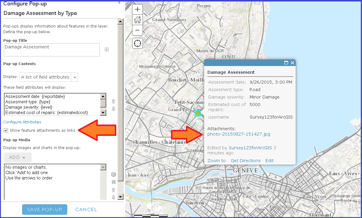
in the map viewer, you can display attachments as links by configuring the popup.

if in the map viewer you cannot see the points, try disabling the time animation in the layer (layer context menu). If you still cannot see the points in the map, open the table for the layer. If there are rows and you cannot zoom to them it means that attributes and photos were captured but not geometries. This may happen when the phone is not able to provide a location and the map was not used to set one.
- Mark as New
- Bookmark
- Subscribe
- Mute
- Subscribe to RSS Feed
- Permalink
The pop up does show the attached image, but the pop up and table doesn't show the GPS coordinates. I can see the GPS coordinates when I download the CSV file. Is there a way that I can see all of the data together? Thank you. This has been so much easier to set up and use than Collector.