- Home
- :
- All Communities
- :
- Products
- :
- ArcGIS Survey123
- :
- ArcGIS Survey123 Questions
- :
- Is it possible to use a created map for a Geopoint...
- Subscribe to RSS Feed
- Mark Topic as New
- Mark Topic as Read
- Float this Topic for Current User
- Bookmark
- Subscribe
- Mute
- Printer Friendly Page
Is it possible to use a created map for a Geopoint question?
- Mark as New
- Bookmark
- Subscribe
- Mute
- Subscribe to RSS Feed
- Permalink
- Report Inappropriate Content
We have a fairly extensive map of points of interest across a region, but are interested in collecting points of interest from people who live in the region. Is it possible to display those points, and the points that others submit on the map in a Geopoint question to reduce the possibility of getting multiple responses for one location?
- Mark as New
- Bookmark
- Subscribe
- Mute
- Subscribe to RSS Feed
- Permalink
- Report Inappropriate Content
Short Answer - Not Really.
Long Answer - If you have internet you can use the inbox functionality to show where forms have been collected. You can not display this information in the geopoint question itself though (at least not currently).
- Mark as New
- Bookmark
- Subscribe
- Mute
- Subscribe to RSS Feed
- Permalink
- Report Inappropriate Content
Hi Logan,
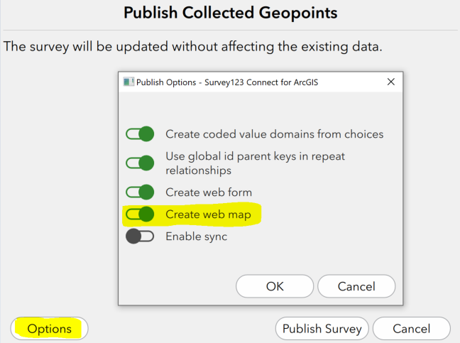
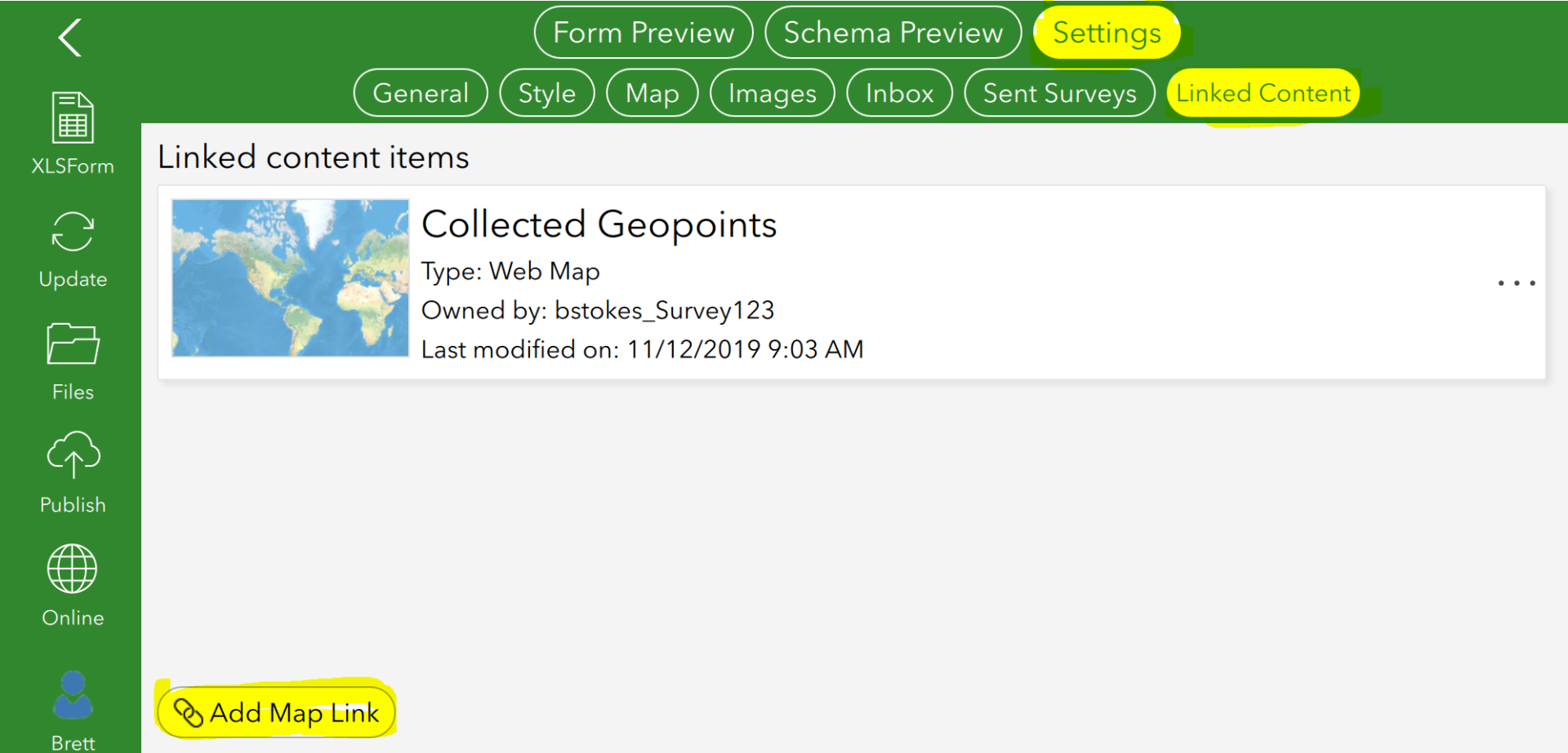
You can now use a web map (configured to include whatever layers you like) as the basemap for your geopoint questions in Survey123. You need to turn on 'Standard (Beta) Map types' in the settings of both Connect and the app. Then go into the Settings → Linked Content for your survey in Connect to configure what content you'd like to link to your survey. By default, a new web map will be created when publishing from Connect and this will be linked to your survey, but you can add others.
From here it's just a matter of changing the basemap for your geopoint question in the field app so you can see previously collected points on the map.
As the Standard Map Type is still in beta, you can find more detailed information in the Early Adopter Community. It is also referred to in the Survey123 Documentation for preparing and using offline basemaps and in the Quick reference.
Brett