- Home
- :
- All Communities
- :
- Products
- :
- ArcGIS Survey123
- :
- ArcGIS Survey123 Questions
- :
- Geopoints missing from GDB?
- Subscribe to RSS Feed
- Mark Topic as New
- Mark Topic as Read
- Float this Topic for Current User
- Bookmark
- Subscribe
- Mute
- Printer Friendly Page
- Mark as New
- Bookmark
- Subscribe
- Mute
- Subscribe to RSS Feed
- Permalink
Hello!
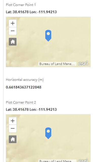
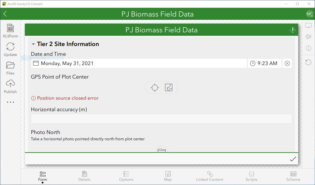
I created a Survey123 survey using Survey123 Connect (version 3.12.232). The survey is aimed at capturing tree data within plot areas. The plots are defined by a plot center and four plot corners. In the survey, I have created these all as geopoints, each of which has an associated horizonal accuracy that is pulled from the GPS data. Screenshot1.jpg shows the Survey123 Connect geopoint of the plot center. Screenshot2.jpg shows the first two plot corner points (there are two others just like them not shown). I will also attach the Excel form for reference. I also have geopoints for every tree within the plot as a repeat.
I just used this survey to collect some data in the field, and when I download the data to a GDB, only the plot center geopoint and the trees repeat geopoints are contained as point feature classes in the resulting data. The four plot corner geopoints are seemingly nowhere to be found (Screenshot3.jpg). However, when I look back at the survey in the app on my phone, the geopoints are clearly there (Screenshot4.png). Likewise, when I look at the data on survey123.arcgis.com, I can see the four geopoints as well (Screenshot5.jpg). So, the data clearly exist, but for whatever reason they are just not making it through to the end as a point feature class.
I'm really hoping there is some way to recover these point locations, and would appreciate any help/guidance as to how I might make that happen. Thanks!
Solved! Go to Solution.
Accepted Solutions
- Mark as New
- Bookmark
- Subscribe
- Mute
- Subscribe to RSS Feed
- Permalink
Hi @mcampbell_utah,
I had a quick look at your survey XSLForm and notice that you have multiple geopoint questions in the same layer. Note that ArcGIS feature layers only support one geometry field, this means there can only be one geopoint question per feature layer.
If you need to have multiple geopoints in one layer, you can make the additional geopoints have a "null" esri field type, however they will still not be stored as a real geometry, but you can then use the pulldata @ geopoint expression to extract the coordinates and store them in text fields.
Otherwise, if you want to collect multiple geopoint questions in one survey that all do have a geometry, you need to put each one in its own repeat, meaning it is in its own feature layer, and each layer will then have it own geometry.
Please refer to the following blog post: https://community.esri.com/t5/arcgis-survey123-blog/the-power-of-nothing/ba-p/893649
And also the documentation here: https://doc.arcgis.com/en/survey123/desktop/create-surveys/geopoints.htm
Regards,
Phil.
- Mark as New
- Bookmark
- Subscribe
- Mute
- Subscribe to RSS Feed
- Permalink
A-ha! Thanks @Anonymous User -- that's definitely the issue. Any thoughts on whether it may be possible to retroactively grab those coordinates using pulldata() for the geopoints that were already collected?
- Mark as New
- Bookmark
- Subscribe
- Mute
- Subscribe to RSS Feed
- Permalink
Hi @mcampbell_utah,
You can not retroactively grab those coordinates from the submitted data, as there will be no data for those geopoint questions in ArcGIS Online or Survey123 website, only geometry data will exist for the first geopoint question in the layer.
However one thing you could try is, when you open the sent surveys on the device, do you see the geopoint questions with the correct location for all of them? If so, you could try and update you survey, by adding an additional text question after each geopoint and add a pulldata expression to get the x,y from each geopoint. Then re-publish your survey and update on each device. Make sure you do not remove the survey from the device, or data will be lost. After the udpated survey is on the device, open the sent surveys again, and see if the calculation updates for those text questions with the coordinates of the geopoints.
If that doesnt work, unfortunately there is no other way to get the data from those geopoints.
Regards,
Phil.