Survey123 Tricks of the Trade: Make (previously known as Integromat)

52862
123
06-04-2019 03:41 AM
IsmaelChivite
Esri Notable Contributor
18 123 52.9K


In this blog post I will explore a few techniques to take your use of Survey123 within Make to the next level.  I am going to assume that you already know the basics of working with Survey123 and Make. If not, you may want to start with https://community.esri.com/groups/survey123/blog/2019/06/02/getting-started-with-survey123-and-integ...


Many more posts like this could be written, because what you can do with Survey123 and Make deserves an entire book, but we need to start somewhere. So here are a handful of ideas. I hope you discover some new things:


Working with Survey123 attachments


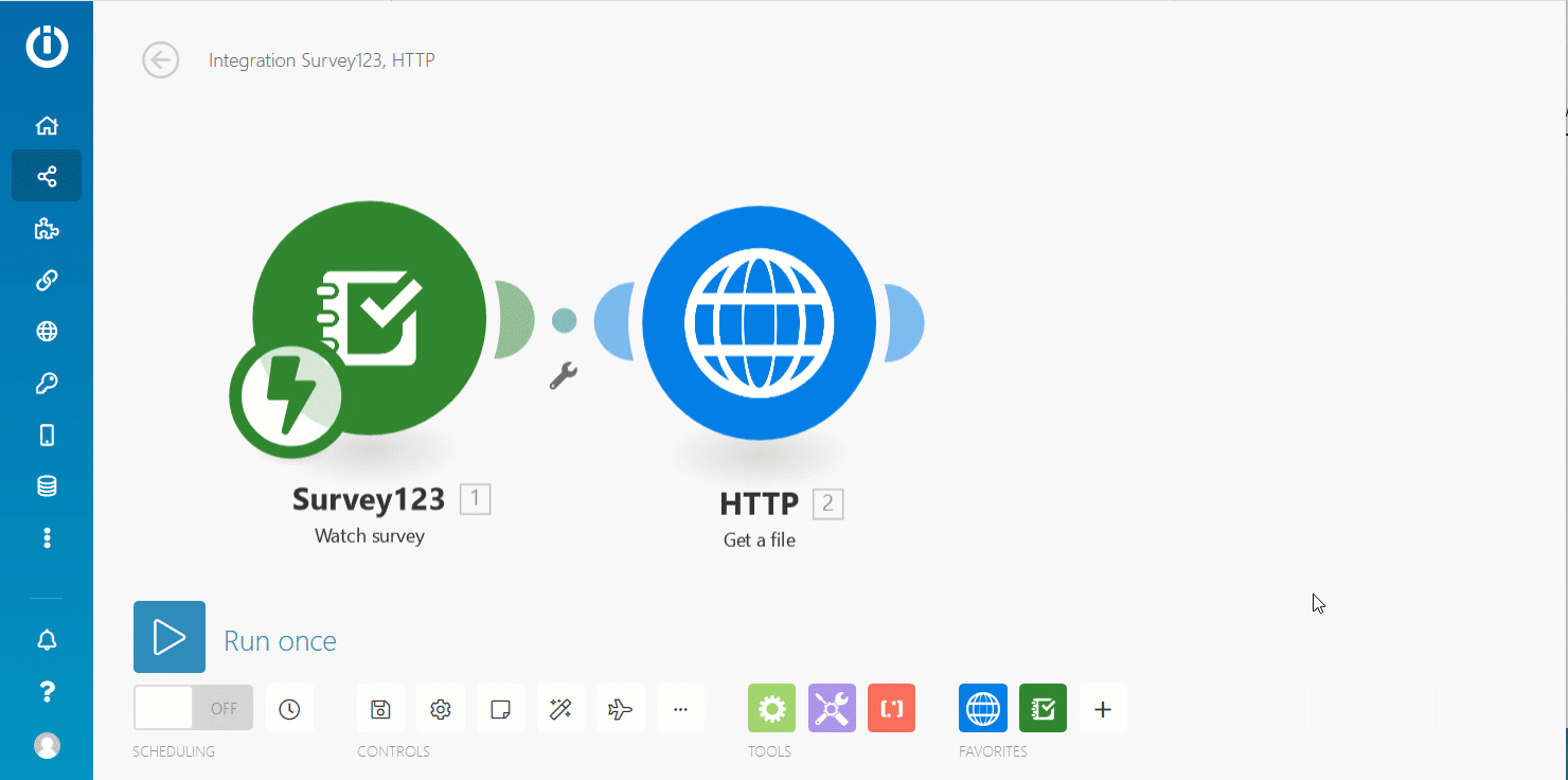
I will start with this one because the topic of working with photo attachments from Survey123 in Make has come up many times before, and it is not entirely obvious how to deal with them.  Say your Survey123 smart form includes a photo and a signature question. Can you work with them in Make? Can you include the photo and signature images as attachments in an e-mail? Can you back-up the images in OneDrive or Box? Yes to all of that and here is how.


The trick is using the Make HTTP module, which includes an action called 'Get a file'.  This action takes the URL of an image as an input, which you can get from the payload of a Survey123 record.


  1. Feed the Survey123 'watch survey' module with a smart form that includes one or more photo/signature questions.
  2. Use the Get a file action in the HTTP module to download your attachment.


The payload of 'Watch a survey' includes a collection of attachmentInfo objects. They are uniquely identified with the name of the question generating the attachment and include a url property that can you use to invoke 'Get a file'.


Once you have the file, you can do a handful of things with it. Of course, you can now include it as an attachment to an email.... That is a classic one! 


But you can do more interesting things too. For example:


  • Back-up your photos and attachments in Google Drive, Microsoft OneDrive, DropBox.
  • Upload images to Flickr, Instagram, Twitter or other social media.
  • Reduce the size of an image before storing it.
  • Extract metadata from the photo, including its name, size or format.
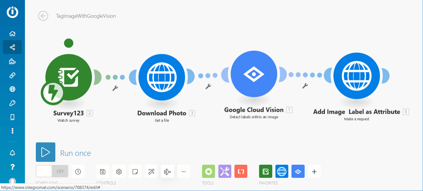
  • Process the photo with Google Cloud Vision to identify elements within the photo or simply extract text from it.


Automating Survey123 custom reports


The Survey123 module includes an action to help you automate Survey123 feature reports. Not familiar with reports in Survey123? We have a video for that here and an introductory blog post too. The Create Feature Report action is pretty much self-explanatory: it takes an input survey, a report template and the objectId of the survey record you want to include in the report.  If the trigger of your scenario is a 'Watch a survey' trigger, then you can use again the payload of your Survey123 web hook to extract the objectId. In this case, it is within the Feature-Result object as shown in the next animation.


The use of the HTTP module to download files as described above also applies to the outputs of the Survey123 report action. That is, after you create a custom report file, you can download it and include it as an attachment in an email, or upload it to cloud storage or FTP site.   Since many cloud storage solutions include options to automatically synchronize the contents of local and cloud folders, I like to upload the Survey123 report files I create to the cloud so they show up in my computer right away. I know, I am old fashioned, but that feels like magic.


When configuring the Create Feature Report action you will notice that at the bottom of the dialog you can expand a window with advanced settings. In there, you will be able to configure the UTC-Offset. This setting will be your friend if you plan to include dates and times in your reports.  Keep in mind that all data within Survey123 -and ArcGIS- is stored in UTC time. Since Make has no real context as from where in the world the report is being invoked, you will need to adjust the UTC offset yourself.

Back to the HTTP module


Earlier, we looked at the 'Get File' action in the HTTP module. This time we will revisit the HTTP module but this time to describe its 'Make a request' action. I personally find this action extremely useful, because it allows your scenarios to interact with pretty much any external web service you want. Using the 'Make a request' action you can for example invoke the ArcGIS REST API to update an attribute in an existing feature, or to simply query a feature service. Lets get down to very specific scenarios:


  • Make a point- in-polygon query to an ArcGIS feature service to get the postal code of the submitted Survey123 record location. Then make another request to add the postal code value as an attribute of the submitted feature.
  • Use information from a submitted Survey123 record to automatically create a new assignment in a Workforce for ArcGIS project (make a request to add a new feature into the Workforce assignments feature layer).
  • After having invoked Google Cloud Vision to categorize the contents of a photo submitted via Survey123, update the attributes of the Survey123 feature accordingly.
  • Update an image_url attribute in the submitted survey so you can later create a popup in ArcGIS that shows your image directly when the popup is open.


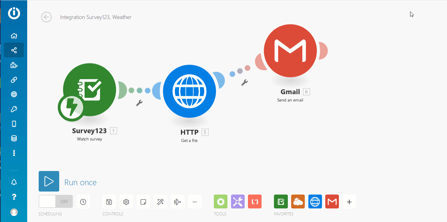
The mechanics for using the 'Make a request' action imply good knowledge of the target web service your are invoking. I will use next a simple scenario to illustrate the essence of this technique. Say for example we want first to get the location of a submitted survey record, get the current temperature at that location using a weather service and store that temperature value as a GIS attribute of the feature that was originally submitted.


Here is how you get the current temperature. OK: so far we are not using 'Make a request' anywhere. We are just setting this up.


Next, we are going to 'Make a request' to the survey feature layer using the ArcGIS REST API to add the temperature to the temperature field of the submitted record. Specifically, we are going to make a request to the Update Features REST API operation. This operation, as described in the Updates Features ArcGIS REST API Developer documentation, is located at:

https://<featurelayer-url>/updateFeatures

All information needed to construct the URL above is included in the survey web hook payload. It is a matter of combining the surveyInfo.serviceUrl and the feature.layerInfo.id properties, followed by updateFeatures.


HTTP_1.gif


Again according to the doc, this operation only supports POST requests and the encoded parameters include:


  • f to define the output format as json or html. This is optional but handy so we can debug, if needed, the output within Make.
  • token to specify a valid token we can use to securely access the feature layer. This parameter is not needed if the feature layer is shared publicly.
  • features to define the actual updates we want to make in the layer. The content of this parameter is a json object with information about the records and fields we want to change.

Lets do f and token first:

jtoken.gif


The most error prone step is adding the exact JSON value for the features parameter. I like to copy the sample JSON that comes in the developer documentation, and then modify it for my own purposes.  It is very important to note that the sample JSON in the documentation must be enclosed with extra brackets as shown in the example below.

IsmaelChivite_0-1667260895343.png

Note that the objectId in green, and the temperature in orange are dynamically populated using outputs from other modules in the scenario. Also note the square [] and curly brackets {} I added

[
  {
    "attributes": {
    "OBJECTID": 14,
    "temperature_c": If a number do not use quotes,
    "city": "If text, use quotes"
    }
  }
]


You will see yourself going through some trial and error until you get it right, but since you can easily look at the output of the 'Make a request' operation, it typically does not take very long before you figure things out.


Using the 'Make a request' action you can do a lot of things. Updating attributes is one of them, but you can really do many others.


A nice complement to the 'Make a request' action in the HTTP app are the many out of the box tools included in Make to parse XML, JSON, HTML and the many functions to handle text, dates, arrays and much more. They will help tremendously when you need parse responses from the web services you are invoking.


Handling Errors


This is all getting very interesting, but as you create more sophisticated scenarios you will face situations where you need to handle run-time errors.  If you are dealing with attachments, what happens if the end-user does not submit one? Or what happens if you hit an external web service and you get a bad output, or a time-out?


By default, when an unexpected error occurs, the execution of the Make scenario is stopped at that point but you can handle errors in other ways. You can for example ignore the error and continue executing, or you can choose to branch off the execution to do different things. This is all described in the Introduction to error handling tutorial in the Integromat Help Center.


The following animation shows how you can add an error handler in case the 'Get file' action fails downloading a non-existing ArcGIS attachment. In this case I chose to simply invoke the Gmail connector to send an e-mail without attachments. If an ArcGIS attachment is found, it gets added to an e-mail, otherwise the email is sent without attachment.


To learn more about error handling in Make, I recommend reading the Advanced error handling help topic.


Connecting Make to an ArcGIS Enterprise instance


By default, the Survey123 modules in Make will connect to ArcGIS Online, but you can actually make Make work against your own instance of ArcGIS Enterprise.


Before we start, it is important to highlight that Make needs to communicate with your own ArcGIS Enterprise instance, and this will not be possible if ArcGIS Enterprise is running completely behind your firewall.  You need to make your ArcGIS Enterprise instance is available to Make over the internet. ArcGIS Enterprise administrators are familiar with this concept, which is often resolved by exposing ArcGIS Enterprise through a reverse proxy in the DMZ, although there are other options.


A second step, involves explicitly registering Make as an app in your ArcGIS Enterprise instance. This step is necessary for Make to be able to securely authenticate against your ArcGIS Enterprise. Follow these steps:


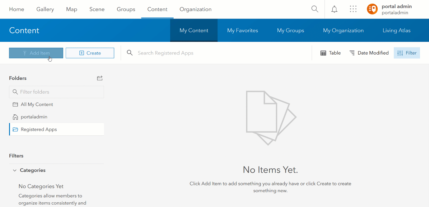
  • Log into your portal and go to Content.
  • Add a new Item of type Application.
    • Type: Application
    • Title: Make (or any other name you like)
    • Tags: Survey123 (Same here, any tag you want)
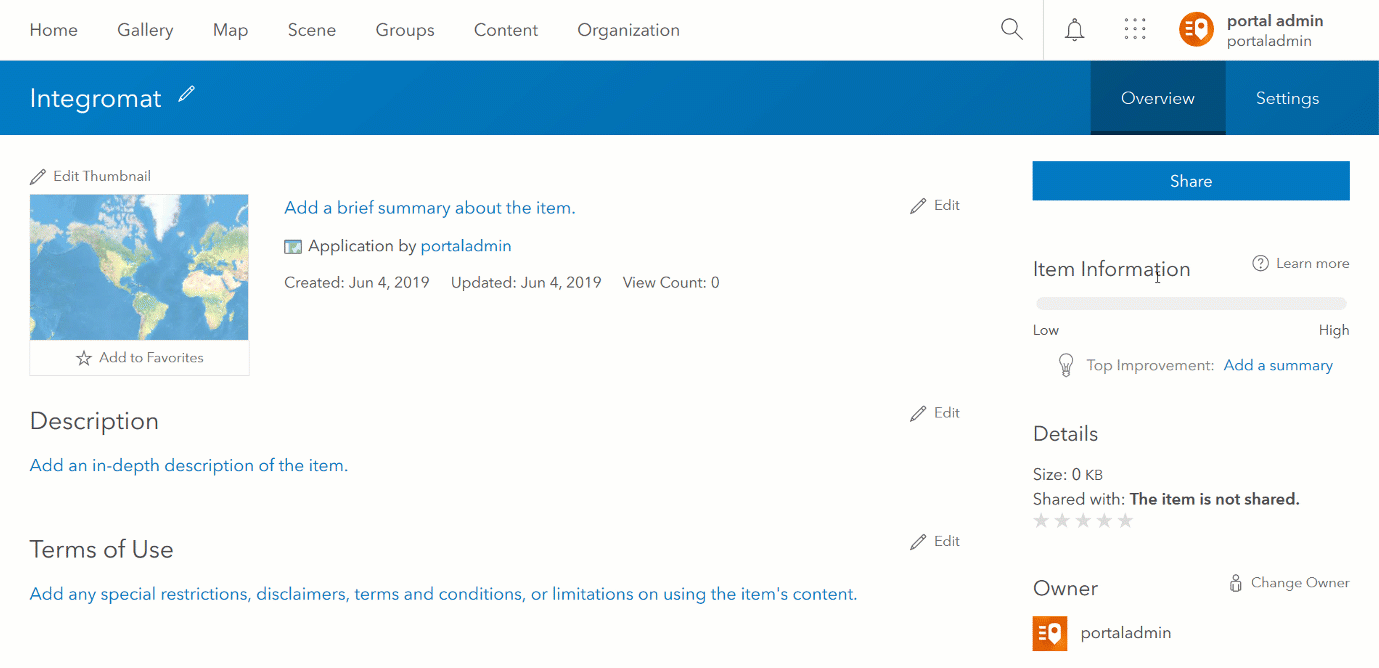


All the above is necessary for Make to be trusted before you can initiate a secure connection to your Enterprise instance.


Now, it is time to create a new Connection within Make to your ArcGIS Enterprise instance.  While adding a new web hook in the Watch a survey or Create a report modules, choose to create a New Connection:


  1. In the Create a New Connection dialog, expand the advanced settings.
  2. Add the https URL of your ArcGIS Enterprise instance, including the web adaptor name.
  3. Populate the AppID and AppSecret properties using the App Registration information from the Application item you created before in your portal.
  4. Click on continue to authenticate against your ArcGIS Enterprise instance.


You will be able to re-use this connection again and again when creating new web hooks.


Add and Edit Trigger Events


Initially, we added support for Add trigger events, meaning that the Survey123 web and field apps would be able to trigger a web hook when a new record was submitted from a smart form.  We are progressively adding support for edit trigger events as well, so you can launch your Make scenarios when a record is updated too.


Support for edit trigger events was added in the Survey123 web app in our https://community.esri.com/groups/survey123/blog/2019/05/24/comet-halley-update-may-23-2019. The Survey123 field app will catch up starting with version 3.5 (scheduled  to be released on June 27, 2019).


If you do not now how to update records using the Survey123 web app, check the https://community.esri.com/groups/survey123/blog/2019/05/24/survey123-tricks-of-the-trade-editing-re... blog post.


While you can configure your Make scenarios to be triggered by Add and Edit events, please be aware that the Survey123 field app will not honor this setting until version 3.5. As of 3.4, only the Survey123 web app supports web hook edit triggers.


Below, you can see how you can configure Make to define which triggers you want to activate in your web hook.


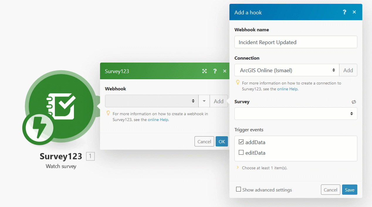
If you happen to activate both of them, you can use the output of the Watch survey module output to tell which event triggered your scenario. This is handy in case you want to build a single scenario and add branching logic to handle adds and edits differently.


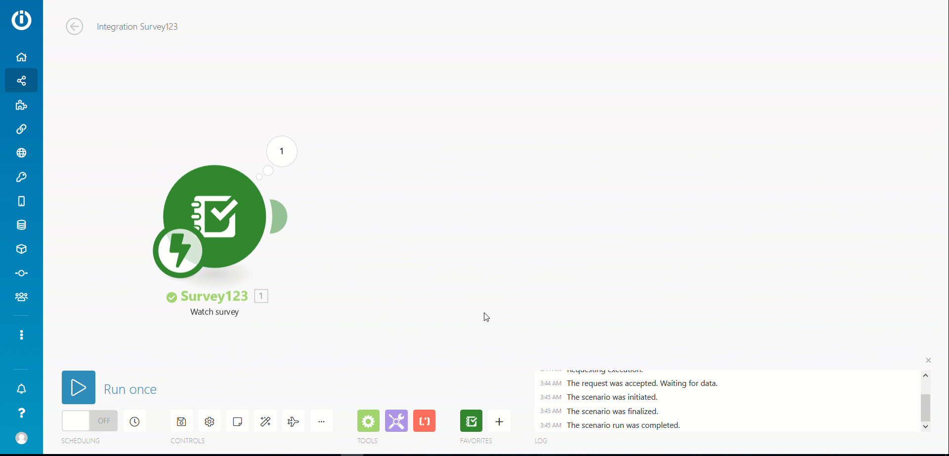
The trick here is that the eventType property is only included in the payload once there is an actual submission of data. You will actually not see the eventType property pre-populated in the output, until you send data.  When working with eventType, I typically put the scenario in listening mode (Run once) and submit data to populate the property. This helps me build the rest of the scenario more easily. Once the scenario is running for good, this property will change accordingly.


Blueprints


Did you know you can export your scenarios as a JSON file and import them later? You can, but only if using a paid subscription to Make.


I included a blueprint of the weather sample as an attachment to this blog so you can play with it. All you need to make it work is a survey with a geopoint question and an additional field where you can store the temperature. Make sure you adjust the name of your temperature field in the features parameter of the 'Make a request' module. By now I am guessing you do not need that I create another gif. I am completely "giffed-out" for today.


As I said at the very beginning, there is so much to write about Survey123 and Make, so this is just a starting point. If you feel there is a particular topic of your interest that should be covered in more detail, do not hesitate asking.

I hope this blog post will give you some ideas to have more fun with Survey123 and Make. I also wish some of you will share some of your creations. Share a screenshot of your scenario and a brief description of what you accomplished with it, or even better the blueprint.  Add them as comments below to inspire others!

123 Comments
HerveyLee
New Contributor III

I am trying to create a new scenario and follow the blog steps in creating a new web hook and new connection.  I am trying to connect to our ArcGIS Enterprise / Portal.  I created the App inside our Portal and put in the App ID and App Secret.  But I keep getting this error.  

I do not have Portal Admin privileges and I am a publisher in our ArcGIS Enterprise.  

Do we need our Portal Admin to create this connection for us?  

JamesTedrick
Esri Esteemed Contributor

Hi Harvey,

Can you confirm that your ArcGIS Enterprise site can be reached from the public internet (say, form your residence without requiring VPN access)?

HerveyLee
New Contributor III

I cannot confirm because I don't have that capability.  Do I need to talk to my IT department?  

JamesTedrick
Esri Esteemed Contributor

Hi Hervey,

If you cannot reach the ArcGIS Enterprise from the public internet (you should confirm with your IT department, but it sounds like this is the case), then you cannot configure the Integromat connector with your ArcGIS Enterprise site.

MickFulton
New Contributor

Hi Carl,

Did you have any luck getting this to work? Cheers Mick

MattCreaney
Occasional Contributor

An answer would be good on this admin!  The documentation is almost non existant.  How should this be structured?  James Tedrick

hgaignard
Esri Contributor

Does Survey123 manage a queue for sending the Payload if the Payload URL is not accessible?

JamesTedrick
Esri Esteemed Contributor

Carl Alexander‌ - did you test your request in a tool like Postman prior to configuring?  As Add Attachment—ArcGIS REST API: Services Directory | ArcGIS for Developers  indicates, the addAttachment operation is done on a feature service feature (i.e., /FeatureServer/<LAYER>/<OBJECTID> ); unfortunately, you don't have the URL construction visible in your screenshots so I can't tell if that is set up properly.  The attachment parameter also looks incorrect; you seem to have replicated the response expected from the operation; attachment should specify the file being attached (should not be string but file/binary).

MattCreaney
Occasional Contributor

I managed to get this to work yesterday about 2 minutes after posting.  This is what my HTTP module looks like, along with the correct URL as James Tedrick‌ mentions.

MackenzieCollins
New Contributor II

Hi!

I am wondering if there are any updates related to sending repeat data through a webhook? Is there a time we could expect this functionality? It would be super helpful in the surveys I am working on.

Thanks,

Mackenzie

JamesTedrick
Esri Esteemed Contributor

Hi Mackenzie,

We have this on our roadmap, though it's a bit early to confirm a release timeline for this.  I would encourage you to join the Survey123 Beta community - it will first be supportable as a beta feature and announced there.

NathanKerr1
New Contributor III

Ismael Chivite and James Tedrick,  Within Integromat I am trying to generate a feature report when a survey is submitted and then have it emailed out.  I am using ArcGIS Enterprise and initially had issues connecting to it from Integromat, but I had IT whitelist the integromat.com domain and connected successfully.  However, even though the connection works the Watch Survey module isn't processing a survey when it is submitted.  With the module schedule set to Immediately the icon just spins and then eventually I get an error in the log as shown below.  Any thoughts?  Are there additional domains or IPs that IT needs to whitelist?  Any help is appreciated.  

JamesTedrick
Esri Esteemed Contributor

Hi Nathan, 

Just to confirm, is the error in the 'Watch Surveys' trigger or 'Create Feature Report' action? If the latter, it may be that the feature report generating components.

NathanKerr1
New Contributor III

It is in the Watch Survey trigger

CarbonCounty_Utah
New Contributor III

Trisha Schlake

Hi Trisha,

We're you ever able to figure out what was causing the login timeout? I'm getting the same thing when trying to link Integromat to our Enterprise Portal. Any information would be greatly appreciated.

Thanks!

TrishaSchlake
New Contributor III

Carbon County Utah‌,

Yes, the issue is that the servers from Integromat are located from the Czech Republic. It was discovered that it would time out because our firewall rules were blocking the traffic. Unfortunately my organization will not allow us to permit the traffic from Integromat because of where the servers are located. So I could not proceed with this webhook solution.

I would check with your organization and make sure that the traffic from Integromat isn't getting blocked as well.  

CarbonCounty_Utah
New Contributor III

Thanks for the response, after I started looking around I suspected the same thing so I will have to talk to our IT people about allowing traffic from Integromat.

NathanKerr1
New Contributor III

James Tedrick

Was checking my Server logs and noticed when I am running the Watch Survey module this error gets kicked back

"u'Error performing queryAttachments operation operation not implemented yet. "layers/0: queryAttachments"' 

I then used developer tools in my browser and the timeout is definitely occurring when Integromat is trying to query my Hosted Feature Service with the queryAttachments command.  Have you run in to anything like that?  

AmyFerdinand1
New Contributor

Hello,

I am working with survey123 and integromat to automate surveys for my field utility operators. Right now since we don't have an ArcGIS account with a lot of credits I am trying to develop a work around for the survey123 feature reports. I am trying to create Word Document reports instead. I noticed that when I try to grab values from a survey123 "select_one" option it gives me the value from the "name" column in the choices tab instead of the actual "label" value. Is there a way to display this? I'm fairly new to html tags and references but if there is a way to grab what I am looking for I greatly appreciate it.

Thanks

MichaelWalsh
New Contributor

Hi James,

I am trying to output Survey123 data to google sheets I'm struggling to get this to work with an edit webhook.  The edited fields from Survey123 transfer fine but all the other fields are blank.  Any suggestions?  I note you suggest querying the data directly but i'm a little lost as to how to do that.  Any helpful advice would be greatly appreciated.

FedericoRiet_Sapriza
New Contributor III

Hi Michael,

I'm in the same path as you I'm trying to output Survey123 data to google sheets, I don't even manage to get any data into a google sheet. I there any info out there to be able to set this up correctly?

Thanks in advance,

Cheers,

Federico

integromat‌

Ismael Chivite

connect excel sheet‌

survey123

PaulSweeney3
Occasional Contributor III

Hi All 

Has anyone had any issues with the drop down list for selecting you survey form in integromat , when adding a new webhook . I may be wrong but mine appears to be only returning the first 100 surveys in my organisation, sorted alphabetically, so anything not within my top 100 surveys when sorted from A-Z are not showing up in the list. We are getting around it by adding custom webhooks but this is not idea as its not as straightforward. 

PatriciaAlgura
New Contributor III

Hi,

I'm trying to implement this. In my survey form, I have the image field set to multiline appearance but when the user attach two or more photos, the HTTP Get a file function can only get one image (the first image attached). Am I missing something here? How can I get all the images attached from the survey?

Hmm, maybe because from the Attachments, I've only added one. Should I add more but still referencing from the same source file? 

Thanks,

Pat

MattCreaney
Occasional Contributor

Hi Pat

I haven’t used this new feature yet but I’d imagine the image that there are multiples of would be an array that you would need to iterate first and then http get with the iterated URL

Get Outlook for iOS<https://aka.ms/o0ukef>

QPWS_SpatialServices
New Contributor II

Hi Paul, I am seeing this now even though I am an admin, I only see Surveys I have created, even though I am a member of the group where the survey is shared to. I am sure I could connect with these credentials before. Not sure what has changed if anything,

PaulSweeney3
Occasional Contributor III

Hi Spatial Services I  think the connection only allows you to see your own content , i could be wrong. but in relation to the list Are you saying you can only see the first 100 or so surveys in you account sorted alphabetically? i raised a ticket with integromat support but i have yet to hear back  

inolaroch
New Contributor III

Hey !! I'm trying to send an email via my outlook when a survey is submitted. I have the following error message... Any solution ? 

Thank you !!

FrankMartin1
New Contributor III

This works great for one attachment, however with two or more attachments you have to use the Integromat array iterator module to retrieve each attachment.  When these are pasted to the HTTP module to get the file they become three operations that gets pasted to the integromat array argregator which ends up with three emails verses one email with three attachments.    The integromat array argregator module doesn't combine operations into a single array.   How do you combine the files back into a single array to be used as an email attachment?

Thanks,

Frank

FrankMartin1
New Contributor III

Hey,

Have you checked with your Microsoft 365 Email admin to make sure that the connection to it is valid?

MattCreaney
Occasional Contributor

HI Frank Martin

The source for your array aggregator should be the iterator, this will mean you have one array output.

inolaroch
New Contributor III

Hey Frank,

We use Outlook Excange, after research i found that Integromat does not support Outook...

FrankMartin1
New Contributor III

Hey Matt,

Thanks for the response. The problem is that because the attachment files are stored in AGOL, the individual attachment files have to be retrieved using the HTTP get file module one at a time from the iterator. That’s why there are three operations. The Aggregator doesn’t seem to be able to combine the results of the input operations into a single array.

Thanks,

Frank

PaulSweeney3
Occasional Contributor III

Hi All 

Is Anyone else experiencing intermittent issues with HTTP module in integromat. i am receiving the following response across multiple scenarios targeting various layers 


{"error":{"code":504,"message":"Your request has timed out.","details":[]}}

fileSize  75

The response is intermittent , happening about 50% of the time i haven't changed or updated anything. it started yesterday even around 3pm (GM+1) .  not sure if its relevant but The output always contains the same error see below. We set u duplicate scenarios to test and the strange thing is one failed and the other ran perfectly with the same webhook and parameters 

Ismael Chivite or James Tedrick  would u be aware of any issues that may be causing this ? 

JamesTedrick
Esri Esteemed Contributor

Hi Paul,

What is the HTTP module retrieving?

PaulSweeney3
Occasional Contributor III

Hi James Tedrick

So it is querying a feature layer in some instances to return one maybe 2 features max . I also have it set up to add features and update these features following the query  , sometime the query works and it moves to the add or update module and sometimes these fail as well.  

just to be sure i have checked and this is happening across multiple layers and scenarios with no apparent pattern. i have attached a snip of the history from one scenario below. The scenarios that fail are showing 5 executions as i have an email attached to the end if the 504 error is returned, the ones showing 4 are working. The forms are generally   not very complex in this instance there is  an option for audit type to decide which group of  questions to complete and some optional attachments , which are not processed in the scenarios. 

JamesTedrick
Esri Esteemed Contributor

Hi Paul,

So it sounds like the 504 Gateway issue is with the feature service?  If that is ArcGIS Online, you may want to open a support ticket to determine if there is an issue; if ArcGIS Enterprise, you would need to check with the administrator of the Enterprise system.

PaulSweeney3
Occasional Contributor III

Hi James Tedrick

Thanks i had rasied a ticket but it suddenly started working again over the week end all scenarios returning expected results with out any changes made on my side 

I can only guess it was some service issue. i ll work with support and explain the situation. Thanks for your response. 

PaulSweeney3
Occasional Contributor III

hi James Tedrick

I am wondering if you can help with this one , I have a survey in a projection  4326. the survey has 2 repeats in it, one point and one polyline, both restricted to a count of 1 . I am trying to append each repeat to another feature layer which is polyline layer. The problem i had was the layer i am appending to is in a different projection 102100. For the point repeats i managed to figure out how to project it  the 102100 and represent the point as a short polyline and append with attachments .  However i am running in to difficulty as i cannot figure out how to extract the geometry from the repeat polyline entry and feed it in to the project  module. it does not make sense to me how it's represented. in the survey 123 module i can see the paths as i would expect but in the mapping for integromat it is shown as some kind of array , see images below. Can you possibly explain how i use this to represent the geometry in my projection request. Hopefully this make some sense. Thanks in advance 

JamesTedrick
Esri Esteemed Contributor

Hi Paul,

You should be able to get paths[], which you could then feed into to 2 for each  to then do the point calc.

PaulSweeney3
Occasional Contributor III

Hi James Tedrick

This is what i would have expected but this is all i see, paths is not listed anywhere in the geometry section .

What i have done is entered a query to return the feature that was submitted in survey123  and parsed to return the geometry with the paths array included. however when i try to construct the geometry i am getting  blank values

PaulSweeney3
Occasional Contributor III

Hi James Tedrick

i see what you mean it took a bit of trial and error  the path is shown as 1 []   you need to specify the number of the item in he array and then then x y and z are represented by numbers themselves in each item of the array. So the first and second  x y coordinates in the path array is  is entered as follows 

  • 1,1
  • 1,2
  • 2,1
  • 2,2

my issue now is how to extract the first and last point from the path array so i can project a simplified version of the original path(polyline) . i can use the first and the second one for the time being but if you know how to get the final item in an array with different counts then that would be great.  

JamesTedrick
Esri Esteemed Contributor

Hi Paul,

Refer to the General Functions – Integromat Support  and Array Functions – Integromat Support  - between them you can get the length of an array and then get the element at the position of length (apparently the array index starts at 1) to get the last item.

by Anonymous User
Not applicable

Hi @IsmaelChivite,


I have used the Survey123 to Get File scenario to grab images from the survey and dump them into a Google Drive folder. I have had great success in the past with older survey123 designs. I am now experiencing an issues with new survey designs working through this scenario. Let me give you my two examples

Old survey- Has twelve induvial photo questions for the user to possibly use. This was done before the repeat function supported multiple photos and before the newer "multiline" photo function that allows for multiple photos without repeats. In my scenario the above mention "get File" url scenario works to pull all the photos and dump them in Google Drive.


My new Surveys - The new surveys utilized the repeat function for photos and now has been converter to the "multiline" photo. I created a identical Integromat Scenario that I hoped to setup to push the photos just as before. No matter how many configurations I have tired I cannot get the scenario to work correctly. When I setup the scenario with identical settings I get an error message at the Google Drive Module that says  "Missing value of required parameter 'File Name'." I have tried coding in a ignore code for the file name, at best I get a .jpg file dumped into google drive but when opened it is all HTML coding. 


When I compare the two scenarios and the inputs/outputs of the modules the only thing I can see different is that the new Survey data using the multiline or repeats photos functions do not send a "file name" I am really stumped at this point so if you have nay suggestions I would great appreciate it. 


Thanks

daveostrander
Occasional Contributor II

@JamesTedrick  stated, "You can query the feature (using the 'Make an HTTP request' action) that was edited to retrieve the full feature information."

Previously the expected behavior when editing a submitted survey record was that only the updated fields would be included within the payload when a survey is submitted. However, it appears that this process has since been improved. All survey fields are now included in the payload, whether actively edited or not, and assuming the webhook setting to submit the survey data has been checked. The update was a good enhancement as it reduces the need to set up superfluous actions within a scenario or flow. I just wanted to point this out to the community since if the expectation is that it doesn't get passed in, that payload information could be overlooked.

PanGIS
by
Occasional Contributor III

Hi @IsmaelChivite , @JamesTedrick  Thank you for your help first of all, you are amazing!

I need to understand where I am wrong, I am testing this: copy a field into another field.

Originally was the objectID (which is still my primary concern) then I started to test with any other field (String) and although everything looks fine my field is still empty:

Thanks!

PanGIS_2-1621439804912.png


GIS_Fox
Occasional Contributor III

Hi All,

I am having date issues in my scenario that pulls from a Survey123 form and creates a scheduled date to an Outlook Calendar. Is there a place where I can read into using dates from survey123 or another date related topic for errors in the esri unix timestamp number?

This is the code suggested previously by integromat that no longer works. Bold is the Survey123 field for date and time on the form.

{{formatDate(parseDate(parseNumber(1.feature.attributes.scheduled_annual_inspection_dat; "."); "x"); "MM/DD/YY")}}


Much appreciated,


LaurenceStephan
New Contributor

@FrankMartin1 did you manage to find a solution for combining operations, so they can be sent as attachments within one email?

CristianChavarini
New Contributor III

@JamesTedrick 

Have you been able to solve this problem of working with repetitions in Integromat?

I need to set up a workflow where it reads a Survey123 containing repeats and impacts a Google Sheets.

In the case that you have not been able to advance in this solution, is there any alternative method with a platform other than Integromat?


Thanks


FabioAndresZambrano
New Contributor

Hi, I have worked with integromat and survey123 for ArcGIS enterprise properly, but since some weeks ago I have been getting this message: "ENOTFOUND: Service is temporarily unavailable." when I'm trying to connect to my portal and now with make it's happening the same issue. any advice to solve this? Thanks for any help.

FabioAndresZambrano_0-1647009475019.png


KaraO_Neill1
New Contributor III

Does anyone have experience renaming the attachments that are a result of the HTTP Get File? The entire process is working fine. I am using a Gmail account to send the email to the users when the report is generated. The name of the pdf is something like this, "UTF-8''%Kristin%Ct @%-Milling.pdf " and I know that the % signs are preventing the emails from going through internal spam blockers. Any help would be greatly appreciated! 


TY.