- Home
- :
- All Communities
- :
- Products
- :
- ArcGIS StreetMap Premium
- :
- ArcGIS StreetMap Premium Questions
- :
- Crime Analysis Geoprocessing Package
- Subscribe to RSS Feed
- Mark Topic as New
- Mark Topic as Read
- Float this Topic for Current User
- Bookmark
- Subscribe
- Mute
- Printer Friendly Page
Crime Analysis Geoprocessing Package
- Mark as New
- Bookmark
- Subscribe
- Mute
- Subscribe to RSS Feed
- Permalink
- Report Inappropriate Content
Where can i find that geoprocessing package used in this video?
http://video.esri.com/watch/192/the-use-of-shared-trade-craft-to-perform-crime-analysis
I had been searched the geoprocessing package (created by that author, like in that video) in all ArcGIS related website but nothing appeared..
The model builder would be useful guide for me for my mini crime analysis projects..
Any helps would be appreciated..
Thank you 😄
- Mark as New
- Bookmark
- Subscribe
- Mute
- Subscribe to RSS Feed
- Permalink
- Report Inappropriate Content
I'm afraid that package was for demonstration purposes only. I will try to track it down for you, but I don't know if it still exists- I would be happy to help you with any specific question or issue you have- please contact me via email, and I can get you hooked up with some additional crime analysis resources!
CD
Chris Delaney
Technical Marketing Analyst �?? Law Enforcement/National Security
Certified Law Enforcement Analyst (CLEA)
W 909-793-2853, ext. 7160 | M 585-406-0349
cdelaney@esri.com | esri.com | arcgis.com
- Mark as New
- Bookmark
- Subscribe
- Mute
- Subscribe to RSS Feed
- Permalink
- Report Inappropriate Content
Hi Chris Delaney!
I would like to know, how to make this polygon ramp available (screenshoot below) so that i can choose my desired area to begin hotspot analysis?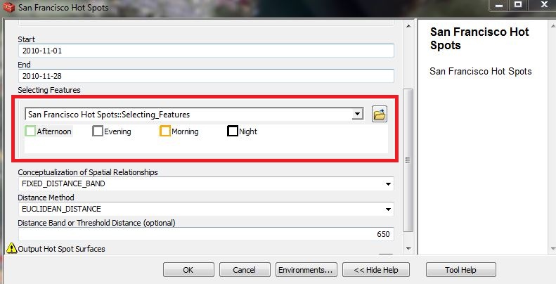
I try to make the selection features in my own model tool, but the polygon ramp did not appear just like above screenshoot, it only appear like this,
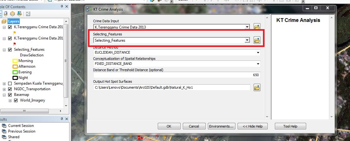
Do you have any idea? or i just missing some step? Tq.
- Mark as New
- Bookmark
- Subscribe
- Mute
- Subscribe to RSS Feed
- Permalink
- Report Inappropriate Content
Did you ever get an answer to this question, because I am intrigued as well. I want to utilize it for some of my model builder processes. Thanks!
- Mark as New
- Bookmark
- Subscribe
- Mute
- Subscribe to RSS Feed
- Permalink
- Report Inappropriate Content
This parameter is a feature set. In modelbuilder you'll either need to create a new variable (of type feature set) and connect it to the tool, or expose the parameter you want from the tool and then switch it to a feature set.
To get the desired behavior (4 options to chose from) like the above screen shot you'll first need to build a good feature template.
You can use an existing featureclass or build a new one. In the above example, a new featureclass was created and the feature template was setup with a field and 4 valid attributes representing the time. A different symbol was attached to each. With the feature template created, this featurelayer was provided as the schema to the feature set inside Modelbuilder.
When you open the model tool, you get the same experience as the feature template. This includes the default values , which is how this model really works. The default value for each of the time features you create gets will be used by the next tool in the model (select by attribute). In short, this particular example of using a feature set is doing double duty: it provides both a location for select by location, as well as an attribute for select by attribute. Its combining 2 steps into 1.
- Mark as New
- Bookmark
- Subscribe
- Mute
- Subscribe to RSS Feed
- Permalink
- Report Inappropriate Content
Thank you for the information . . . A new feather for the cap this morning . . . I will have to test that out later today!
- Mark as New
- Bookmark
- Subscribe
- Mute
- Subscribe to RSS Feed
- Permalink
- Report Inappropriate Content
Zack,
This should be the model you're looking for:
http://www.arcgis.com/home/item.html?id=2b6872972cec47d1ba763859a23a77e1