- Home
- :
- All Communities
- :
- Products
- :
- ArcGIS Spatial Analyst
- :
- ArcGIS Spatial Analyst Questions
- :
- Unable to assign Pour Points Shapefile
- Subscribe to RSS Feed
- Mark Topic as New
- Mark Topic as Read
- Float this Topic for Current User
- Bookmark
- Subscribe
- Mute
- Printer Friendly Page
Unable to assign Pour Points Shapefile
- Mark as New
- Bookmark
- Subscribe
- Mute
- Subscribe to RSS Feed
- Permalink
Hello everyone,
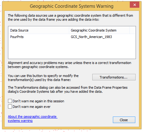
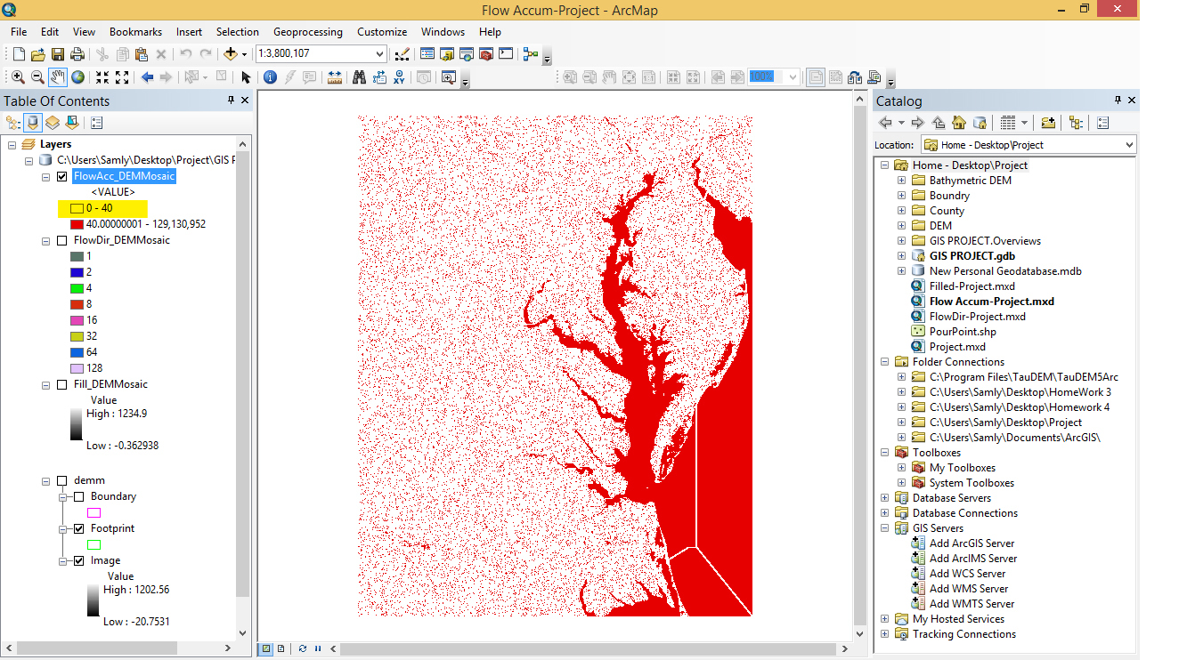
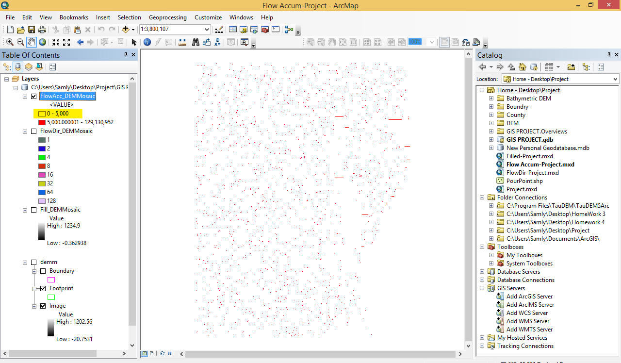
I need to delineate the Chesapeake Bay watershed. For this reason, I took 16 tiles of DEM production(Arcgrid) from USGS database and merge them through Mosaic Database. I ran spatial analyst toolbox (Fill, Flow Direction, Flow Accumulation respectively) with the same spatial references as that of dem datasets (GCS_North_American_1983). Now, when I want to define pour point Shapefile to finalize watershed delineation, It can not snap the cell with the high accumulation. I am sure that Geographic Coordination System is same for my all layers. But when I want to assign relevant cells into the Shapefile of pour-points, it show a warning in which alert for inconsistency between Shapefile and one of the layers (Attachment-1). Also the result of flow accumulation doesn't seem to be satisfactory (Please see Attachment-2,3).
Is there any help you can give me. I don't know where the problem comes from.
Thank you very much
@
- Mark as New
- Bookmark
- Subscribe
- Mute
- Subscribe to RSS Feed
- Permalink
Can you post a screenshot of your flow direction? Your flow accumulation does look weird.
- Mark as New
- Bookmark
- Subscribe
- Mute
- Subscribe to RSS Feed
- Permalink
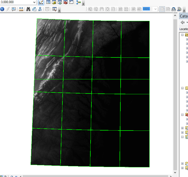
Yes, I think its weird either, here is a Flow-direction result: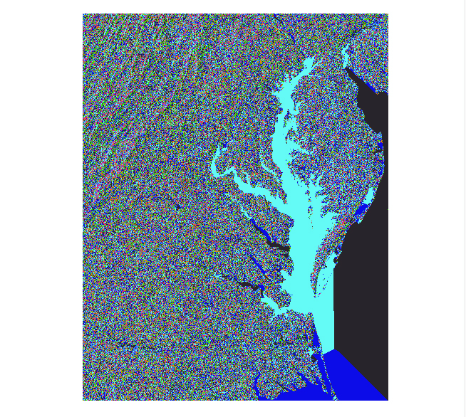
- Mark as New
- Bookmark
- Subscribe
- Mute
- Subscribe to RSS Feed
- Permalink
Yes, something is definitely wrong with it. Do you mind posting a screenshot of the DEM?
- Mark as New
- Bookmark
- Subscribe
- Mute
- Subscribe to RSS Feed
- Permalink
Not at all. Here is a original DEM datasets, taken from (USGS TNM 2.0 Viewer), with Geographic Coordination of GCS_North_American_1983 and Cell size of 1-Arc second:
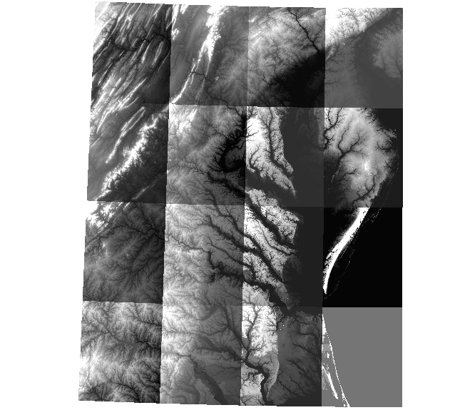
This is the Mosaic Dataset, as s result of the DEM tiles merging, with projection Coordination system of (WGS_1984_UTM_Zone_18N).
Thank you,
- Mark as New
- Bookmark
- Subscribe
- Mute
- Subscribe to RSS Feed
- Permalink
Hmmm, well, that looks reasonable, although it's hard to tell down in the flat areas. Something is not coming out right with that flow direction though. Maybe try running it again.
- Mark as New
- Bookmark
- Subscribe
- Mute
- Subscribe to RSS Feed
- Permalink
Thank you so much Mr.Fox. Don't you think the problem comes from a bay in my area of study (Chesapeake Bay watershed)? I have also a bathymetric DEM datasets of watershed. Do you have any idea if they will be helpful to rout the flow to the bay? I ran the flow_direction and Flow_Accumulation at least three times, each time at least 2.5 hours. Still not working.
- Mark as New
- Bookmark
- Subscribe
- Mute
- Subscribe to RSS Feed
- Permalink
Well, large flat expanses can do weird things, but it looks just as odd at higher elevations. Out of curiosity, when you open the raster properties of your projected DEM, what does it say for cell size?
- Mark as New
- Bookmark
- Subscribe
- Mute
- Subscribe to RSS Feed
- Permalink
The cell size is same as that of original DEMs: 30.92208078, 30.92208078.
- « Previous
-
- 1
- 2
- Next »
- « Previous
-
- 1
- 2
- Next »