- Home
- :
- All Communities
- :
- Products
- :
- ArcGIS Spatial Analyst
- :
- ArcGIS Spatial Analyst Questions
- :
- Re: Slope: Spatial Analyst vs Image Analysis
- Subscribe to RSS Feed
- Mark Topic as New
- Mark Topic as Read
- Float this Topic for Current User
- Bookmark
- Subscribe
- Mute
- Printer Friendly Page
Slope: Spatial Analyst vs Image Analysis
- Mark as New
- Bookmark
- Subscribe
- Mute
- Subscribe to RSS Feed
- Permalink
- Report Inappropriate Content
Hi
I have a DEM (1 m resolution, Z in meter) derived from lidar data.
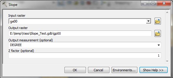
When I run Slope from ArcToolBox (Spatial Analyst, Surface) and i compare my result with the Slope function from Image Analysis tools, i don't get the same result slope image.
The second one is approximately 80% higher.
I've found the help for "How Slope works" in Spatial Analyst but nothing in Image Analysis.
http://help.arcgis.com/en/arcgisdesktop/10.0/help/index.html#/How_Slope_works/009z000000vz000000/
Does anyone know why I do not get the same results?
Alexandre
- Mark as New
- Bookmark
- Subscribe
- Mute
- Subscribe to RSS Feed
- Permalink
- Report Inappropriate Content
Perhaps this page in degrees, or scaled I suspect. To test use the method in the spatial analyst and choose the opposite of what you selected last time.
- Mark as New
- Bookmark
- Subscribe
- Mute
- Subscribe to RSS Feed
- Permalink
- Report Inappropriate Content
- Mark as New
- Bookmark
- Subscribe
- Mute
- Subscribe to RSS Feed
- Permalink
- Report Inappropriate Content
A quick test is to subtract the two rasters to see if there are real differences and if there are, then where they are. If the results are both in degrees. Slope can be determined in a variety of ways (ie maximum drop, 4 direction, 8 direction etc) and I don't think that they would use different methods without specifying the differences. So if there are real differences it is either due to a different representation of slope (ie degrees slope versus % slope ) of it is just a symbology issue. If the subtraction yields a grid of 0's, then it is a symbology issue solely
- Mark as New
- Bookmark
- Subscribe
- Mute
- Subscribe to RSS Feed
- Permalink
- Report Inappropriate Content
- Mark as New
- Bookmark
- Subscribe
- Mute
- Subscribe to RSS Feed
- Permalink
- Report Inappropriate Content
Ok, I just wanted to make sure it isn't a degrees slope issue versus a % slope issue ... ie 45° = 100% 22.5° = 50%... slope in degrees versus % slope
- Mark as New
- Bookmark
- Subscribe
- Mute
- Subscribe to RSS Feed
- Permalink
- Report Inappropriate Content
I understand your suspicious question...
All my process are with the "DEGREE" parameter.
Results are simply different.
Alex
- Mark as New
- Bookmark
- Subscribe
- Mute
- Subscribe to RSS Feed
- Permalink
- Report Inappropriate Content
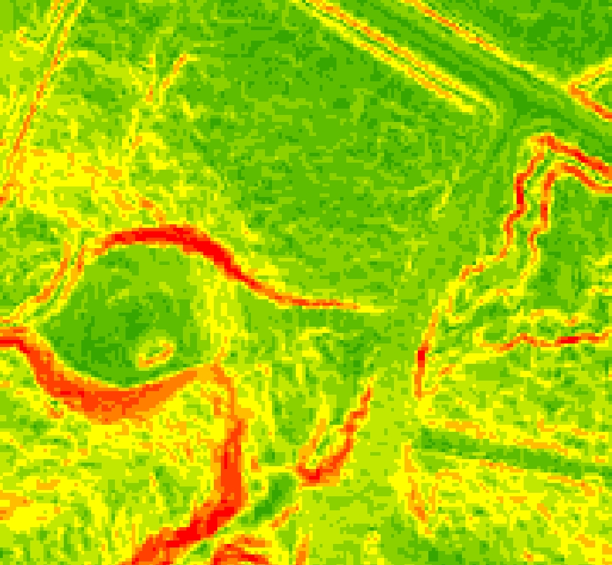
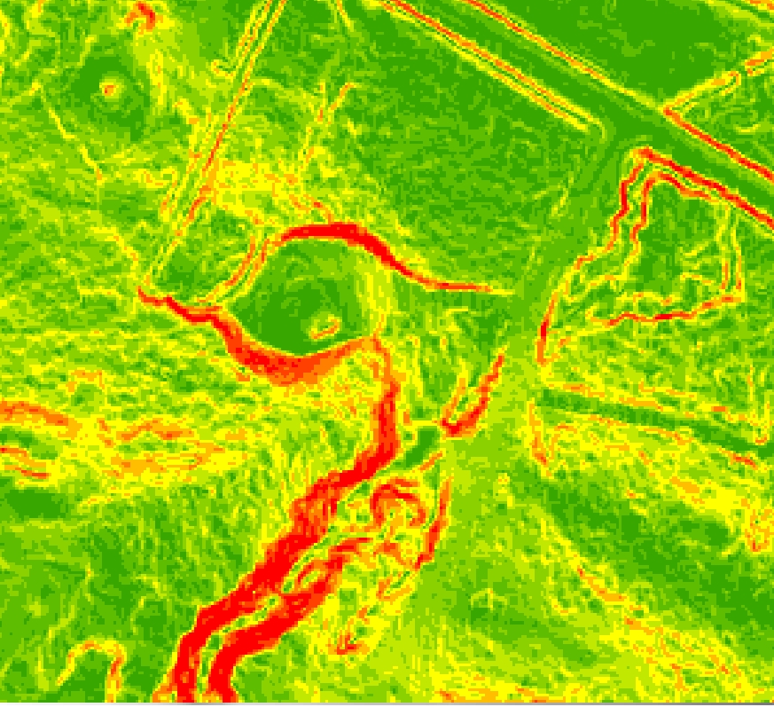
Step by step:
1. Slope with Spatial Analyst
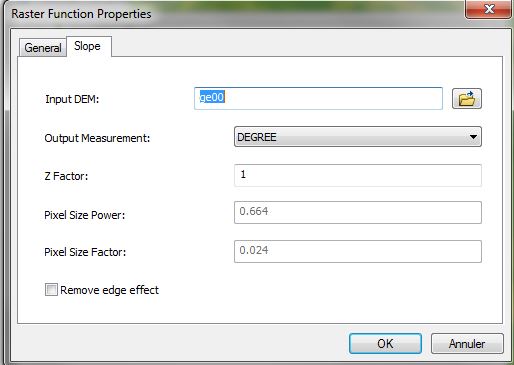
2. Slope with Image Analysis
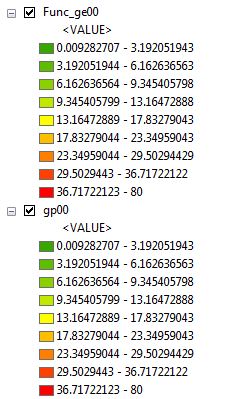
Result gp00: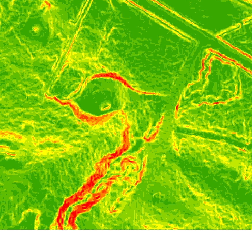
Result Func_ge00:
Same Symbology
Difference 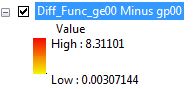
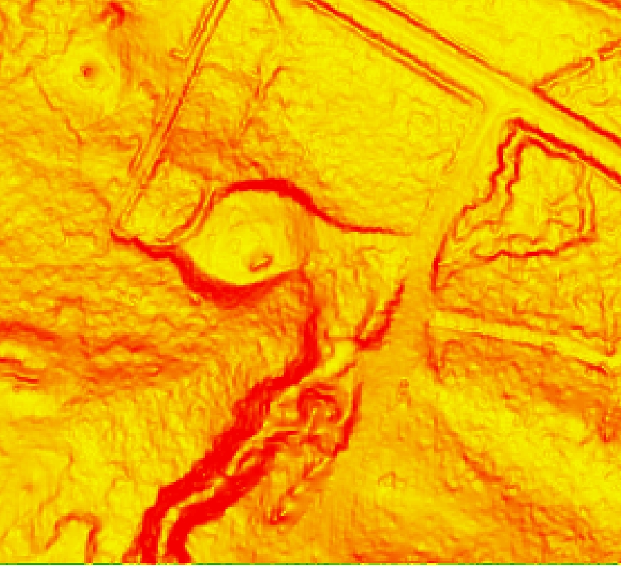
I really think the formulas are not the same!
Alex
- Mark as New
- Bookmark
- Subscribe
- Mute
- Subscribe to RSS Feed
- Permalink
- Report Inappropriate Content
In the image analysis window, what do those 2 extra variables do? Pixel Size power etc
- Mark as New
- Bookmark
- Subscribe
- Mute
- Subscribe to RSS Feed
- Permalink
- Report Inappropriate Content
The 2 parameters are not considered with the Slope option
They are valid only with the "SCALED" option.
I did change the value, and then came back to DEGREE option, there's no consequence.
Alex