- Home
- :
- All Communities
- :
- Products
- :
- ArcGIS Spatial Analyst
- :
- ArcGIS Spatial Analyst Questions
- :
- Determining the difficulty/grade of hiking tracks/...
- Subscribe to RSS Feed
- Mark Topic as New
- Mark Topic as Read
- Float this Topic for Current User
- Bookmark
- Subscribe
- Mute
- Printer Friendly Page
Determining the difficulty/grade of hiking tracks/trails
- Mark as New
- Bookmark
- Subscribe
- Mute
- Subscribe to RSS Feed
- Permalink
- Report Inappropriate Content
So I have mountain trails/tracks as polylines and I want to determine their difficulty/grade: easy, medium, difficult. In order to do that I have to work with slopes and elevation. I am using ASTER SRTM for that manner. I followed these instructions but the values I'm getting for the slopes are weird (see the picture).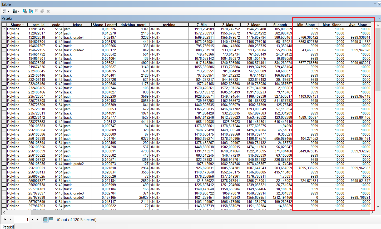
What am I doing wrong here? Is there any other way for me to find the difficulty of the tracks?
Thanks in advance.
Solved! Go to Solution.
Accepted Solutions
- Mark as New
- Bookmark
- Subscribe
- Mute
- Subscribe to RSS Feed
- Permalink
- Report Inappropriate Content
how are you calculating slope? And by the looks of your shape_length field, I suspect that you aren't using projected data but your coordinates are in decimal degrees and your elevations are in meters. Project your file to a suitable projection so that all your positional values are in planar units. Once you have fixed that, then make sure you decide whether to record slope as either a percentage or in degrees...
- Mark as New
- Bookmark
- Subscribe
- Mute
- Subscribe to RSS Feed
- Permalink
- Report Inappropriate Content
Thank you! You saved me 
Do you think this is the proper method for determining the difficulty of the trails?
- Mark as New
- Bookmark
- Subscribe
- Mute
- Subscribe to RSS Feed
- Permalink
- Report Inappropriate Content
definitely one way... you could also incorporate the concept of the length of a slope as well ... it will be more difficult to follow a 10 deg slope for 1 km than one that is only 10 meters.