- Home
- :
- All Communities
- :
- Products
- :
- ArcGIS Spatial Analyst
- :
- ArcGIS Spatial Analyst Questions
- :
- Re: DEM Artefacts
- Subscribe to RSS Feed
- Mark Topic as New
- Mark Topic as Read
- Float this Topic for Current User
- Bookmark
- Subscribe
- Mute
- Printer Friendly Page
DEM Artefacts
- Mark as New
- Bookmark
- Subscribe
- Mute
- Subscribe to RSS Feed
- Permalink
- Report Inappropriate Content
I have a collection of data points from which I am trying to generate a DEM and, ultimately, a hillshade for use as a backdrop in a map. Whichever way I try to process it (using Topo to Raster) I get artefacts where the points are located. See the attached example: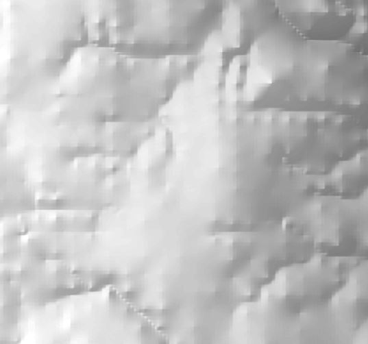
Any ideas what might be causing this?
- Mark as New
- Bookmark
- Subscribe
- Mute
- Subscribe to RSS Feed
- Permalink
- Report Inappropriate Content
Dan, It seems the article you referred is from tech support and I added comment for them to update this for 10.x.
For any continuous surface, bilinear or cubic re-sampling should be used instaed of default nearest neighbor to avoid artifacts (such as stair case).
- Mark as New
- Bookmark
- Subscribe
- Mute
- Subscribe to RSS Feed
- Permalink
- Report Inappropriate Content
thanks for updating the thread with the information... still no update but the link will be useful because of the image documentation
- Mark as New
- Bookmark
- Subscribe
- Mute
- Subscribe to RSS Feed
- Permalink
- Report Inappropriate Content
Does the DEM you have are in known projection rather than geographic coordinate systems ? I'd check on that ..
- « Previous
-
- 1
- 2
- Next »
- « Previous
-
- 1
- 2
- Next »