- Home
- :
- All Communities
- :
- User Groups
- :
- ArcGIS Server with JavaScript API
- :
- Questions
- :
- Importing Ascii (.asc) lidar data to create 3d ter...
- Subscribe to RSS Feed
- Mark Topic as New
- Mark Topic as Read
- Float this Topic for Current User
- Bookmark
- Subscribe
- Mute
- Printer Friendly Page
Importing Ascii (.asc) lidar data to create 3d terrain?
- Mark as New
- Bookmark
- Subscribe
- Mute
- Subscribe to RSS Feed
- Permalink
- Report Inappropriate Content
First of all, I should mention that I have no experience with height or point data at all. I have an Ascii file of lidar data that I want to create 3d terrain from. I tried to import the file into meshlab and also into a CAD program, but the results differed and were not what I expected at all. So I thought I would try ArcGis Pro. I have not been able to work out how to do it. Any advice would be greatly appreciated. The .asc file is here if you'd like to take a look: ShareFile
- Mark as New
- Bookmark
- Subscribe
- Mute
- Subscribe to RSS Feed
- Permalink
- Report Inappropriate Content
Hi Dan Patterson, thanks for the reply. The results from the mesh are a long flat plane, which isn't as expected. As mentioned I have no previous experience with this, so I'm not sure where the problem is. I hope you don't mind helping here.
I offered to create a DEM for a relative, to help them visualise a plot of land for planning purposes. I have a good amount of 3d visualisation experience, so I thought I'd find this relatively straight forward. The plot itself is very steep, and the surrounding area varies quite a lot, which is why I don't understand why I've managed to get a flat plane for my resulting mesh.
The OS map reference for the plot is SX2553NE, so I downloaded SX25 open lidar data from the governments website: Survey Open Data , and used the SX2553_DTM_50cm.asc file. If it wasn't for my complete lack of experience I'd assume that the height data was just plain wrong.
- Mark as New
- Bookmark
- Subscribe
- Mute
- Subscribe to RSS Feed
- Permalink
- Report Inappropriate Content
I think MeshLab is more for raw pointcloud data, but I could be wrong.
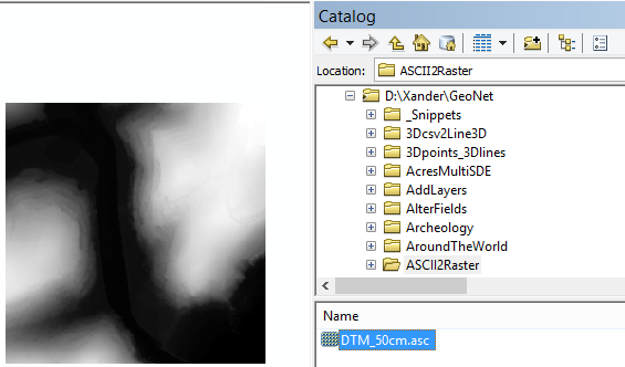
Dan's link to ASCII To Raster works for me:
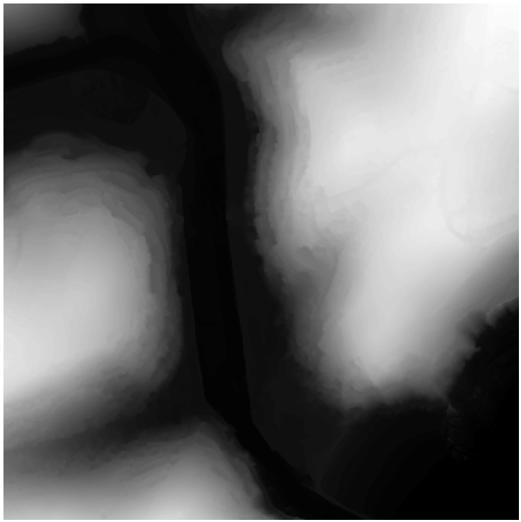
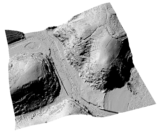
Hillshade:
- Mark as New
- Bookmark
- Subscribe
- Mute
- Subscribe to RSS Feed
- Permalink
- Report Inappropriate Content
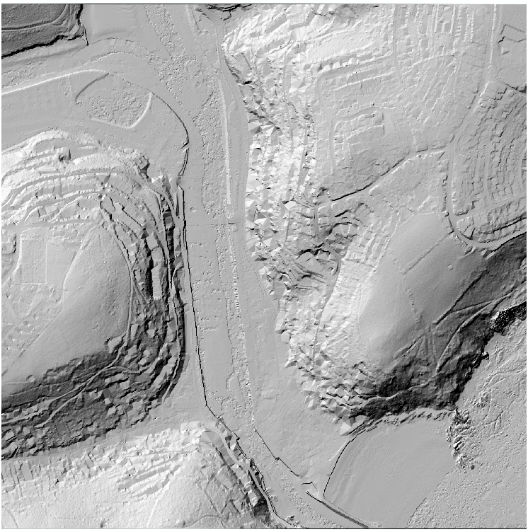
To confirm the question, the images Darren posted are based on your file. You can also simply drag the file from the catalog window to the dataframe to display it without conversion:
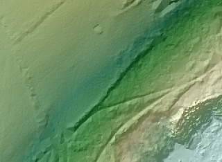
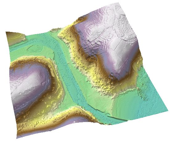
You will probably have to do some post processing since there are some parts that are likely covered with high vegetation and lack detail:

Other parts appear to have more detail (probably higher point density representing bare earth due to lack of vegetation):
- Mark as New
- Bookmark
- Subscribe
- Mute
- Subscribe to RSS Feed
- Permalink
- Report Inappropriate Content
- Mark as New
- Bookmark
- Subscribe
- Mute
- Subscribe to RSS Feed
- Permalink
- Report Inappropriate Content
I'll try that out Darren.
- Mark as New
- Bookmark
- Subscribe
- Mute
- Subscribe to RSS Feed
- Permalink
- Report Inappropriate Content
- Mark as New
- Bookmark
- Subscribe
- Mute
- Subscribe to RSS Feed
- Permalink
- Report Inappropriate Content
I don't know why you deleted all of your posts and are now adding in pictures. If you're not going to help then stay out of the thread Dan.
- Mark as New
- Bookmark
- Subscribe
- Mute
- Subscribe to RSS Feed
- Permalink
- Report Inappropriate Content
My links had all the information...you just were looking for a detailed step-by-step so there is no point in keeping them. thread can be easily locked if you prefer...just let me know... just showing it can be done with a few paragraphs of reading.
- Mark as New
- Bookmark
- Subscribe
- Mute
- Subscribe to RSS Feed
- Permalink
- Report Inappropriate Content
Your initial link makes no sense to someone with no experience, and your second link was irrelevant. You've clearly shown that you're capable of doing it quickly, and with your experience you could have easily broken it down and helped me to understand where I'm going wrong. Instead I've wasted a load of time.